
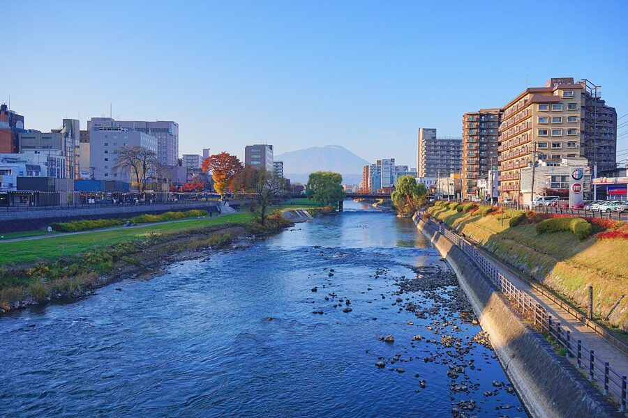
Iwate Prefecture (岩手県) covers 15,275 square kilometres, more than Tokyo, Kanagawa, Chiba and Saitama put together, and about 1.13 million people live in it. Those two numbers explain most of a trip here. The distances are long, the towns are small and far apart, and the roads between them run through forest for an hour at a time.
Inside those borders sit three quite different journeys. In the south is Hiraizumi (平泉), twelfth-century capital of the Northern Fujiwara, with its golden hall and Pure Land gardens. In the middle are Morioka, a castle town with its own noodles, and Tono, the valley of folk tales. Out east is the Sanriku coast, torn apart by the tsunami of 11 March 2011 and still rebuilding.

The name, in the prefecture’s own telling, comes from a demon. Three great rocks at Token-ji temple in Morioka are said to have been flung out by Mount Iwate, and when a demon called Rasetsu troubled the villagers, the god of the rocks bound him to them. Before he was freed he pressed his hands into the stone as a pledge never to return: iwa (rock) and te (hand).
Contents
- The shape of Iwate: a valley, two ranges and a broken coast
- Hiraizumi (平泉): the Pure Land of the north
- Geibikei (猊鼻渓) and Genbikei (厳美渓): two gorges either side of Ichinoseki
- Morioka (盛岡): a castle town on three rivers
- Tono (遠野) and the folk tales
- The Sanriku coast (三陸)
- Getting there and getting around
- Seasons
- How many days, and in what order
The shape of Iwate: a valley, two ranges and a broken coast
Iwate is a rough oval, about 189 kilometres north to south and 122 east to west. The Ou Mountains run down the western border with Akita, carrying Mount Iwate, the Hachimantai plateau and most of the snow. Parallel to them in the east lie the older, rounder Kitakami Highlands.
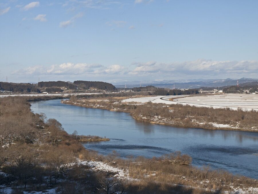
Between the two, the Kitakami River flows south through a long, flat valley, and almost everything a first-time visitor needs is strung along it. Morioka, Hanamaki, Kitakami, Oshu, Hiraizumi and Ichinoseki all sit on the Tohoku Shinkansen and the Tohoku Expressway, which follow the river the whole way.

The coast is a different country. North of Miyako it is an uplifted shore of terraces and sea cliffs, which at Kitayamazaki in Tanohata stand about 200 metres high for some eight kilometres. South of Miyako the highlands sink into the sea and the shore breaks into deep inlets, the classic ria coastline, with a fishing port in every bay. Those funnel-shaped bays are why tsunamis here have always risen so high.
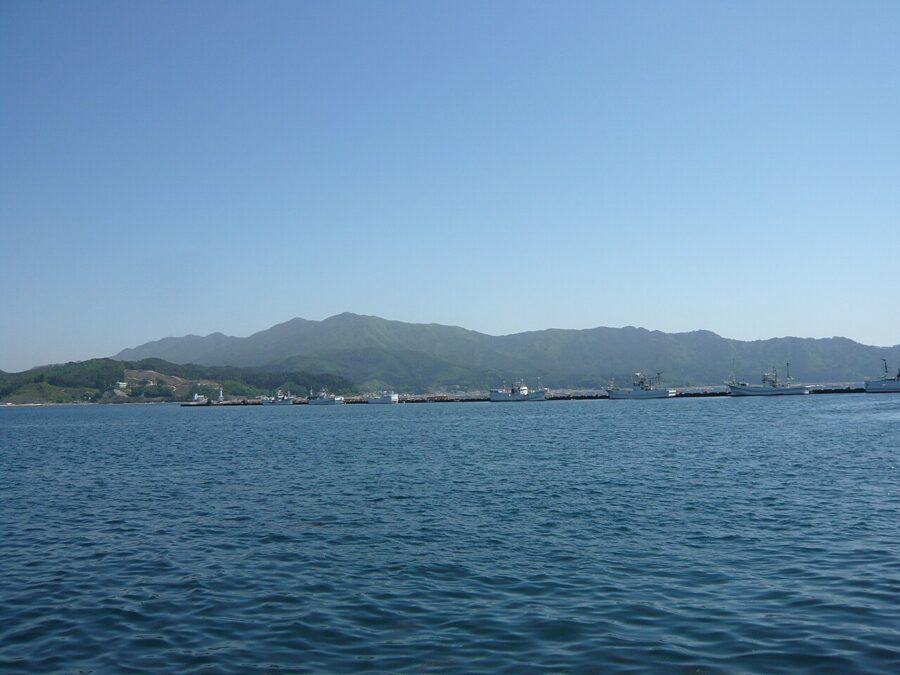

The easiest way to picture getting around is a ladder. The valley line is one upright and the coast the other, with three rungs across the highlands: Ichinoseki to Rikuzentakata in the south, Hanamaki to Tono and Kamaishi in the middle, Morioka to Miyako in the north. Each rung takes one to two hours or more, and planning Iwate is choosing which rungs to climb.
The prefecture holds three World Heritage listings: Hiraizumi (2011), the Hashino iron-mining site near Kamaishi within the Meiji industrial revolution listing (2015), and the Goshono Jomon site at Ichinohe within the northern Jomon listing (2021).

Hiraizumi (平泉): the Pure Land of the north
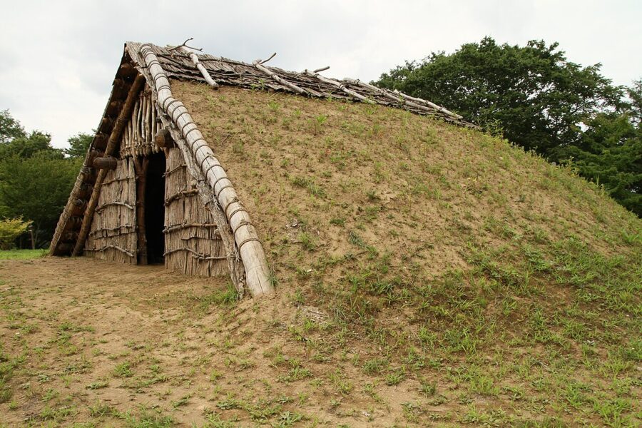
For about a century, until 1189, Hiraizumi was the seat of the Northern Fujiwara, who ruled the north of Honshu on the strength of gold, horses and trade. The first lord, Fujiwara no Kiyohira, had lost his family in the two wars that tore the region apart in the late eleventh century. In 1105, by the temple’s own history, he began building Chuson-ji as an offering for every life lost on both sides, human and animal.
Four generations built on that idea. Then in 1189 the forces of Minamoto no Yoritomo overran Hiraizumi, after the fourth lord, Yasuhira, had driven Yoritomo’s fugitive brother Yoshitsune to his death. Basho, arriving 500 years later, found fields where the palaces had been and wrote on the hill of Takadachi: “Summer grasses: all that remains of warriors’ dreams.”
Hiraizumi became a World Heritage Site in 2011 for temples, gardens and archaeological sites representing the Buddhist Pure Land: Chuson-ji, Motsu-ji, the ruins of Kanjizaio-in and Muryoko-in, and Mount Kinkei.
Chuson-ji and the Konjikido
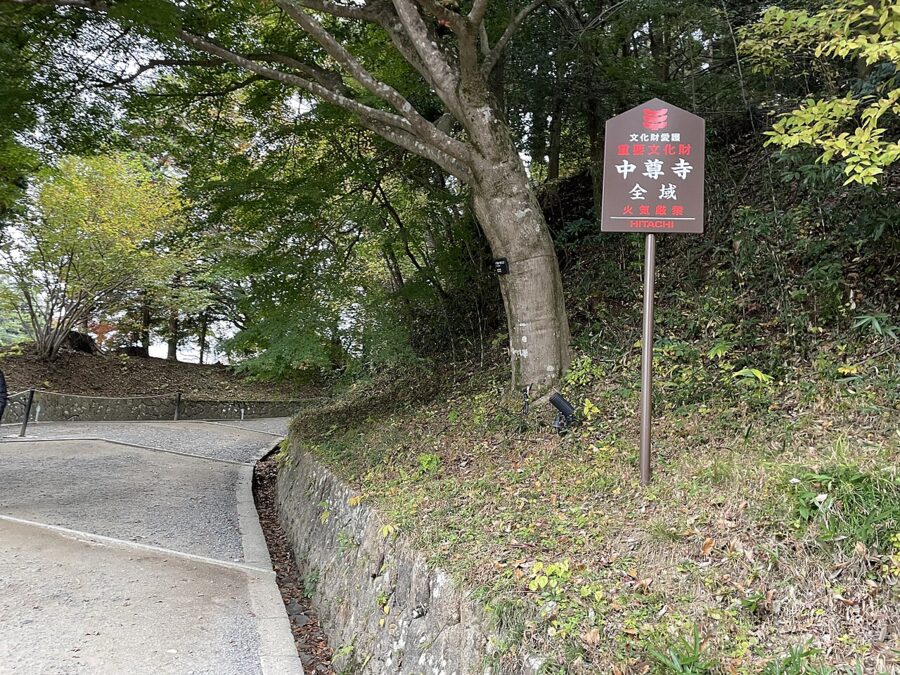
The approach is Tsukimizaka, a steep slope under cedars planted by the Sendai domain about 350 years ago. Halls line the ridge above, and near the top, inside a concrete shelter, stands the Konjikido, or Golden Hall, raised in 1124 and the only building left from the temple’s founding.
The hall is small, three bays square, and covered inside and out in gold leaf. Its inner sanctuary is inlaid with mother-of-pearl from tropical sea-snail shells and set with ivory and precious stones. The remains of the four Fujiwara lords still lie in golden coffins beneath the altar. When Japan began designating national treasures under the 1950 cultural properties law, the Konjikido was the first building on the list.
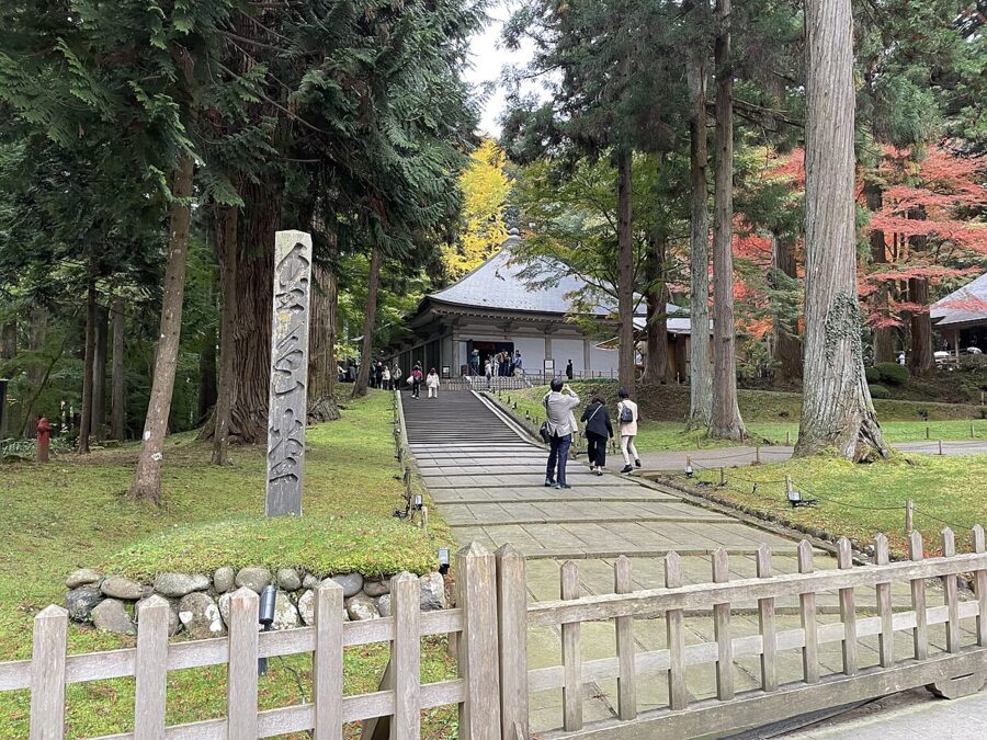
The ordinary ticket covers the Konjikido, the Sankozo treasure museum, the sutra hall and the old shelter: ¥1,000 (about £5 / $6) for adults. Tickets are sold 8:30 to 17:00 between 1 March and 3 November and 8:30 to 16:30 the rest of the year, stopping ten minutes before closing (as of November 2026).
Kyoto‘s Golden Pavilion is the comparison everyone reaches for, but it is a 1955 rebuilding after the original burned. The Konjikido is the twelfth-century hall itself. Give the Sankozo more time than most people do; its statues and gilt ornaments once furnished the halls.
Motsu-ji and the Pure Land garden
Motsu-ji, seven minutes’ walk from Hiraizumi station, was built up by the second and third lords and was said to outdo Chuson-ji. Every building burned after the Fujiwara fell, but the garden survived almost whole: the great pond of Oizumi-ga-ike, a pebbled spit with a standing stone at its tip, an island and a winding stream. It is both a Special Historic Site and a Special Place of Scenic Beauty, a double honour few places in Japan hold.
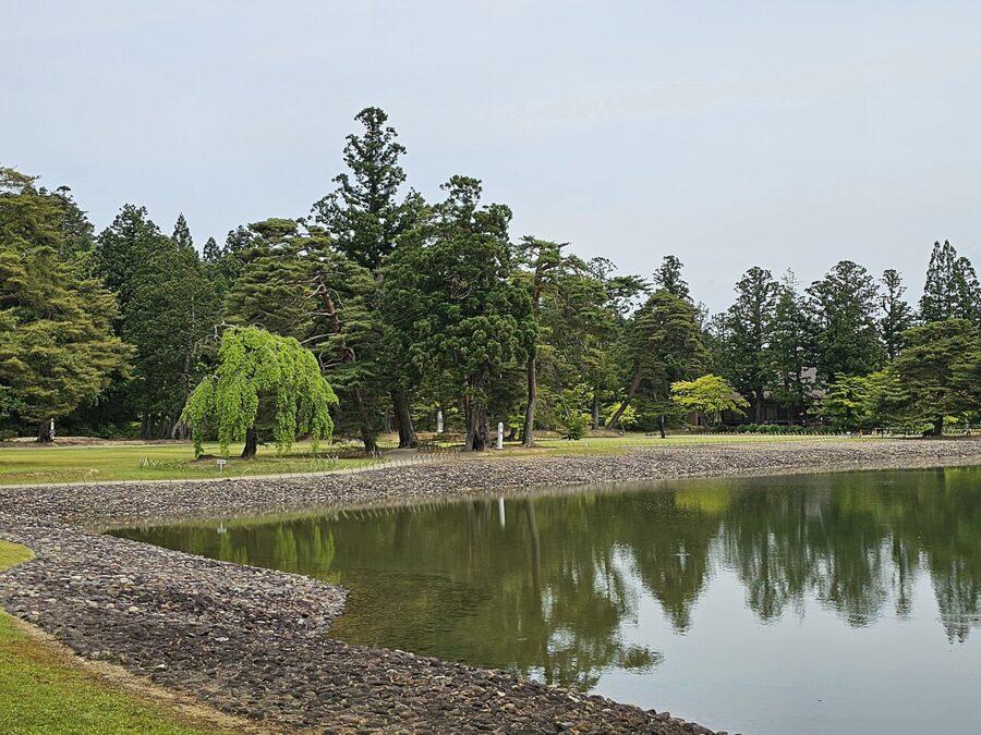

Admission is ¥700 (about £3.40 / $4.40) for adults, and the gates open 8:30 to 17:00, closing at 16:30 between 5 November and 4 March (as of November 2026). Time a visit by the temple calendar if you can. The Gokusui no En, a Heian-style poetry party beside the garden stream, falls on the fourth Sunday of May, and the iris festival runs from mid-June to early July.
Muryoko-in, Takadachi and the rest of the town
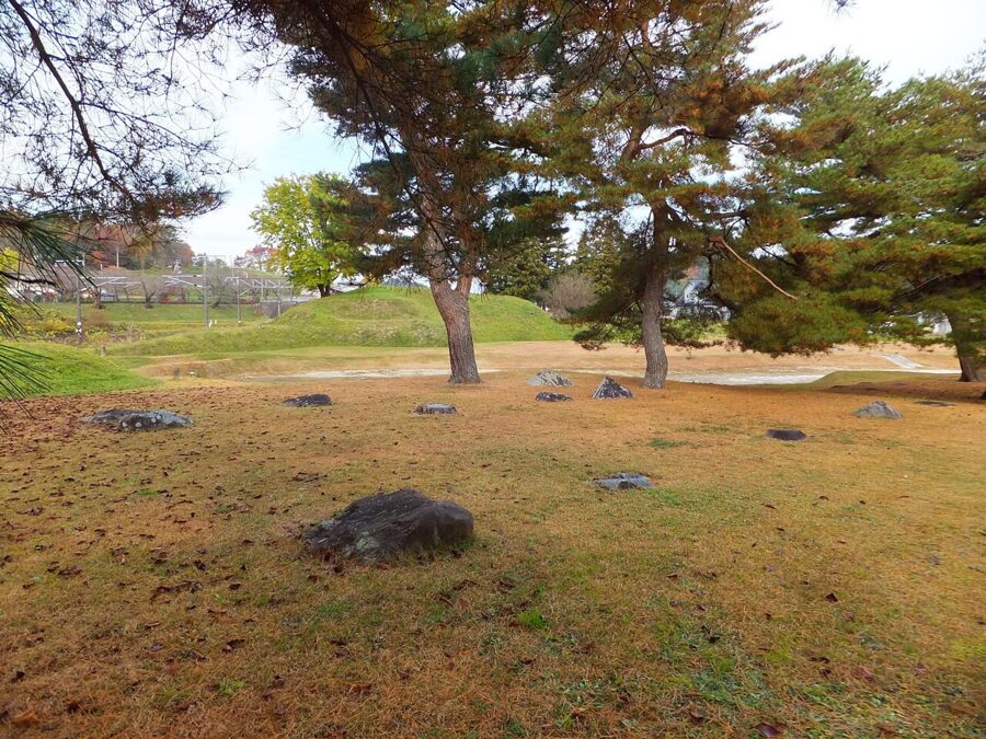
Muryoko-in was the third lord’s copy of the Byodo-in at Uji; only foundation stones and the outline of its pond remain, thought to be laid out so that the sun set behind the hall and Mount Kinkei. Mount Kinkei, where sutra mounds have been excavated, is free to climb. Takadachi Gikeido, on the hill where Yoshitsune is said to have died, charges a small fee and has the best river view in town.

Hiraizumi in a day
Hiraizumi station is nine minutes up the Tohoku Main Line from Ichinoseki, the Shinkansen stop. In 2026 the Run Run loop bus (station, Motsu-ji, Chuson-ji) runs only on weekends and holidays from 11 April to 29 November, at ¥200 (about £1 / $1.30) a ride or ¥550 (about £2.60 / $3.50) for a day ticket. On other days the regular Iwate Kenkotsu bus from Ichinoseki passes the station and Chuson-ji, and bicycles can be hired at the station.
My order would be Motsu-ji while the garden is empty, Chuson-ji for the late morning, then Takadachi and Muryoko-in after lunch. That fits between two Shinkansen; for Geibikei as well, start early or sleep in Ichinoseki.
Geibikei (猊鼻渓) and Genbikei (厳美渓): two gorges either side of Ichinoseki
The names differ by one sound and are constantly confused, but the two gorges lie on opposite sides of Ichinoseki and could hardly be less alike. Geibikei, to the east, is still and deep and seen from a boat. Genbikei, to the west, is short and rushing and seen on foot.
Geibikei: the boat ride
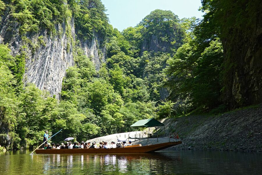
Geibikei follows the Satetsu River for about two kilometres between limestone walls more than 50 metres high, and in 1925 it became the first national Place of Scenic Beauty in Iwate. Boatmen pole flat-bottomed boats upstream, set passengers down for a short walk, and bring them back singing the boat song Geibi Oiwake, which echoes off the cliffs.
The round trip takes about 90 minutes and costs ¥2,000 (about £10 / $13) for adults (from April 2026). At the turning point, two lucky stones cost ¥100 (about 50p / 60 cents) to throw at the great rock of Daigeibiiwa. In winter the boats carry kotatsu, low tables heated under a quilt, and the autumn colours peak from mid-October to early November.
Geibikei station, on the JR Ofunato Line from Ichinoseki, is a few minutes’ walk from the boats; by car it is about 30 minutes from the Ichinoseki interchange.
Genbikei: the flying dumplings
Genbikei is the Iwai River, which rises on Mount Kurikoma, cutting through rock for about two kilometres just west of Ichinoseki. It is a national Place of Scenic Beauty and Natural Monument, free and open all year, and about 20 minutes from Ichinoseki station on the Iwate Kenkotsu bus.
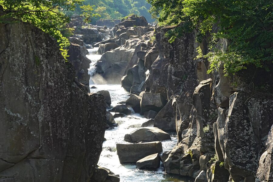

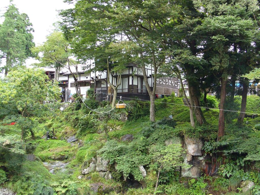
The eating is the point. The Kakko Dango teahouse on the far bank sends its “flying dango” across the gorge in a basket on a rope. Touristy, yes, and fun, and the dumplings are good.

Morioka (盛岡): a castle town on three rivers
Morioka, the prefectural capital, is the most pleasant small city in Tohoku to walk. The Kitakami, Nakatsu and Shizukuishi rivers meet here, and one morning covers the castle, the river and the Meiji-era banks.
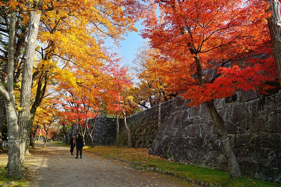

Morioka Castle was begun by Nambu Nobunao and completed in 1633. The towers came down after the Meiji Restoration, but the walls of local granite remain at the heart of Morioka Castle Site Park (Iwate Park). Below them the Nakatsu River runs so clear through the town that salmon can be watched coming up to spawn in autumn.
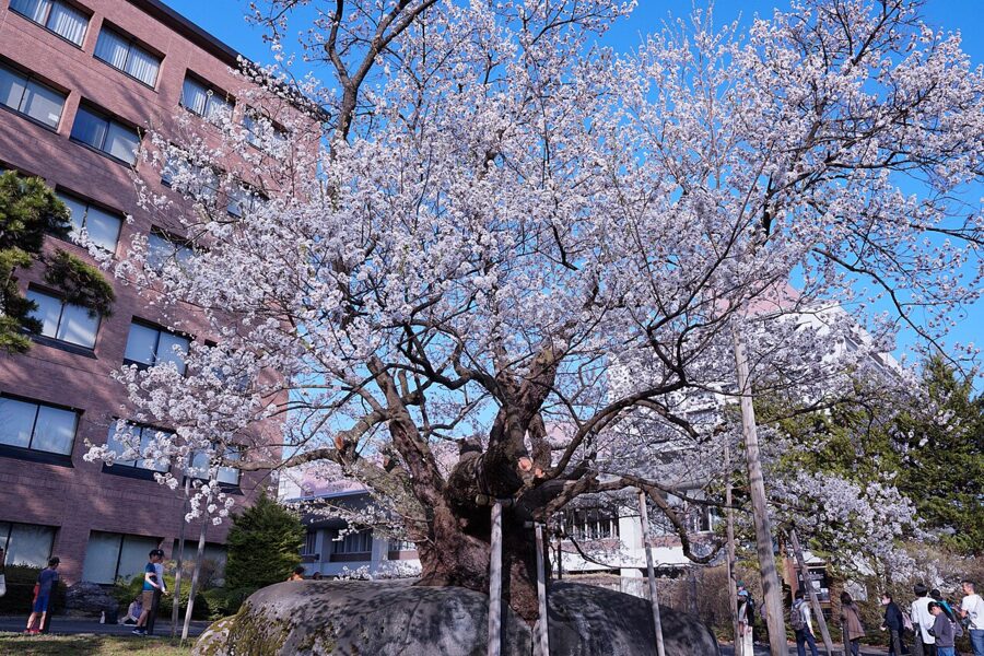
In front of the Morioka District Court, the Ishiwarizakura, a cherry thought to be about 360 years old, grows out of a split in a granite boulder 21 metres round. It is a national Natural Monument.

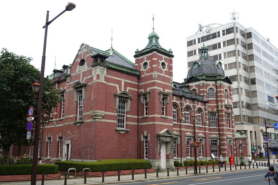
The Iwate Bank Red Brick Building by Nakanohashi bridge is the former Morioka Bank head office, designed by the office of Tatsuno Kingo and Kasai Manji and finished in 1911. It opens 10:00 to 17:00 and closes on Tuesdays. One half is free; the restored Morioka Bank zone costs ¥300 (about £1.40 / $1.90) (as of November 2026).
From there, walk along the Nakatsu River past Gozaku, a merchant house in business since 1816, to the castle park, and you have seen the best of the old town in two hours.
The three noodles
Morioka has built a civic identity on three noodle dishes, and you can eat all three in a day.
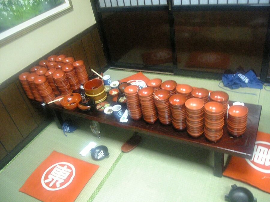

Wanko soba is the performance. A server stands at your elbow and flips one mouthful of soba into your bowl the moment you empty it, calling out to keep you going, until you put the lid on and the bowls are counted. Azumaya is the best-known house; book ahead at weekends. The noodles are ordinary soba, and the fun is in the pace.
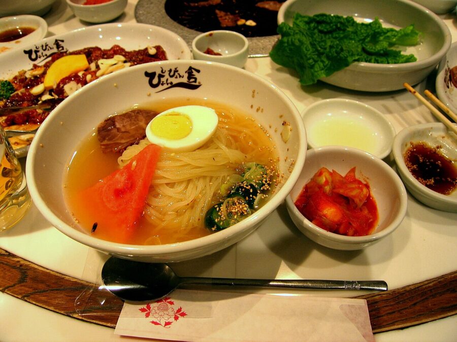

Morioka reimen comes from the Korean cold-noodle tradition and has been made in the city since the 1950s: firm, glassy noodles in cold beef broth with kimchi, egg and fruit such as watermelon or pear. Yakiniku restaurants serve it to finish a meal; Pyonpyonsha, with a branch in front of the station, is an easy start.
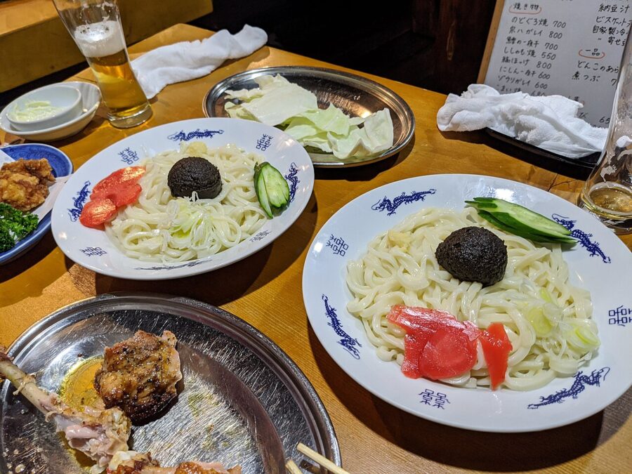

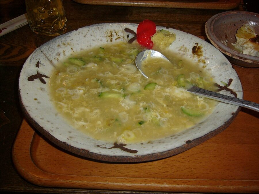
Jajamen is the local cousin of Chinese zhajiangmian, brought back from Manchuria after the war and adapted at Pairon, the small counter restaurant near the castle park that still defines it. The ritual comes at the end. Crack a raw egg into the last of the sauce, hand the bowl back, and the kitchen pours in hot noodle water to make chi-tan-tan, an egg soup you season yourself.

Festivals in Morioka
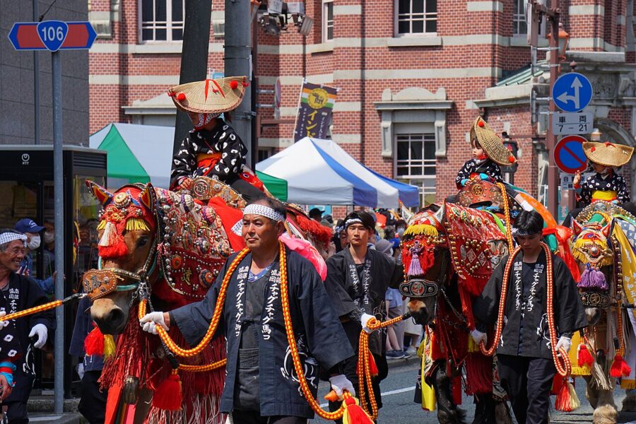
Chagu Chagu Umakko, on the second Saturday of June (13 June in 2026), is a procession of about 70 horses in bright harness and bells, walking 14 kilometres from Onikoshi Sozen Shrine in Takizawa to Morioka Hachimangu in honour of the guardian god of horses. The name is the sound of the bells, chosen as one of the 100 soundscapes of Japan worth preserving.

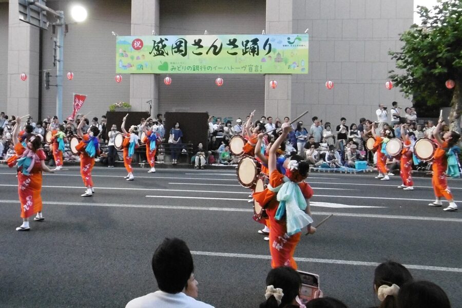
The Morioka Sansa Odori starts on 1 August each year, when thousands of drummers and dancers fill Chuo-dori for the evening parade from 18:00, ending in a circle dance anyone can join. Book a bed early for either date.

Tono (遠野) and the folk tales
Tono sits in a basin in the Kitakami Highlands, halfway between the valley and the coast, where seven old roads met and traders stopped to rest. In 1910 the scholar Yanagita Kunio published Tono Monogatari, The Legends of Tono, 119 short tales told to him by a young local writer, Sasaki Kizen. Its preface begins: “All of these tales I heard from Mr Sasaki Kyoseki of Tono.”
If any single book shows how rural Japan understood its fields, rivers and spirits, it is this one, and it makes Tono a chapter in Japanese culture rather than a farming town on the way to the coast.
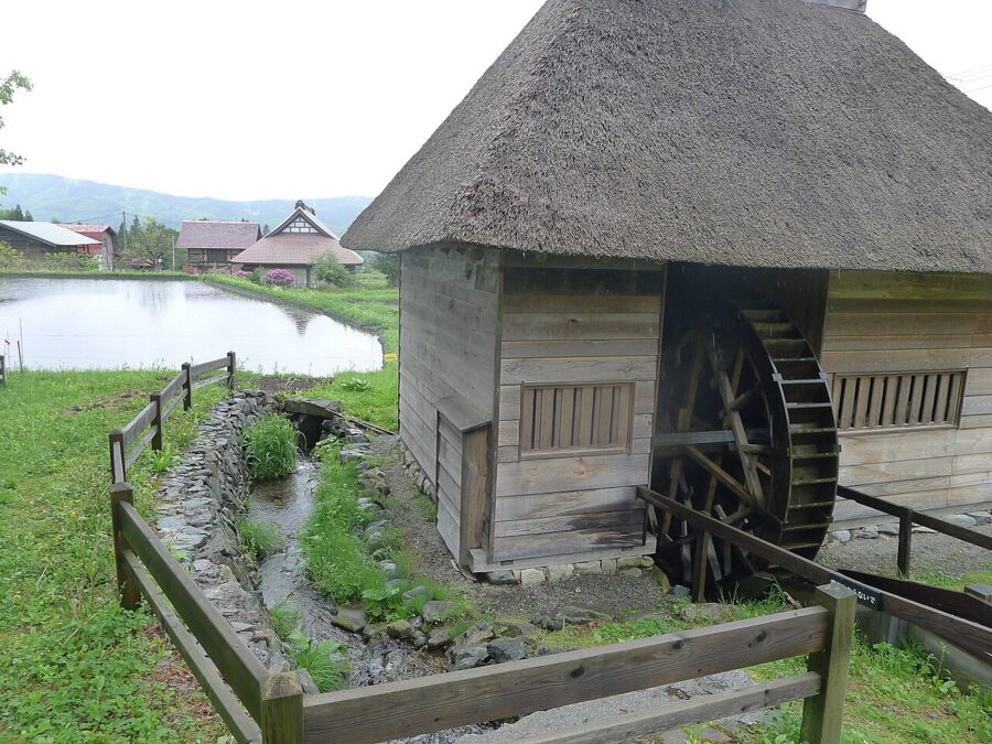

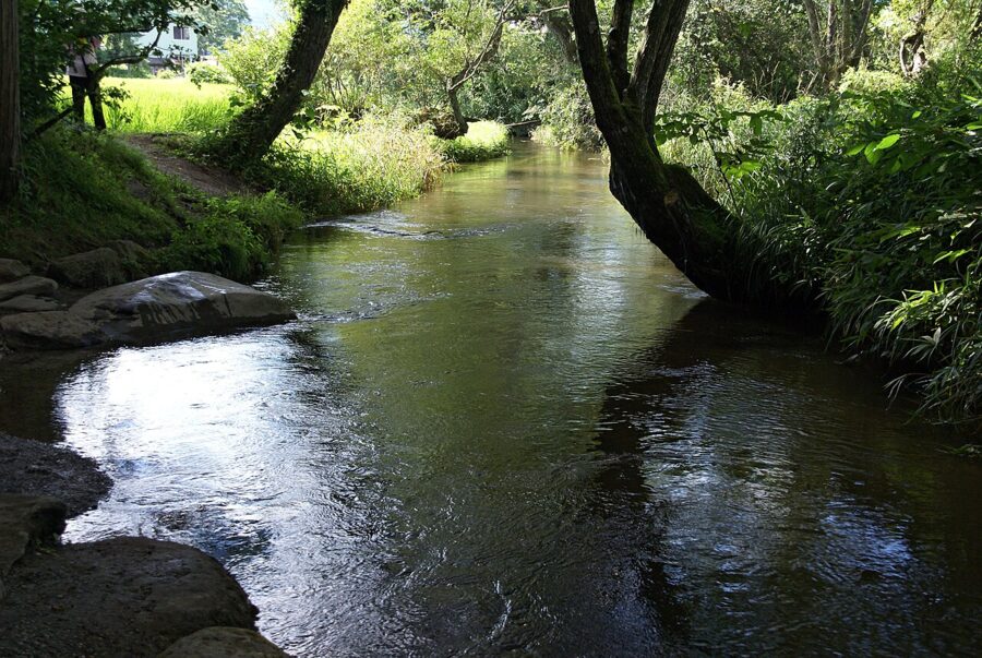
The tales are full of kappa, the water imps; zashiki-warashi, the child spirits who bring a house its fortune; mountain men, foxes and the household gods called oshira-sama. The places are real. Kappa-buchi, the stream pool behind Joken-ji temple, is the best-known kappa haunt.
Since 2004 the Tono tourist association has issued a kappa-catching permit, sold at its office, at Denshoen and at Tono Furusato Village. The kappa must be caught alive and unharmed. The association counts 14 places where kappa have been seen, the last in July 1975.

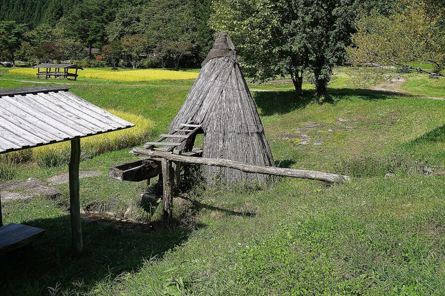
For the tales in their setting, go to Yamaguchi in Tsuchibuchi, selected in 2013 as a nationally Important Cultural Landscape. Its water mill, the pool of Obako-buchi from tale 58 and the site of the Magozaemon house, which the zashiki-warashi of tale 18 were seen leaving, are all within walking distance. Bring a translation.

Tono Furusato Village brings together six magariya, the L-shaped farmhouses where families and their horses lived under one roof. Entry is ¥550 (about £2.60 / $3.50) for adults, or ¥750 (about £3.60 / $4.70) during the summer festival. It opens 9:00 to 17:00 (16:00 in the winter months) and closes over the New Year and on Wednesdays in January and February (as of late 2025).
The village is about 16 minutes’ drive from the station, which sums up Tono: the sights are spread across the basin, buses are few, and a hire car or bicycle makes the day. Give it a day and a night; mornings, with mist in the paddy fields, are best.
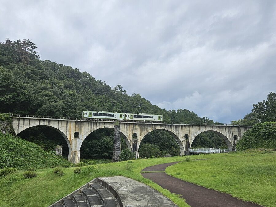

Trains reach Tono on the JR Kamaishi Line from Hanamaki and Shin-Hanamaki, which continues over the highlands to Kamaishi.
The Sanriku coast (三陸)
The Iwate coast runs the whole eastern side of the prefecture between Rikuzentakata in the south and Hirono in the north, much of it inside the Sanriku Fukko (Reconstruction) National Park. For most visitors from abroad it is the least known part of Iwate.
Jodogahama and Miyako
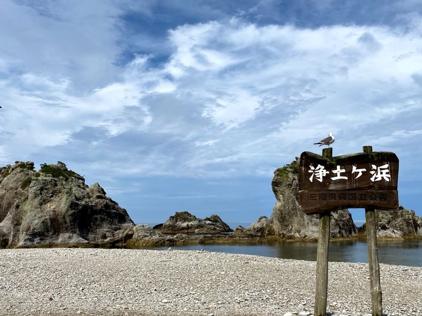
Jodogahama, in Miyako, is the classic view: a small bay closed off by white rhyolite spires topped with pines, and water clear and calm enough for swimming in high summer. The name means Pure Land Beach; according to the city, a priest of Joan-ji temple gave it in the early 1680s.
From Morioka the 106 express bus crosses the highlands to Miyako for ¥2,300 (about £11 / $14.50), some services continuing to the Jodogahama Park Hotel stop. JR Yamada Line tickets between Morioka and Miyako are valid on the 106 bus until March 2030, useful when trains are sparse. The Yamada Line is suspended for works from late November to early December 2026, when the bus is the only way through.
At the bay, small fishing boats called sappa-bune run into a sea cave known as the Blue Grotto in the warmer months; ask at the beach.
Kitayamazaki and the northern line
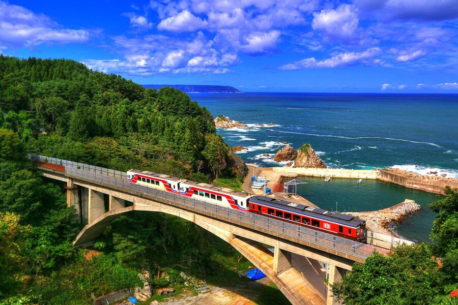
North of Miyako the coast rises into the cliffs of Unosu and Kitayamazaki, and the Sanriku Railway is the way to see it without a car. Since March 2019 its Rias Line has run 163 kilometres from Sakari in Ofunato to Kuji, after JR handed over the Miyako to Kamaishi section of its tsunami-wrecked Yamada Line. Kuji is the model for the town in Amachan, the 2013 television drama about a young woman diver.
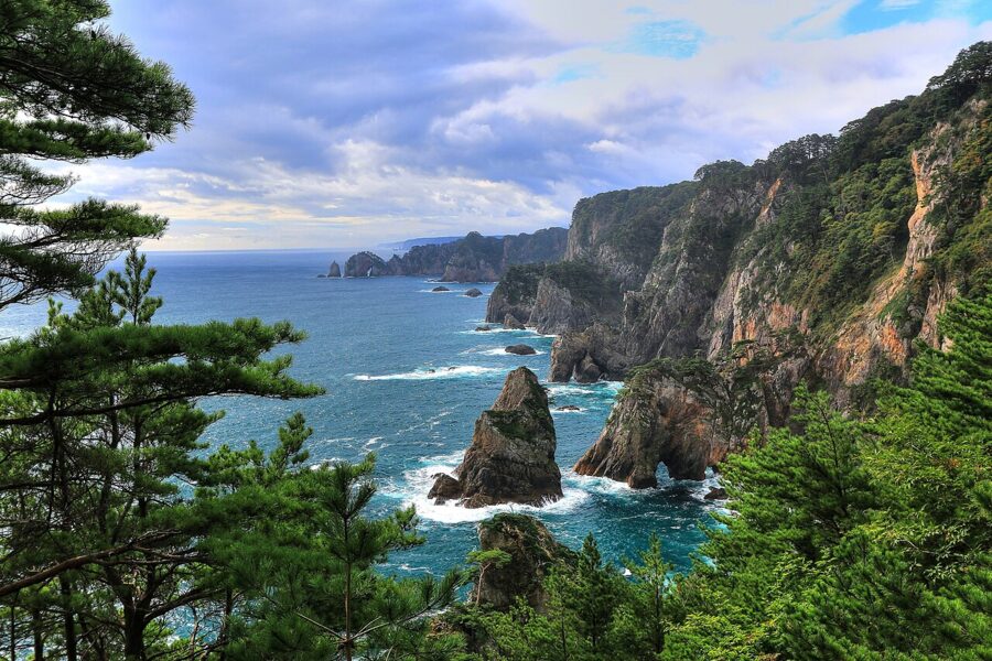

The railway became a symbol of recovery when its first trains ran again on 16 March 2011, five days after the tsunami.
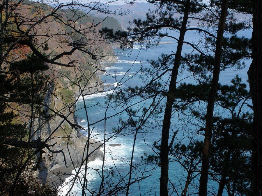

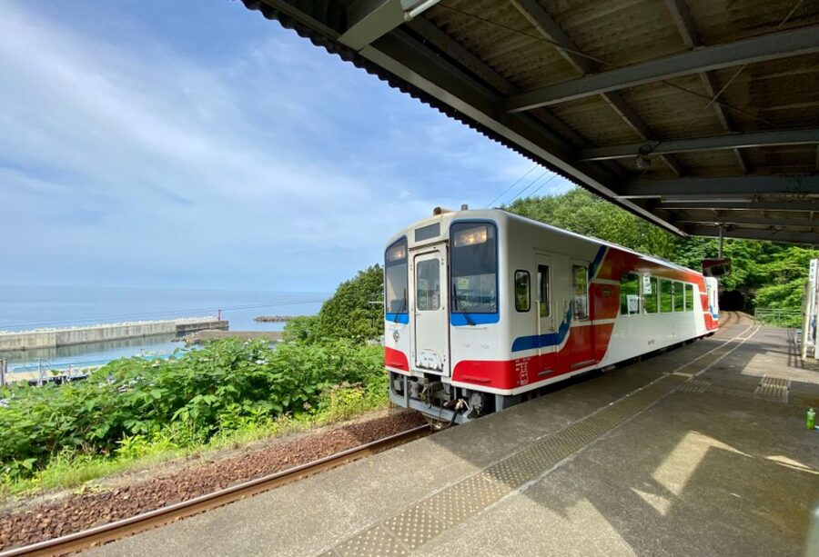
In winter, kotatsu trains run between Kuji and Miyako with heated tables, a local packed lunch, a guide and a visit from the namomi, masked figures of the coast’s Little New Year. Book ahead. As of 19 November 2026 the Rias Line was running normally.

The 2011 tsunami and the coast today
On 11 March 2011 the tsunami struck the whole Iwate coast. Rikuzentakata and Otsuchi were largely destroyed, and every other town on the coast suffered heavy losses. Today the coast is a mix of rebuilt centres on raised ground, tall new sea walls, empty stretches where houses stood, and memorials to be visited with care.
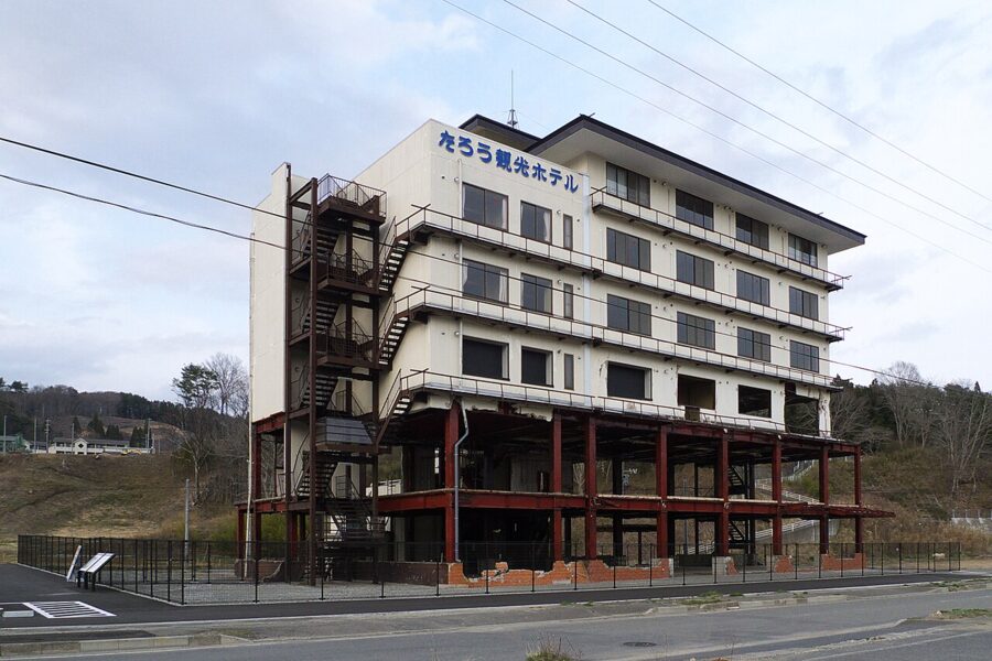

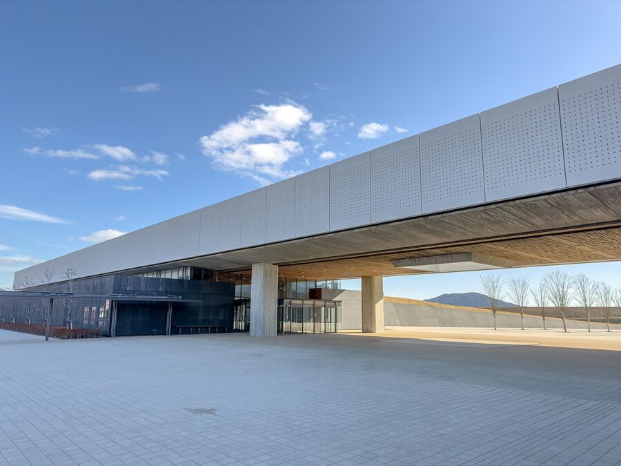
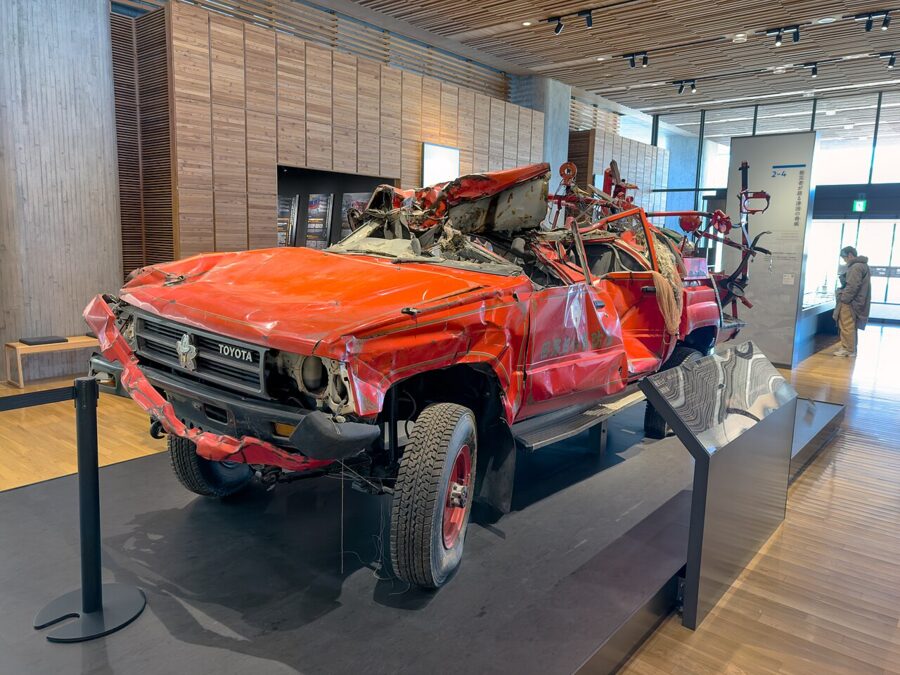
Begin at Rikuzentakata, in the Takata Matsubara Tsunami Reconstruction Memorial Park. At its centre is the Iwate Tsunami Memorial (東日本大震災津波伝承館), opened by the prefecture in 2019, which sets out what happened, what failed and what saved lives, with damaged objects from along the coast. Entry is free; it opens 9:00 to 17:00 and closes from 29 December to 3 January (as of November 2026).


A path leads on to the Miracle Pine, the one tree left standing from a forest of about 70,000 pines. It later died from the salt and now stands preserved, the ruined youth hostel behind it.
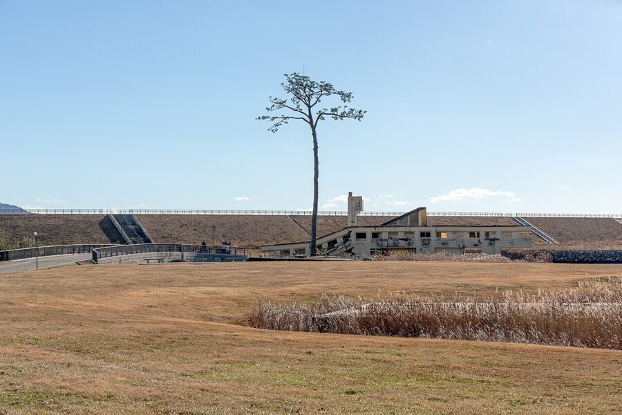

By public transport, the museum’s directions are the JR Ofunato Line from Ichinoseki to Kesennuma (about 1 hour 20 minutes), then the Ofunato Line BRT bus for about 30 minutes to the Kiseki no Ippon Matsu stop. Most of the Sanriku and Kamaishi expressways are toll-free, which makes the coast far easier by car than before 2011.
Getting there and getting around
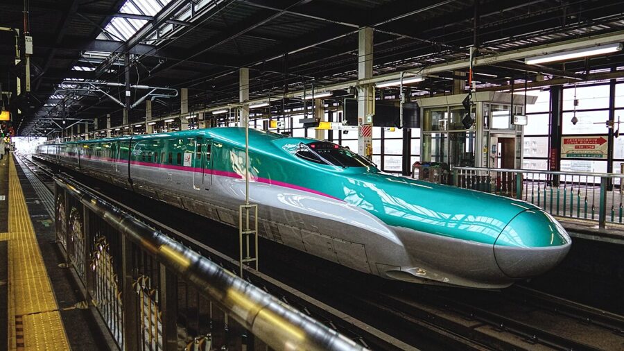
The Tohoku Shinkansen is the way in. The fastest Hayabusa trains reach Morioka from Tokyo in about two hours ten minutes, and Ichinoseki, for Hiraizumi and the gorges, in about two hours twenty. Every Hayabusa seat is reserved.
After the JR East fare revision of March 2026, a regular-season reserved seat from Tokyo costs ¥15,450 (about £74 / $97) to Morioka and ¥13,810 (about £66 / $87) to Ichinoseki. Ichinoseki is 32 minutes from Sendai. For how the lines join Iwate to its neighbours, see getting to Tohoku.

Iwate Hanamaki Airport has flights from Sapporo (about 55 minutes), Nagoya (about 1 hour 10 minutes) and Osaka (about 1 hour 20 minutes), but none from Tokyo. Overnight highway buses from Tokyo suit tight budgets.
The valley is easy by train; the coast and Tono are not, because crossing lines are infrequent and many sights sit far from stations. I would take the train along the valley and hire a car for the coast. Morioka to Hiraizumi is about 50 minutes on the expressway, and the Ichinoseki interchange to the Rikuzentakata memorial about an hour and a quarter.
Seasons
Iwate is cold. Morioka has the long winters of an inland valley, the Ou Mountains take heavy snow, and the coast north of Miyako stays cool even in summer, when the yamase, a damp wind off the sea, can bring days of fog.
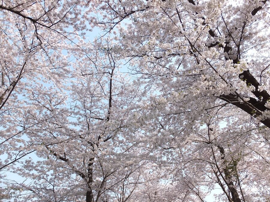

Spring comes late, with cherries in late April and Hiraizumi’s Spring Fujiwara Festival on 1 to 5 May. Early summer brings Chagu Chagu Umakko and the irises at Motsu-ji; August brings Sansa Odori and the beach season on the coast. Autumn is the best season overall, with clear air, salmon in the rivers and the gorges in colour from mid-October.
One autumn caution: black bears. In September 2026 the prefecture again urged hikers, foragers and anyone walking near woodland to take precautions. At the main sights it hardly matters; on rural walks around Tono or in the hills, it does.
Winter brings the kotatsu boats and trains and snow on the cedars of Tsukimizaka, but shorter opening hours and icy highland roads.
How many days, and in what order
Two days covers the valley: Hiraizumi and one gorge from Ichinoseki, then Morioka and its noodles. It is the trip most people make, and a good one.
Four days is what I would give Iwate. Add a night in Tono and a day on the coast: the 106 bus from Morioka to Miyako for Jodogahama, south on the Sanriku Railway to Kamaishi, inland to Tono, and back to the Shinkansen at Shin-Hanamaki. Check connections first, because one missed train on this loop can cost two hours.
With five or six days and a car, drive the coast from Rikuzentakata to Kitayamazaki and Kuji, with time for the memorial and a night by the sea. From Morioka the Shinkansen then runs north into Aomori or back south through Miyagi.
Iwate rewards anyone who accepts its size. Choose your rungs of the ladder, give each a full day, and on the last morning go and find the demon’s handprints at Token-ji before the train south.