
Miyagi Prefecture (宮城県) covers 7,282 square kilometres, less than half the area of Iwate next door, and about 2.21 million people live in it. Almost half of them live in one city. Sendai is the largest city in Tohoku, the north-east of Japan’s eight regions, and the rest of the prefecture arranges itself around it: a bay of pine islands half an hour up the coast, hot spring valleys an hour inland, a volcano on the western border and, to the north-east, the shore that the tsunami of 11 March 2011 struck harder than anywhere else in Japan.
That arrangement makes Miyagi easy to travel: from one hotel in Sendai you can reach most of it by train and bus.


Contents
- The shape of Miyagi: a plain, a bay and two coasts
- Sendai (仙台): the city Masamune built
- Matsushima (松島): the bay of pines
- Shiogama (塩竈): the shrine and the fishing port
- Akiu Onsen (秋保温泉): the hot spring on Sendai's doorstep
- Naruko Onsen (鳴子温泉) and the gorge
- Zao (蔵王) and the Okama crater
- The 2011 coast: Ishinomaki, Minamisanriku and Kesennuma
- Getting there and getting around
- Seasons
- How many days, and in what order
The shape of Miyagi: a plain, a bay and two coasts
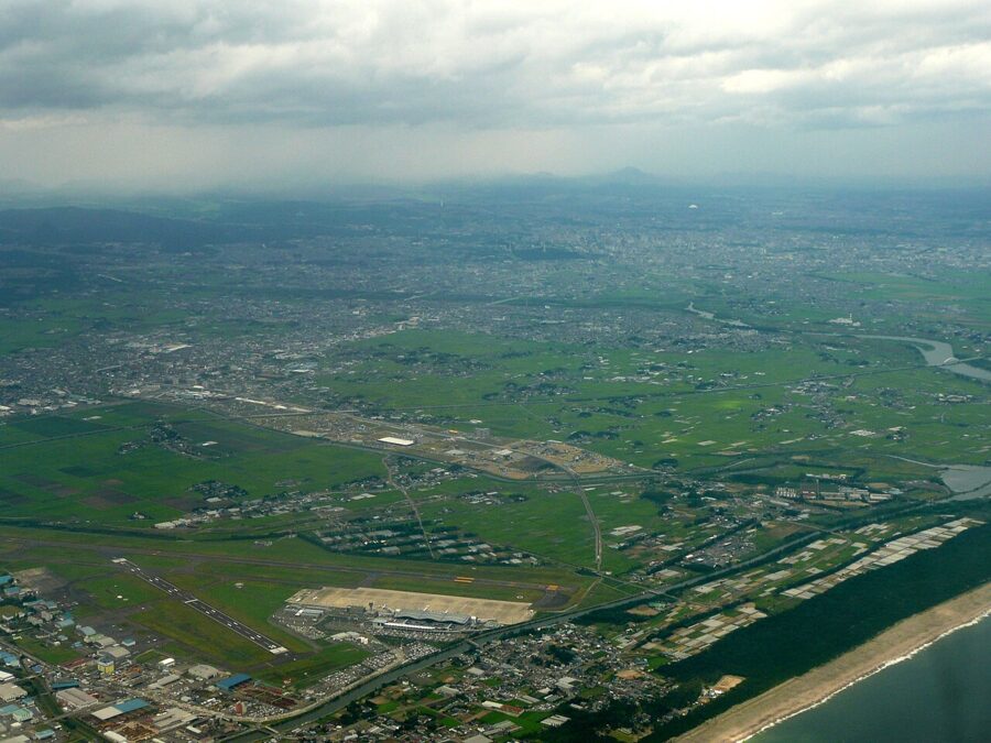
Miyagi is built in three bands running north to south. In the west the Ou Mountains form the border with Yamagata, with the Zao volcanoes at the southern end and the Kurikoma range at the northern. Most of the hot springs sit in their folds: Togatta below Zao, Akiu and Sakunami behind Sendai, and Naruko in the north-west.
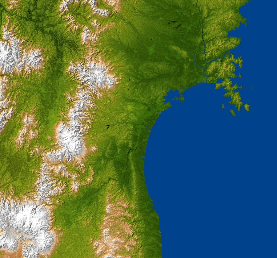
East of the mountains lies the Sendai plain, the largest in Tohoku, with rice fields running down to a straight, sandy shore. The Tohoku Shinkansen and the Tohoku Expressway cross it north to south, so almost everything inland is a short ride from Sendai station.
The coast changes character at Matsushima. South of the bay it is long beach and low dunes. North of it, past the Oshika Peninsula and Ishinomaki, the hills meet the sea and the shore breaks into the deep inlets of the Sanriku ria coast, with Minamisanriku and Kesennuma at the heads of their bays. Those funnel-shaped bays concentrated the 2011 wave.

Sendai (仙台): the city Masamune built
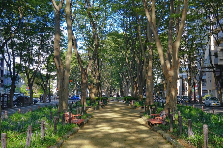
Sendai is a castle town of just over a million people, burned in an air raid in July 1945 and rebuilt on a wide, orderly grid. It calls itself Mori no Miyako, the city of trees, and the zelkova avenues earn the name. It is an easy city to stay in, and I would base myself here for most of a Miyagi trip.
The man behind it is Date Masamune (1567 to 1636), the one-eyed warlord who moved his seat here at the start of the seventeenth century and built his castle on a hill above the Hirose River. Most of what a visitor sees in Sendai traces back to him or his heirs.
Zuihoden and the castle site
Masamune’s mausoleum, Zuihoden (瑞鳳殿), stands on a wooded hill by the Hirose River, a short bus ride from the castle site. The original of 1637 was a National Treasure and burned in 1945; the present building, reconstructed in 1979, has the black lacquer, gilded carving and coloured brackets of the Momoyama style. Two smaller mausoleums hold the second and third lords, and a small museum shows the faces of all three, reconstructed from their remains.
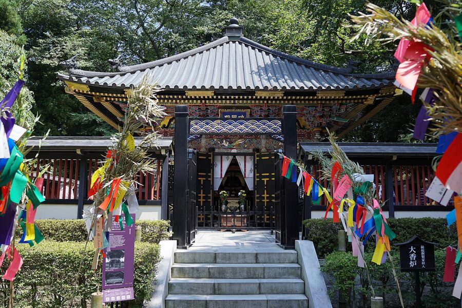

Admission is ¥570 (about £3 / $4). As of November 2026 it opens 9:00 to 16:50 from February to November and 9:00 to 16:20 in December and January, with last entry 20 minutes before closing.
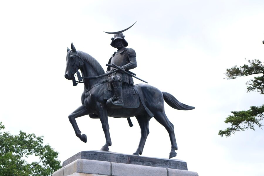
The castle itself is gone. Sendai Castle never had a keep, and on Aobayama today there are stone walls, a rebuilt corner tower and the equestrian statue of Masamune. Go up for the view east over the city to the sea, which shows you the whole plain in one look.
Osaki Hachimangu
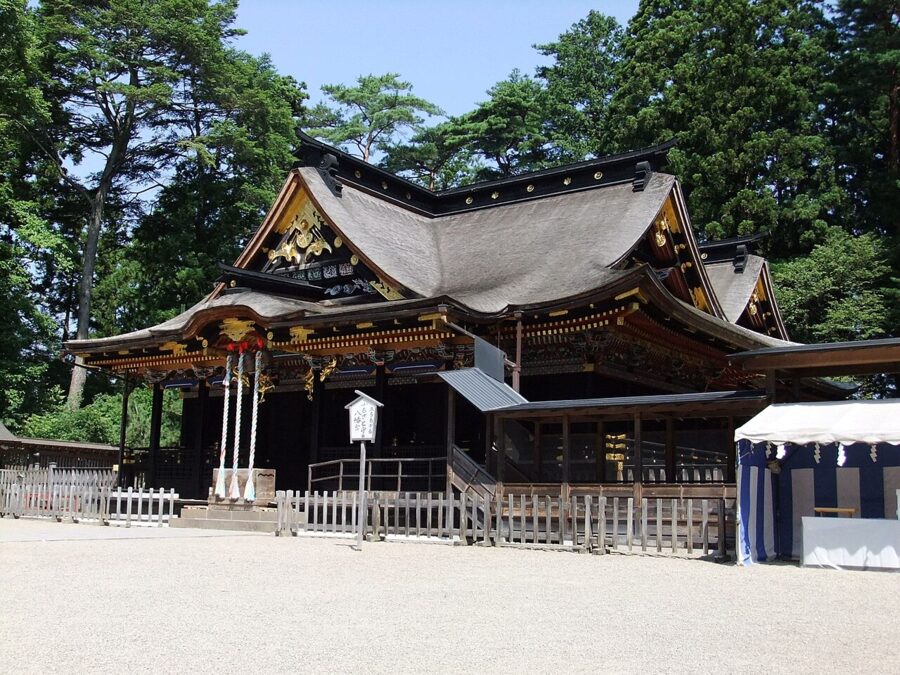
Masamune’s shrine is in the north-west of the city. Osaki Hachimangu (大崎八幡宮) was completed in 1607, and its main hall, lacquered black and decorated in gold and colour, is a National Treasure. It is a working shrine with free grounds, and quieter than Zuihoden on most days.

The Loople Sendai (るーぷる仙台) bus links Zuihoden, the castle site and Osaki Hachimangu with the station. It runs one way round a loop of about 70 minutes, every 20 minutes on weekdays and every 15 at weekends and through August, from bay 16 at the west exit bus terminal. As of November 2026 a ride is ¥300 (about £1.40 / $2), a day pass ¥700 (about £3 / $4), and a day pass that adds both subway lines ¥1,000 (about £5 / $6).
Gyutan, zunda and the Sendai table
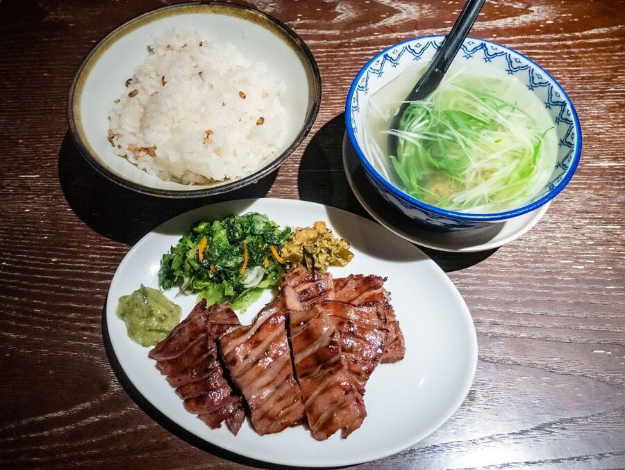
Sendai’s own dish is gyutan, grilled beef tongue. The usual story credits a cook called Sano Keishiro, who began serving tongue salted and grilled over charcoal in the hungry years after the war; sources give 1948 or 1950, depending on whether they count the restaurant or the set meal. The classic gyutan teishoku comes with mugimeshi (rice cooked with barley), oxtail soup and pickles. Order it salted the first time.

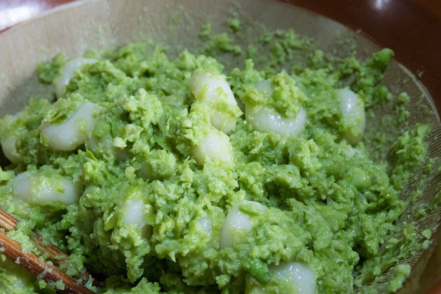
The other taste of Sendai is zunda, a sweet paste of mashed green edamame, served on rice cake as zunda mochi and blended into shakes on the station concourse.

Tanabata and the city’s year
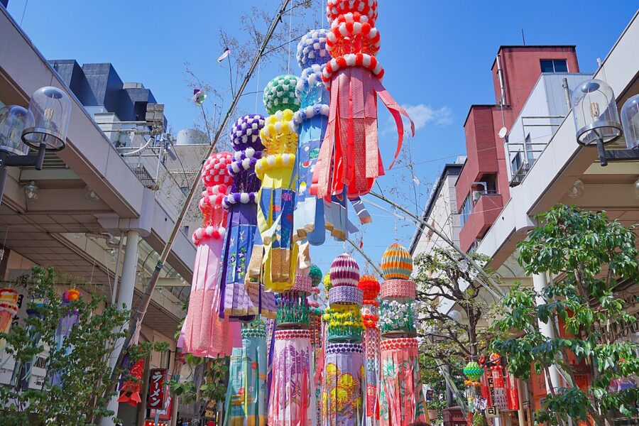
Sendai’s great festival is Tanabata, the star festival, held on 6 to 8 August every year, a month after the 7 July date kept in much of Japan. The organisers trace it to Masamune’s time and count more than two million visitors over the three days. There are no floats and little noise: the festival is the decorations, huge pieces of paper and bamboo hung along the arcades of Ichibancho and Chuo-dori by shops and schools.
The traditional set has seven kinds of ornament, each with its own wish: streamers for skill at weaving, paper strips for calligraphy, strings of paper cranes for long life, and paper kimono, purses, nets and baskets for the rest. Walk the arcades in the morning, and book a bed months ahead, because Sendai’s hotels fill for these three nights.

Matsushima (松島): the bay of pines
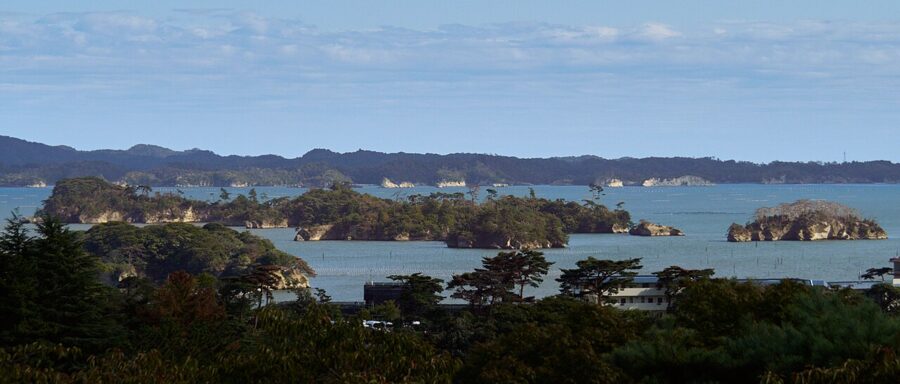
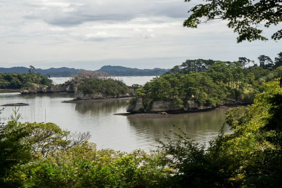
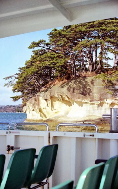
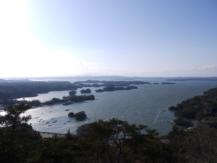
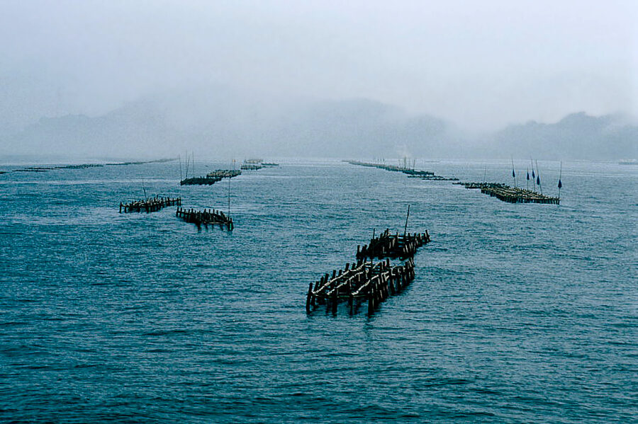
Matsushima has been counted among the Three Views of Japan (日本三景) since the seventeenth century, with Amanohashidate and Miyajima. Its claim rests on about 260 islands of pale tuff and sandstone, worn into arches and pedestals and capped with black pines. They fill a shallow bay north-east of Sendai, and the best way to understand them is from the water.
Matsushima-Kaigan station is about 40 minutes from Sendai on the JR Senseki Line, and the town is a short walk from it. The Tohoku Main Line reaches Matsushima station in about 25 minutes, but leaves a 20-minute walk into town.
On the water
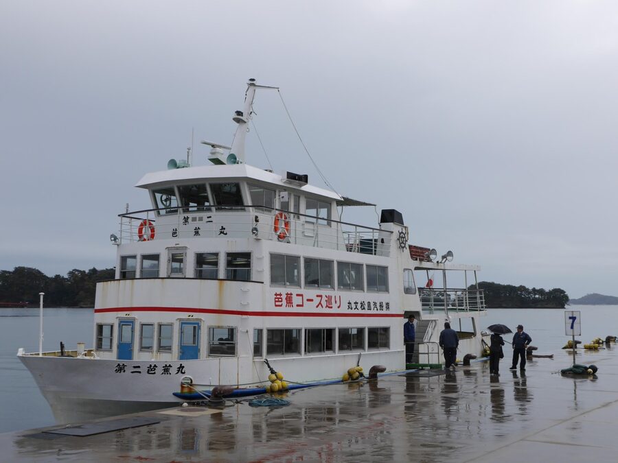
Two scheduled cruises leave the pier: a loop of the bay, and Marubun Matsushima Kisen’s crossing between Matsushima and Shiogama. Both take about 50 minutes and, as of 2026, cost ¥1,500 (about £7 / $9) for adults and half that for primary school children. I would take the Shiogama crossing one way and the train the other, which turns the cruise into a journey rather than a loop.
Zuiganji, Godaido and Fukuurajima
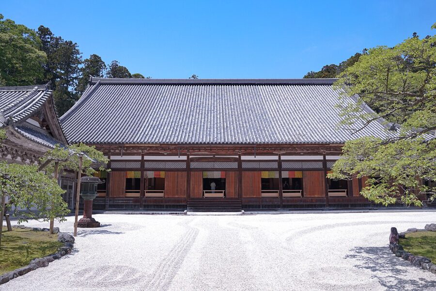
Zuiganji (瑞巌寺) is the Zen temple Masamune rebuilt as the family temple of the Date, and its main hall is a National Treasure. As of November 2026 entry is ¥1,000, with the gates open from 8:30 and closing between 15:30 in January and 17:00 from April to September. The cedar avenue to the gate passes caves cut into the cliff, once used for meditation and memorials.

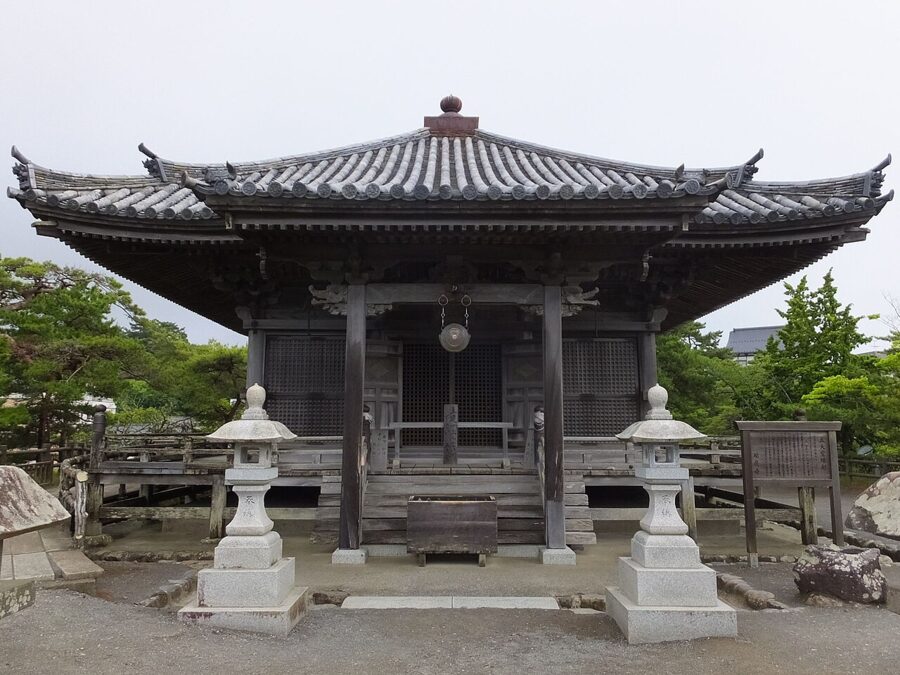
Godaido (五大堂), the small hall on an islet reached by two short bridges, is the picture on every Matsushima poster. Masamune rebuilt it in 1604, and it is counted the oldest Momoyama-style building in Tohoku. The five guardian figures inside are shown once every 33 years; the next opening is due in 2039.

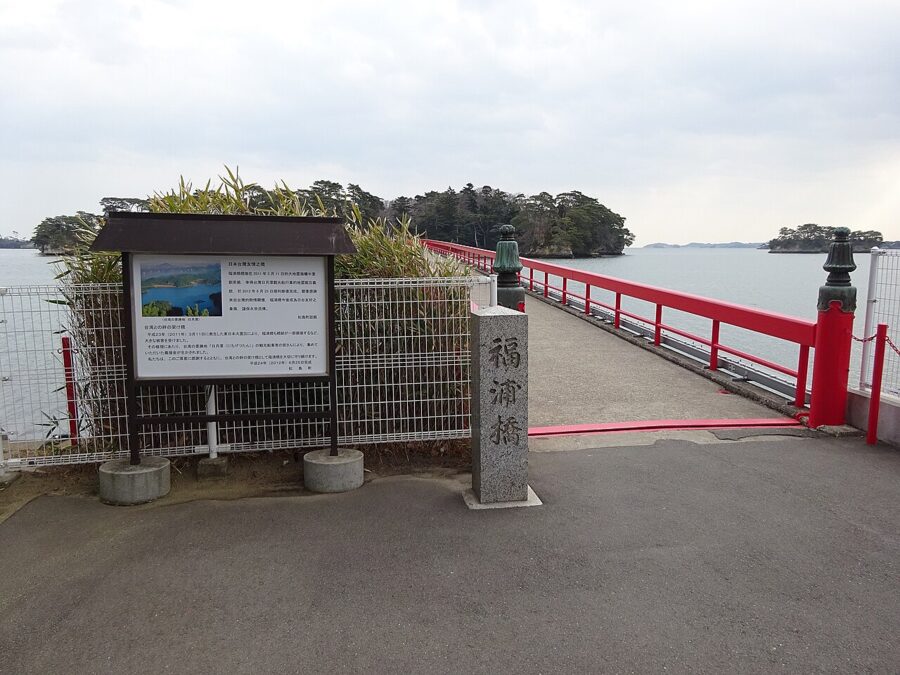
For a walk, cross the red bridge to Fukuurajima (福浦島), a wooded island with a path round its edge. As of November 2026 it costs ¥300 and opens 8:30 to 17:00, closing at 16:30 from November to February.

Basho and the four great views
The poet Matsuo Basho came here in 1689 on the journey he wrote up as Oku no Hosomichi, and left no verse of his own about the bay; he wrote instead that he shut his mouth and tried to sleep. The famous line that simply repeats the name in wonder is often credited to him, but it is not his.
To see the bay from above, Matsushima has four classic viewpoints, the Shikan (四大観): Ogidani and Tomiyama in Matsushima town, Otakamori on Miyato island and Tamonzan in Shichigahama. Their names grade the views, from Otakamori’s grand to Ogidani’s secluded. All four need a car or a taxi.


Shiogama (塩竈): the shrine and the fishing port
Shiogama sits at the southern corner of the bay on the same Senseki Line, and most visitors pass through only to catch the boat. Above the port stands Shiogama Shrine (鹽竈神社), long the chief shrine of the old province of Mutsu, sharing its hilltop with Shiwahiko Shrine.
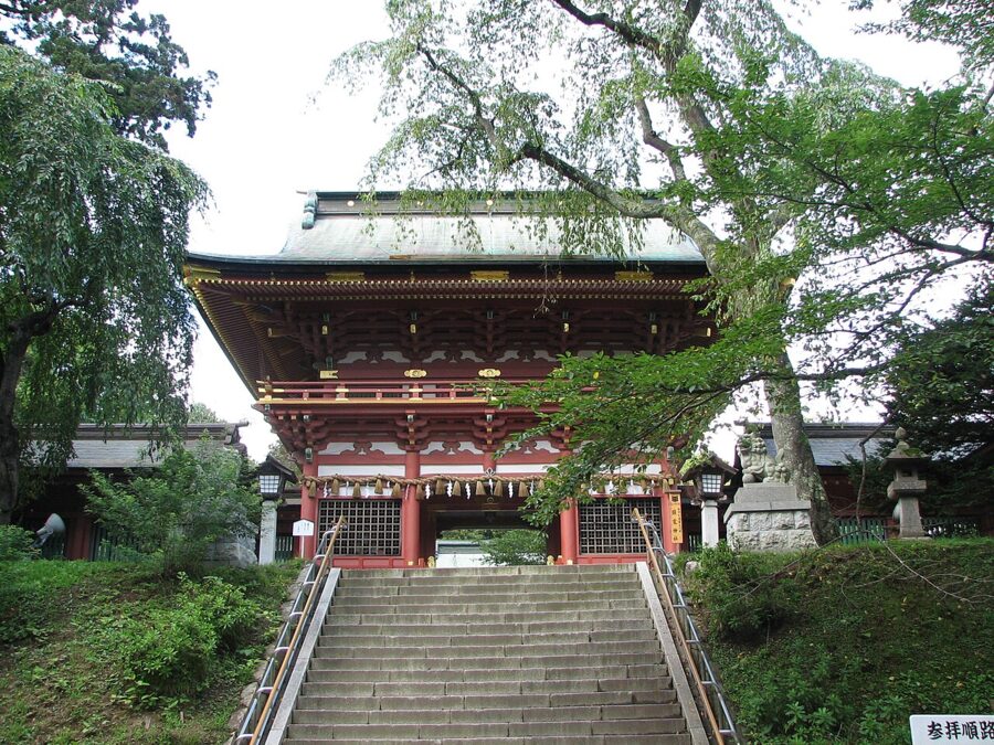
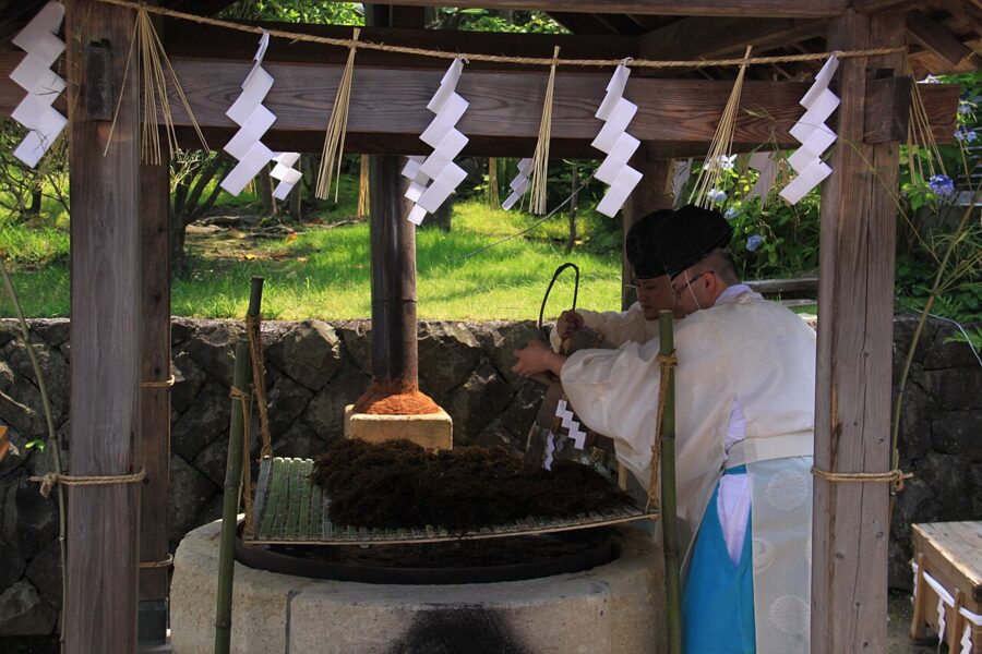
The shrine’s god is said to have taught people to make salt from seawater, and each July the small Okama Shrine in town re-enacts it, boiling brine over seaweed in iron cauldrons. Shiogama is still a working fishing port, and I would rather eat sushi here than in Sendai; lunch before the afternoon boat makes an easy half day.

Akiu Onsen (秋保温泉): the hot spring on Sendai’s doorstep
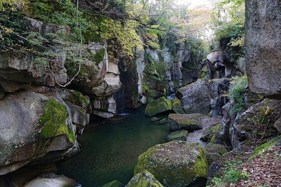
Akiu is Sendai’s own hot spring, in the Natori River valley west of the city, and is counted with Iizaka in Fukushima and Naruko as one of the three famous baths of the old north. It is a spread-out resort of large hotels about an hour from Sendai station by Miyagi Kotsu bus. You come for the baths, and for Rairaikyo, a short gorge cut through grey rock right below the hotels.
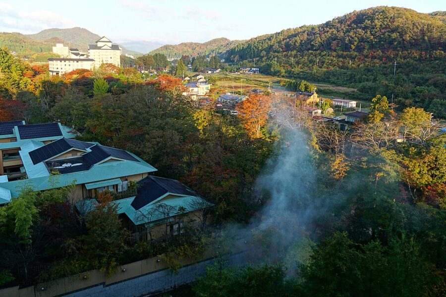


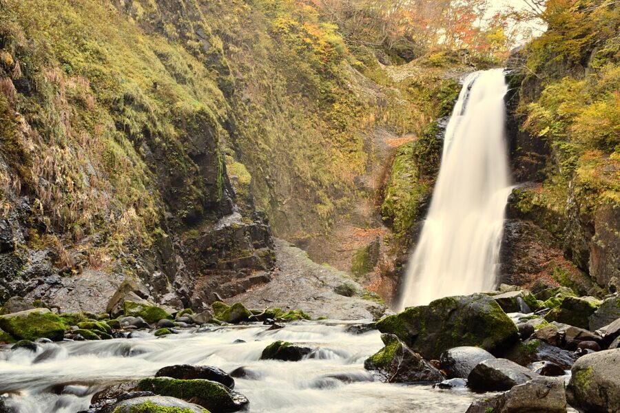
Further up the valley, Akiu Great Falls (秋保大滝) drops 55 metres in a single fall about 6 metres wide. On weekends and holidays a rapid bus runs between Sendai station and the falls; it usually stops for the winter, but this season the city is keeping it running until 28 February 2027.

Naruko Onsen (鳴子温泉) and the gorge
In the north-west corner of the prefecture, Naruko is the opposite of Akiu: a real hot spring town of steep lanes, steaming drains, wooden bathhouses and kokeshi workshops. The Naruko area is five spa villages along one valley, Naruko, Higashi-Naruko, Kawatabi, Nakayamadaira and Onikobe. If you stay one night in a Miyagi hot spring, I would make it here.
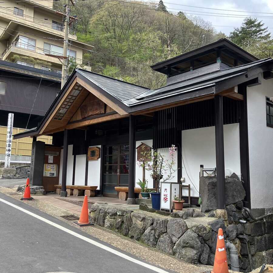

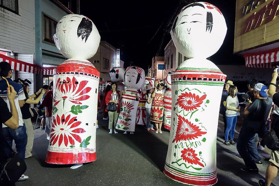
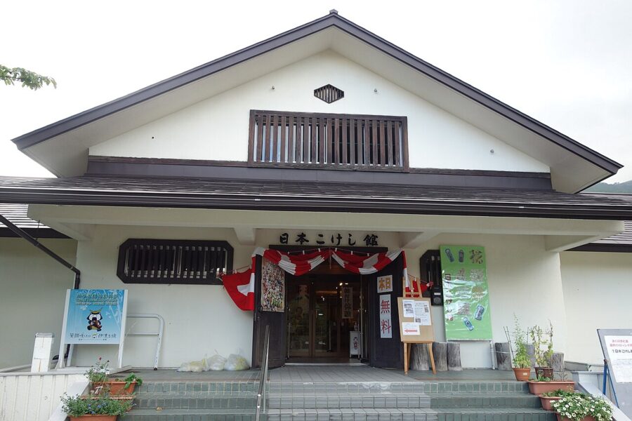
The bath to try is Taki-no-yu (滝の湯), where entry is ¥300 from the ticket machine. Another public bath, Waseda Sajiki-yu, has been closed since 3 September 2026 for work on its source, with no reopening date. Naruko is also a home of kokeshi, the turned wooden dolls of Tohoku, here with heads that squeak when turned; the Japan Kokeshi Museum shows the regional styles.


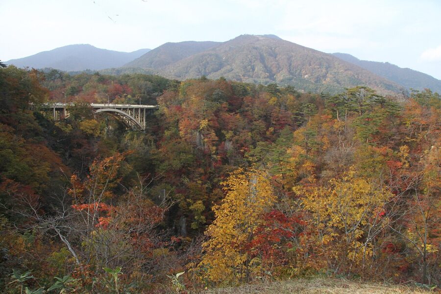
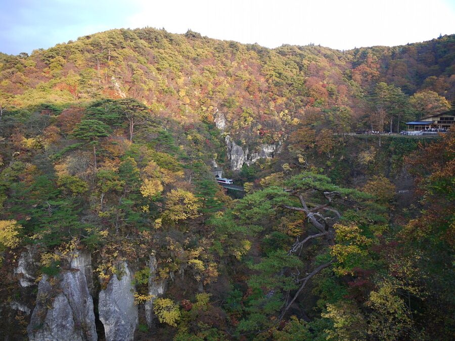
Naruko Gorge (鳴子峡) lies just west of the town, a canyon about 100 metres deep cut by the Otani River and one of Tohoku’s best places for autumn colour, usually from late October to early November. In 2026 a temporary bus ran from the station from 26 October to 8 November. The viewing deck by the Naruko Gorge Rest House looks down the canyon to the arch of the Ofukazawa bridge.

To reach Naruko, take the Shinkansen one stop north from Sendai to Furukawa, then the JR Rikuu East Line to Naruko-Onsen. Beyond Naruko the line to Shinjo in Yamagata has been closed since the heavy rain of 25 July 2024, with replacement buses; JR East expects repairs to be finished during the 2028 financial year.

Zao (蔵王) and the Okama crater
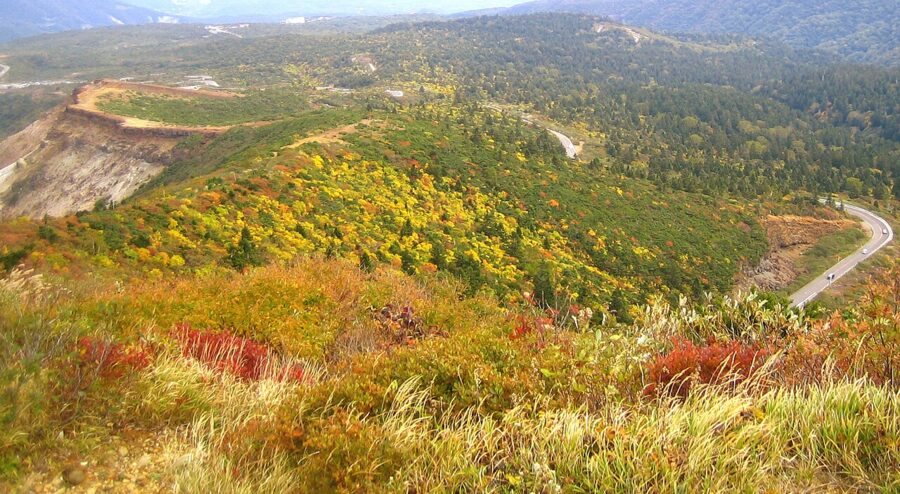
The Zao range on the Yamagata border is Miyagi’s volcano. The base on the Miyagi side is Togatta Onsen (遠刈田温泉), a hot spring town with its own style of kokeshi, reached by Miyako bus from Shiroishi-Zao station, a quarter of an hour from Sendai by Shinkansen. From Togatta the Zao Echo Line climbs over the range, and near the top a short toll road, the Zao High Line, branches off to the summit car park on Mount Katta.

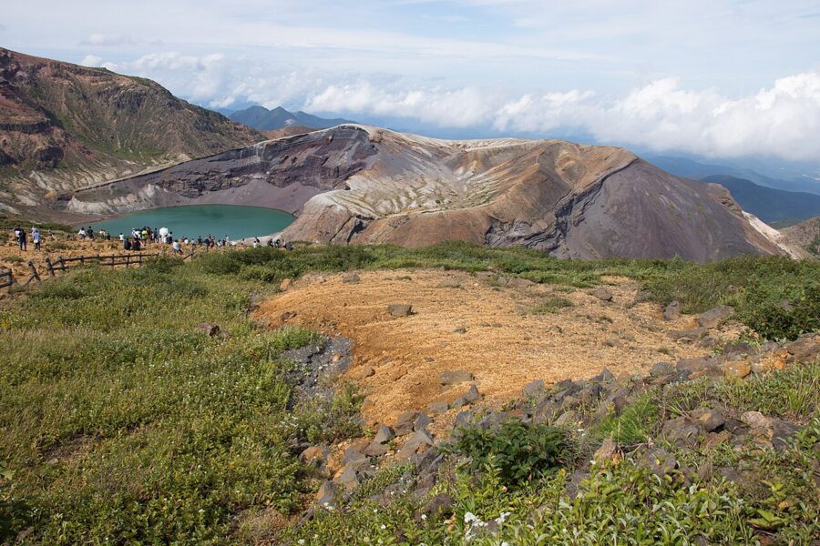
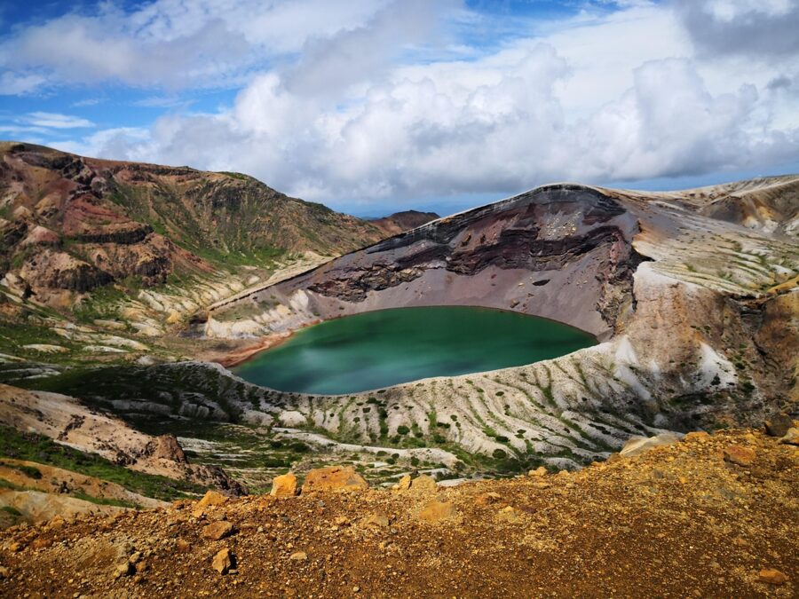
From the car park it is a few minutes’ walk to the rim above Okama (御釜), a round crater lake whose milky green water changes shade with the light, which earned it the name Goshikinuma, the five-colour pond. The water is acid and holds no life.
The season is short. The Echo Line and High Line close for winter in early November; in 2026 the closure began on 4 November. They reopened on 24 April 2026 at 11:00, and until the morning of 7 May the road was shut every night from 17:00 to 8:00 for ice. Expect a similar pattern in spring 2027, with walls of cleared snow beside the road.
Zao is an active volcano. As of the Japan Meteorological Agency’s October 2026 report there was no eruption warning in force and no sign of unusual activity, but check before you go. In recent seasons some weekend buses have continued from Togatta to the summit; without a car, confirm the timetable with Miyako bus first.
The 2011 coast: Ishinomaki, Minamisanriku and Kesennuma
The Great East Japan Earthquake of 11 March 2011 killed more than 10,000 people in Miyagi, more than in any other prefecture. The tsunami reached kilometres inland across the Sendai plain and rose highest in the narrow bays of the north-east. Fifteen years on, the towns have been rebuilt, many on raised ground or behind tall sea walls, and each has kept something of that day for the people who come to learn.
These are places of mourning first. Allow time to read and listen, keep your voice down, ask before photographing anyone, and stay off the remains. Many of the memorial museums offer talks by survivors, the kataribe or storytellers, which are worth booking ahead.
Ishinomaki
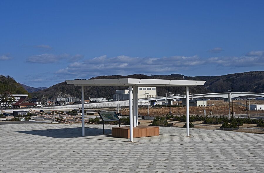
Ishinomaki, at the mouth of the Kitakami River and about an hour from Sendai on the JR Senseki-Tohoku Line, lost more people than any other town or city in Japan. Minamihama, once a residential district between river and sea, is now the Ishinomaki Minamihama Tsunami Memorial Park, with lawns, wetland, a place of prayer and the prefecture’s memorial museum (みやぎ東日本大震災津波伝承館). The museum is free and, as of November 2026, opens 9:00 to 17:00, closing on Mondays.

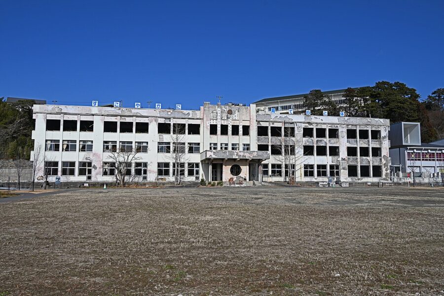
At the edge of the park, the burned shell of Kadonowaki Elementary School (門脇小学校) is kept as a memorial; the tsunami and the fires after it gutted the building, and the pupils at school that afternoon escaped up Hiyoriyama. As of November 2026 entry is ¥600 (about £3 / $4), and it opens 9:00 to 17:00, with last entry at 16:00 (15:30 from November to January), closing on Mondays.

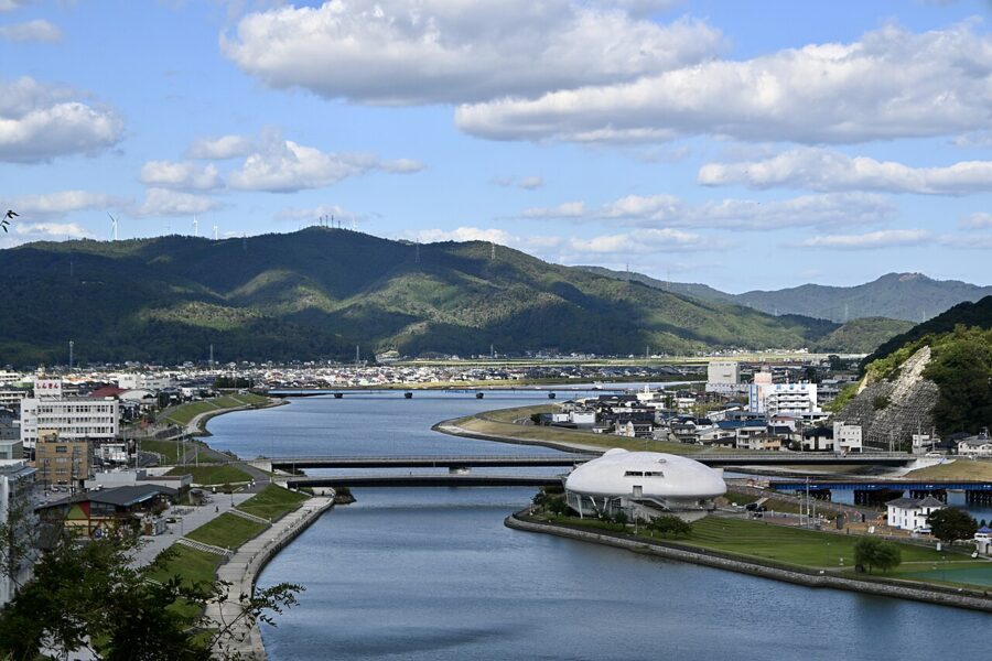
Walk up Hiyoriyama afterwards, the site of the old castle. From the top you see the whole story at once: the river, the rebuilt town, the empty memorial ground and the sea.

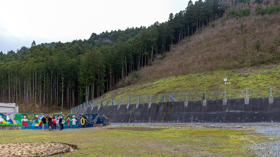
The hardest place on this coast is the former Okawa Elementary School (大川小学校), about 4 kilometres up the Kitakami. The tsunami came up the river and over its bank, and 74 children and 10 staff died after waiting in the schoolyard while the adults decided where to go. Families took the city and prefecture to court, and the ruling that found them liable became final in 2019. The site is free, open 9:00 to 17:00, and best reached by car.

Minamisanriku
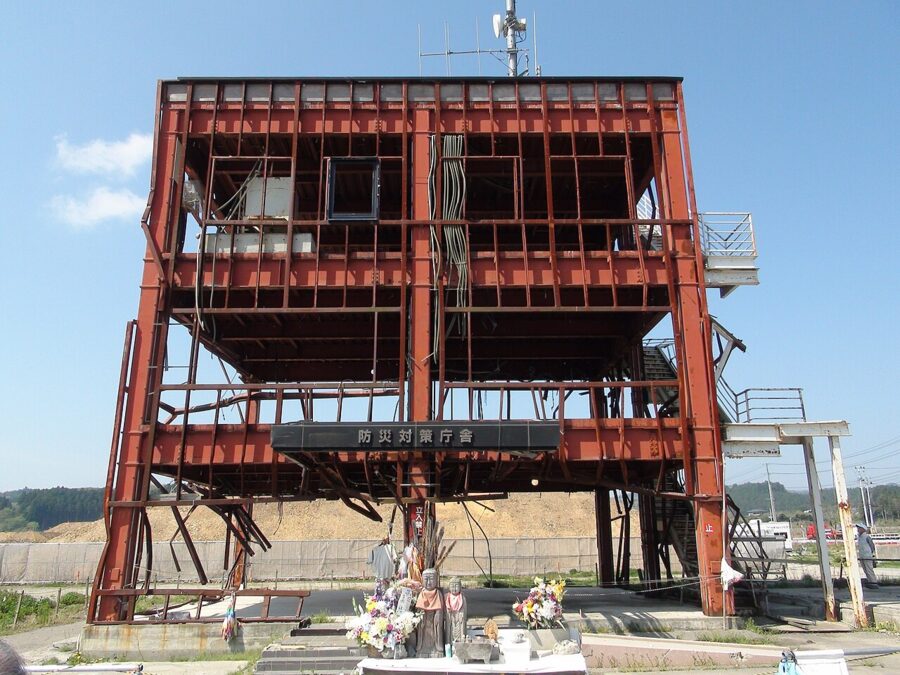
Almost all of central Minamisanriku was destroyed. The red steel frame of the town’s three-storey disaster prevention building still stands; staff kept broadcasting evacuation warnings until the wave went over the roof, and most of those inside died, among them Miki Endo, whose voice on the loudspeakers is credited with saving many lives.

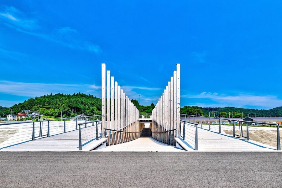

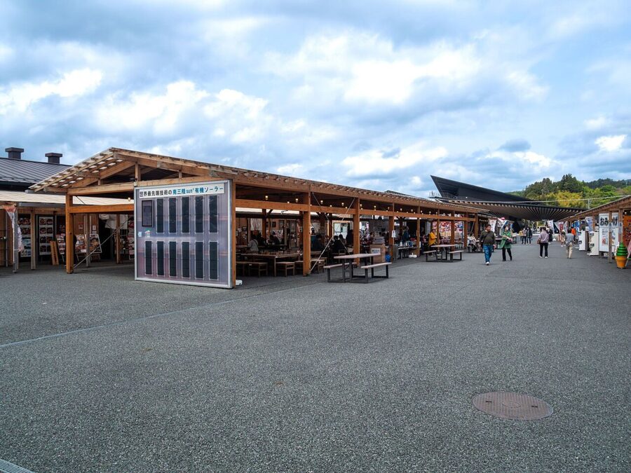
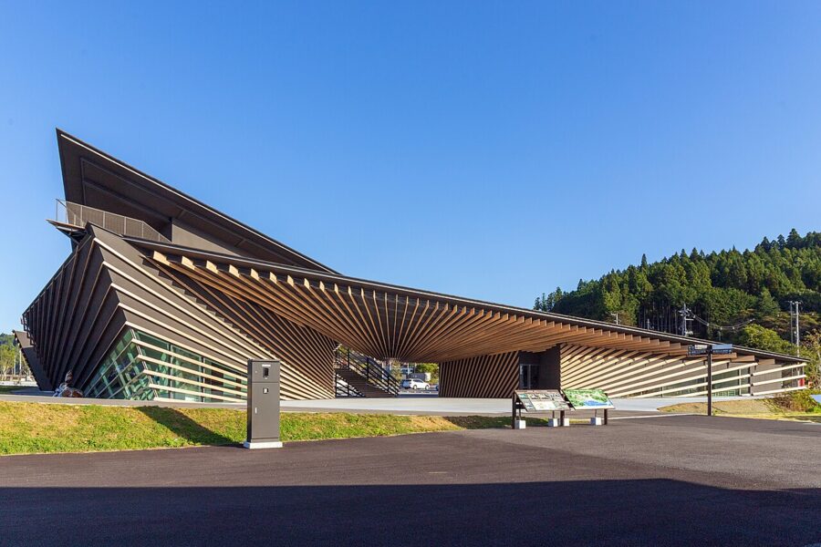
Across the river is the Sun Sun shopping village, low timber shops and seafood counters that began as a temporary market after the disaster. The village and the footbridge to the memorial park were designed by Kengo Kuma, as was the Minamisanriku 311 Memorial beside the shops, which tells the town’s story through residents’ testimony. As of November 2026 it opens 9:00 to 17:00 from March to November and to 16:00 in winter, closing on Tuesdays; its 60-minute learning programme costs ¥800 (about £4 / $5).


Kesennuma
Kesennuma, at the northern end of the coast, is one of Japan’s great fishing ports, landing bonito and swordfish and known for shark fin. In 2011 the wave and the oil fires that followed burned across its harbour. South of the town, the Kesennuma City Memorial Museum keeps the old Kesennuma Koyo High School as it was found: the tsunami reached the fourth floor and drove a factory building into its walls, and the 45 people inside all survived on the roof.
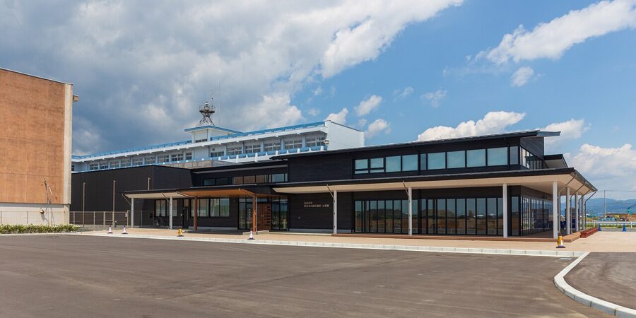

As of November 2026 entry is ¥600, and the museum opens 9:30 to 17:00 from April to September and to 16:00 from October to March, closing on Mondays. Take the BRT to Rikuzen-Hashikami and walk just over 20 minutes.
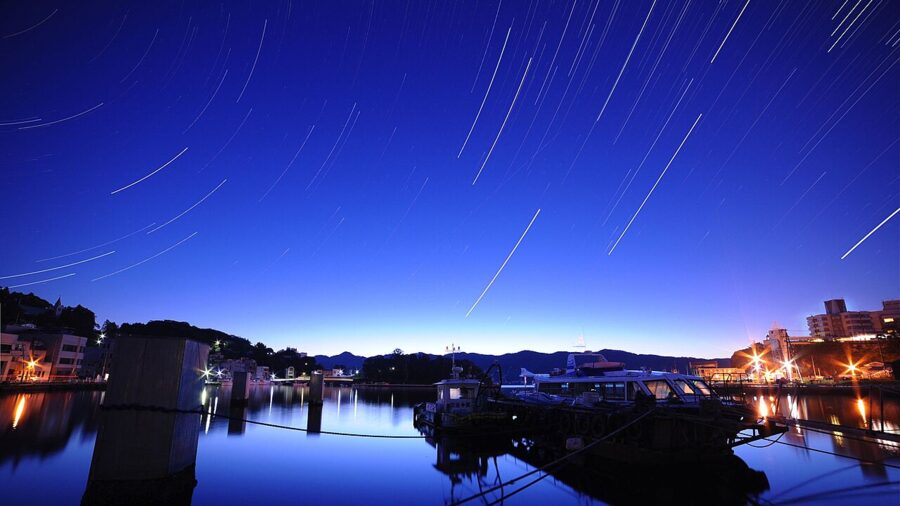

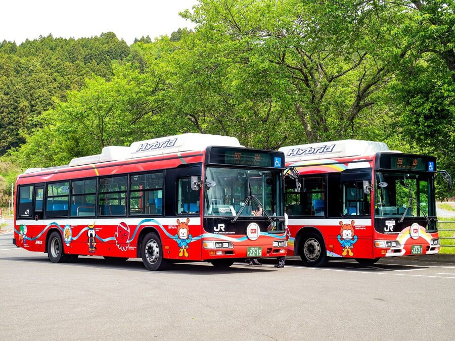
The railway along this coast was never rebuilt. JR runs Bus Rapid Transit on the old track bed instead, the Kesennuma Line BRT south towards Yanaizu and the Ofunato Line BRT north into Iwate. By car, Kesennuma is about one hour and 50 minutes from Sendai on the Sanriku Expressway, which is toll-free north of Naruse-Okumatsushima.

Getting there and getting around
Sendai is about 90 minutes from Tokyo on the fastest Tohoku Shinkansen services, the Hayabusa. After JR East’s fare revision of March 2026, a reserved seat costs about ¥11,630 (about £55 / $73) at normal season.
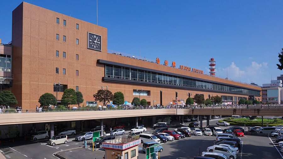

Sendai Airport, on the coast south of the city, has domestic flights from Osaka, Sapporo, Fukuoka and other cities, and the Sendai Airport Access Line runs to Sendai station in under half an hour. Within the prefecture:
- Matsushima and Shiogama: JR Senseki Line, about 40 minutes to Matsushima-Kaigan.
- Ishinomaki: JR Senseki-Tohoku Line, about an hour.
- Naruko: Shinkansen to Furukawa, then the JR Rikuu East Line.
- Zao: Shinkansen to Shiroishi-Zao, then Miyako bus to Togatta Onsen.
- Akiu: Miyagi Kotsu bus from Sendai station, about an hour.
- Hiraizumi: Shinkansen north to Ichinoseki in Iwate, an easy day out.
For the coast north of Ishinomaki and the Matsushima viewpoints, a car makes life far easier; rental offices cluster around Sendai station. Cash, cards and mobile data are covered in the general information guide.
Seasons
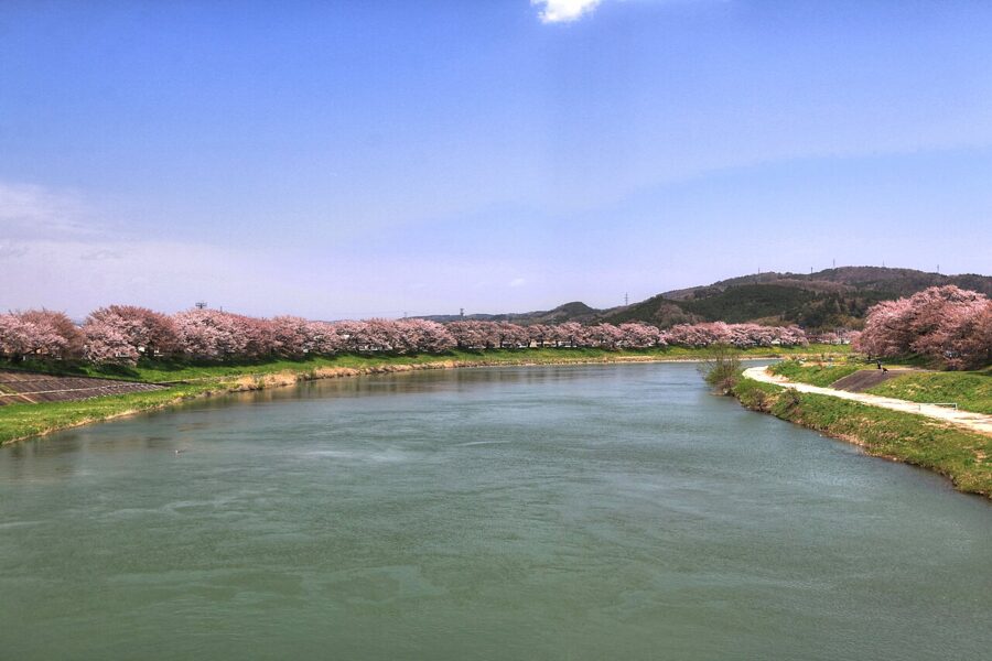
Sendai is mild for Tohoku, with less snow than the mountains to the west. Cherry blossom comes in early to mid April, about two weeks after Tokyo, with the long bank of trees beside the Shiroishi River at Ogawara the best-known sight, and the Echo Line reopens in late April between walls of snow. Summer brings Tanabata; autumn is the best season, with colour on the Zao summit in early October and at Naruko and Akiu from late October.

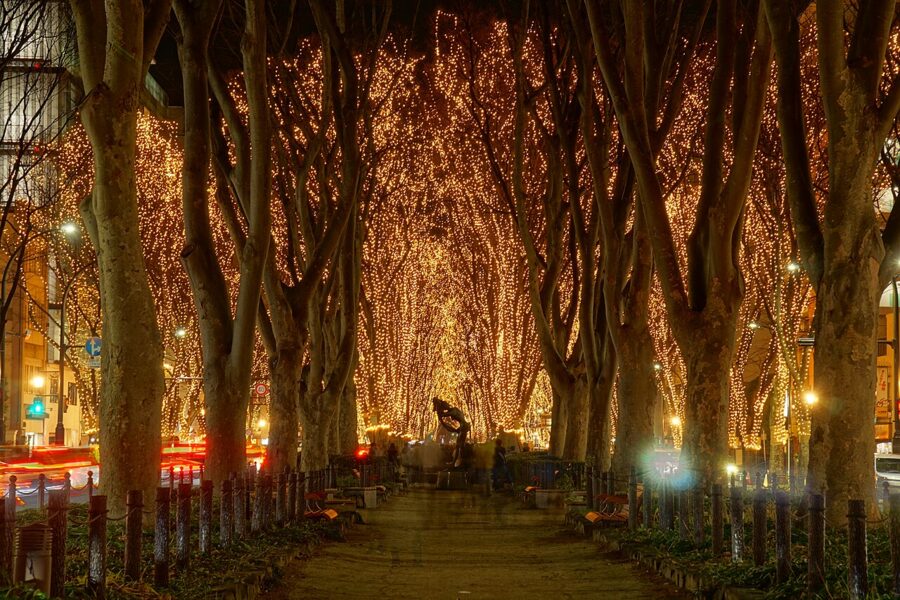

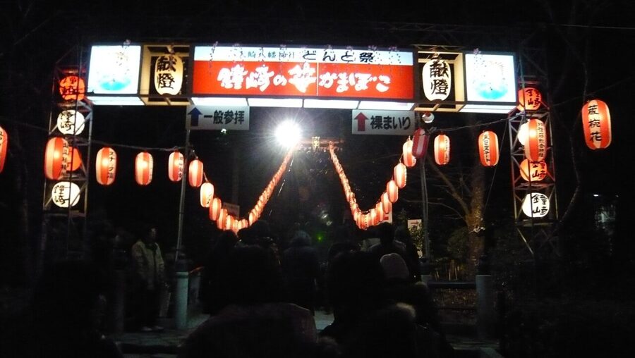
Winter brings the SENDAI Pageant of Starlight on Jozenji-dori, planned for 4 to 27 December 2026, the Dontosai at Osaki Hachimangu on 14 January, and Matsushima oysters at their best, but shorter opening hours almost everywhere.

One more caution: bears. In 2026 the prefecture issued bear warnings for parts of Sendai’s Aoba ward in August and for Kesennuma in October, after repeated sightings near houses. At the main sights it hardly matters; on rural walks and in the gorges, carry a bell and be off the trails by dusk.
How many days, and in what order
Two days covers the core: Sendai on the first, Matsushima and Shiogama by boat and train on the second.
Four days is what I would give Miyagi. Add a night at Naruko or Akiu for the baths and a gorge, and a day at Ishinomaki, by train to the town and memorial park or by car to include Okawa. In season, swap the hot spring for Zao.
With five or six days and a car, drive the coast: Matsushima and its viewpoints, Ishinomaki, Minamisanriku for lunch and the memorial, and a night in Kesennuma, then continue north into Iwate and return by Shinkansen from Ichinoseki. Choose where to stay by the route: Sendai for the city and day trips, a ryokan for the hot springs, a port town for the coast.
However you arrange it, finish at Matsushima if you can, on the last boat of the afternoon, when the light lies low across the islands and the bay looks much as it did when Basho saw it and chose to keep quiet.