
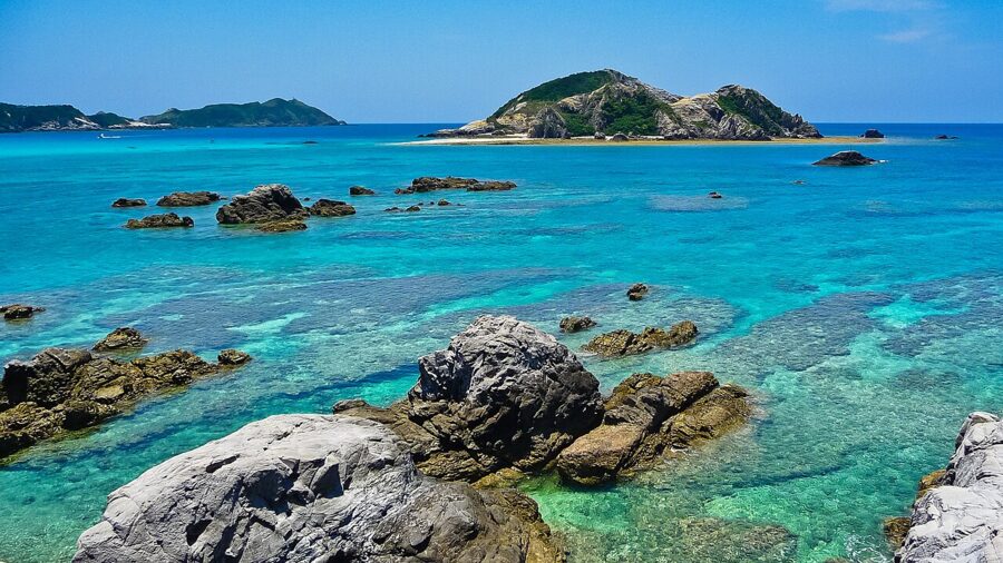
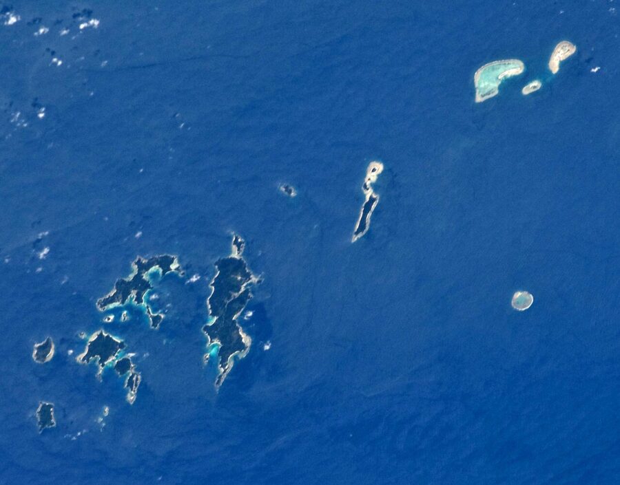
On a clear day you can see the mountains of Taiwan from Yonaguni (与那国島), the last of the Okinawa islands, 111 kilometres across the water. Tokyo is about 2,000 kilometres the other way. Okinawa Prefecture (沖縄県) fills the gap between them with 160 islands spread over a stretch of sea 1,000 kilometres from east to west and 400 from north to south, and fewer than fifty of them have anyone living on them.
Most people see two or three of them. The main island holds Naha, the airport, the royal castle at Shuri, the battlefields of 1945 and the forest of the north. The outer islands are a boat ride or a short flight away: the Kerama group within sight of Naha, then Miyako and the Yaeyama islands far to the south-west, where Ishigaki sits nearer to Taipei than to Naha.
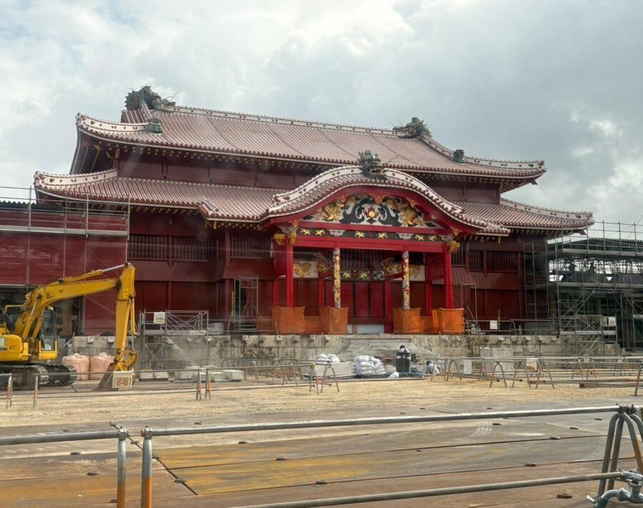

Shuri Castle’s main hall, the Seiden, which burned in October 2019, is open again from 23 November 2026. I would give the main island five days and one outer group three or four more, and plan both around the weather, which decides more Okinawa trips than any timetable.

Contents
- The shape of Okinawa: an island chain 1,000 kilometres wide
- Naha: Kokusai-dori, the market and the potters' quarter
- Shuri Castle: the hall rebuilt again
- The south: memorials, caves and the sacred grove
- The middle of the island: bases, castles and causeways
- The north: Motobu, Churaumi and Yanbaru
- The outer islands, and how to choose
- When to go: rain in May, typhoons in late summer
- Getting there and getting around
The shape of Okinawa: an island chain 1,000 kilometres wide
Okinawa Island itself is long and thin, a little over 100 kilometres from Cape Hedo in the north to Kyan in the south, and only about four kilometres across at its waist near Ishikawa. The south and middle are low limestone country, built over from Naha to Okinawa City. North of the waist the island rises into the forested hills of Yanbaru (やんばる), where the roads thin out and the villages sit at the river mouths.
Naha is about 1,550 kilometres from Tokyo and about 1,250 from Kyoto, but only 630 from Taipei. The flight from Tokyo Haneda takes about two and a half hours, and there are direct flights from Taipei, Seoul and Hong Kong as well as from most large Japanese cities.
The Kerama Islands lie about 40 kilometres offshore, close enough for a day trip by boat. Miyako is about 290 kilometres away and Ishigaki about 410, and only aircraft link them with Naha; the long-distance passenger ferries stopped in 2008.
The Ryukyu kingdom in brief
Okinawa was a country before it was a prefecture. In the fourteenth century the main island was split between three rival kingdoms, north, middle and south, each ruled from its gusuku, a stone castle on a hilltop. Sho Hashi united them in 1429, and his court at Shuri grew rich on trade between China, Japan, Korea and South-east Asia.
In 1609 the Satsuma domain of southern Kyushu invaded, and for two and a half centuries the kingdom paid tribute to both China and Japan while keeping its own king. Japan abolished the kingdom in 1879 and made it Okinawa Prefecture. In 1945 the islands saw the last great land battle of the Pacific war, and they stayed under United States administration until 15 May 1972.
That history explains much of what you see. The castles are Ryukyuan rather than Japanese, with curving walls of fitted limestone. The food leans on pork, bitter melon and wheat noodles, and the old language survives in greetings: haisai means hello (haitai if a woman is speaking), and mensore, welcome, is painted over shop doors.
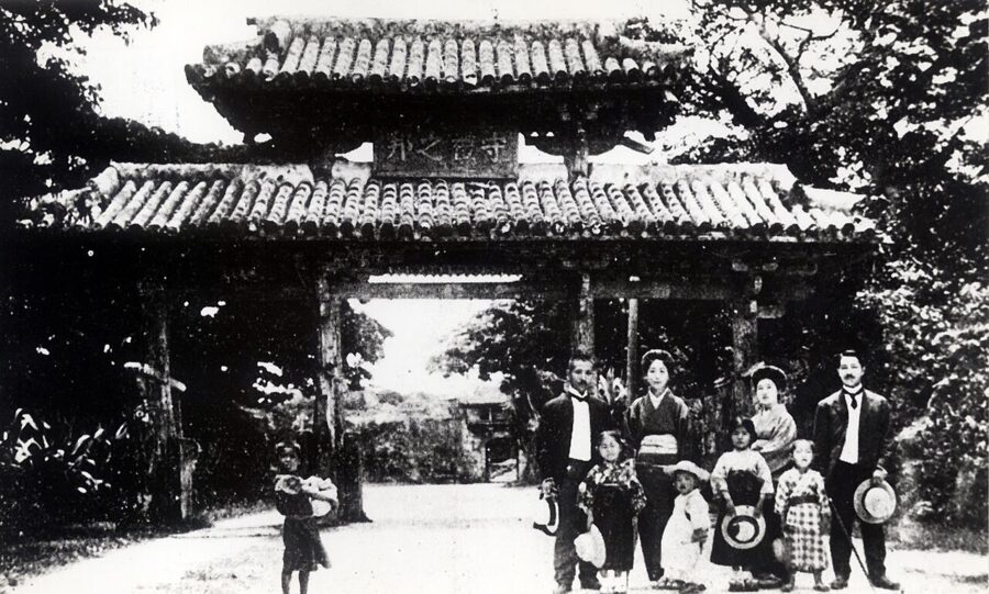
Naha: Kokusai-dori, the market and the potters’ quarter
Naha (那覇) is a working city of about 310,000 people, and most first nights are spent within ten minutes’ walk of Kokusai-dori. The 1.6-kilometre avenue runs from the prefectural office east towards Makishi. Its name means International Street, and it rose out of the burnt ground after 1945 quickly enough to be nicknamed the Miracle Mile.
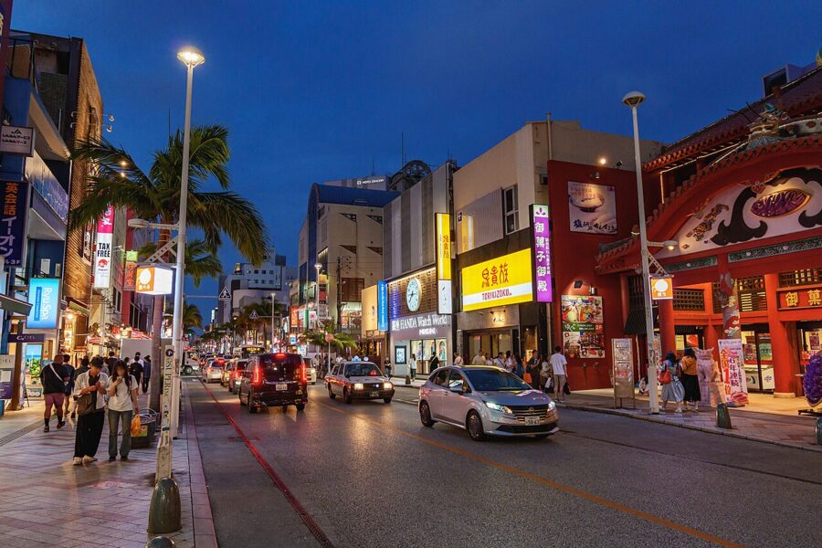

By day the avenue sells Orion beer shirts, brown-sugar sweets and sea salt; after dark it fills with izakaya crowds and the sound of the sanshin, the snakeskin-covered lute. One evening is enough.
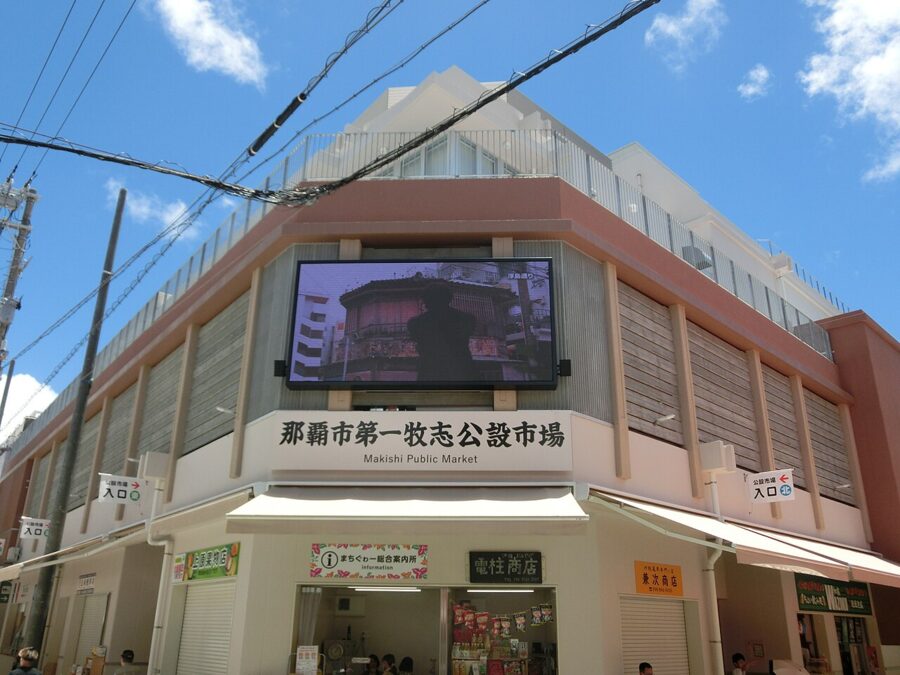
Turn off into the covered arcades of Ichiba-dori and Heiwa-dori for the better part of the city. The Daiichi Makishi Public Market, Naha’s food market since the years after the war, reopened in a new building in 2023, and it keeps the old arrangement: buy fish, crab or lobster on the ground floor and have it cooked in one of the small restaurants upstairs for a fee.
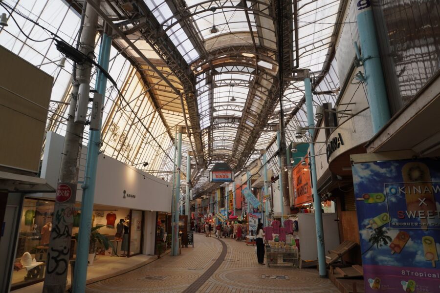
South of the arcades lies Tsuboya, where the kingdom gathered its potters in 1682. The stone-paved Tsuboya Yachimun-dori is still lined with workshops selling yachimun, the thick glazed stoneware of Okinawa, and an old climbing kiln survives among the houses on the hillside. Buy a pair of shisa, the lion-dogs that guard Okinawan roofs, here rather than on the main avenue.
Eat Okinawa soba before you go anywhere else. It is not buckwheat at all but thick wheat noodles in a pork and bonito broth, topped with braised pork belly or rib; add a few drops of koregusu, chillies steeped in awamori, the island’s rice spirit. Goya champuru, bitter melon stir-fried with tofu, egg and pork, is the other dish every menu carries.
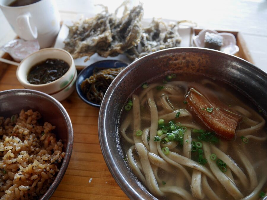
Base yourself in Naha for the first two or three nights; you need no car until you leave the city.
Shuri Castle: the hall rebuilt again
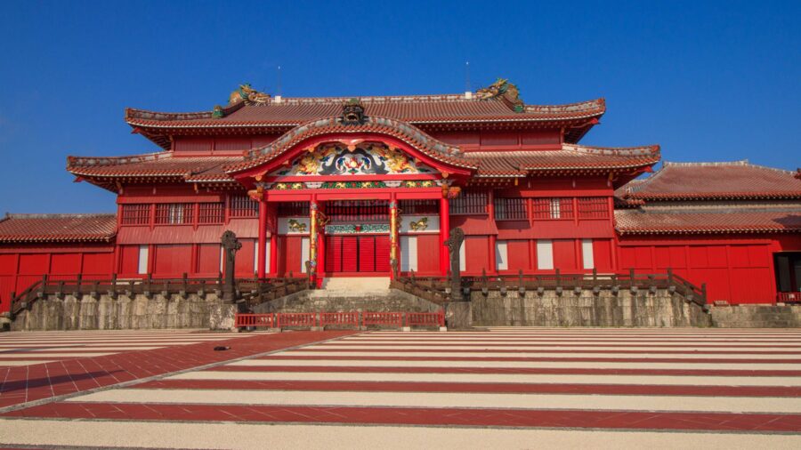
Shuri Castle (首里城) stands on a ridge about three kilometres east of Kokusai-dori, and for four and a half centuries it was the seat of the Ryukyu kings. Its main hall has burned five times: in a succession war in 1453, by accident in 1660 and 1709, in the battle of 1945, and in a night fire on 31 October 2019 that took the Seiden and the halls around it. The hall that burned in 2019 was itself a reconstruction, finished in 1992.
The World Heritage listing of 2000, Gusuku Sites and Related Properties of the Kingdom of Ryukyu, covers the stone walls and the buried foundations rather than the timber halls.
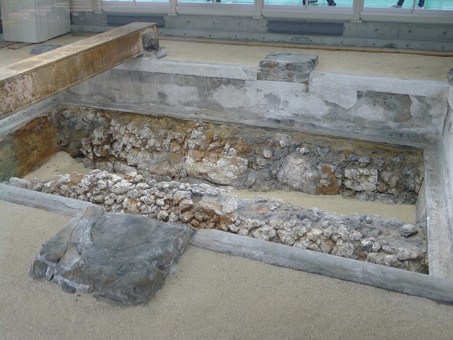

The new Seiden is open from 23 November 2026. Admission to the paid area is ¥1,000 (about £5 / $7) for adults, ¥760 (about £4 / $5) for high-school students and ¥370 (about £2 / $2.50) for younger children, the same whether or not you go inside the hall. To see the interior you book a ticket with a date and time slot, which costs nothing extra, and slots can sell out (all as of November 2026).
From July to the end of November the free area opens at 8.00 and the paid area runs from 8.30 to 19.00, with the last tickets sold at 18.30; hours change with the season, so check the castle park’s own site before a winter visit. Go early, before the tour groups arrive from mid-morning.
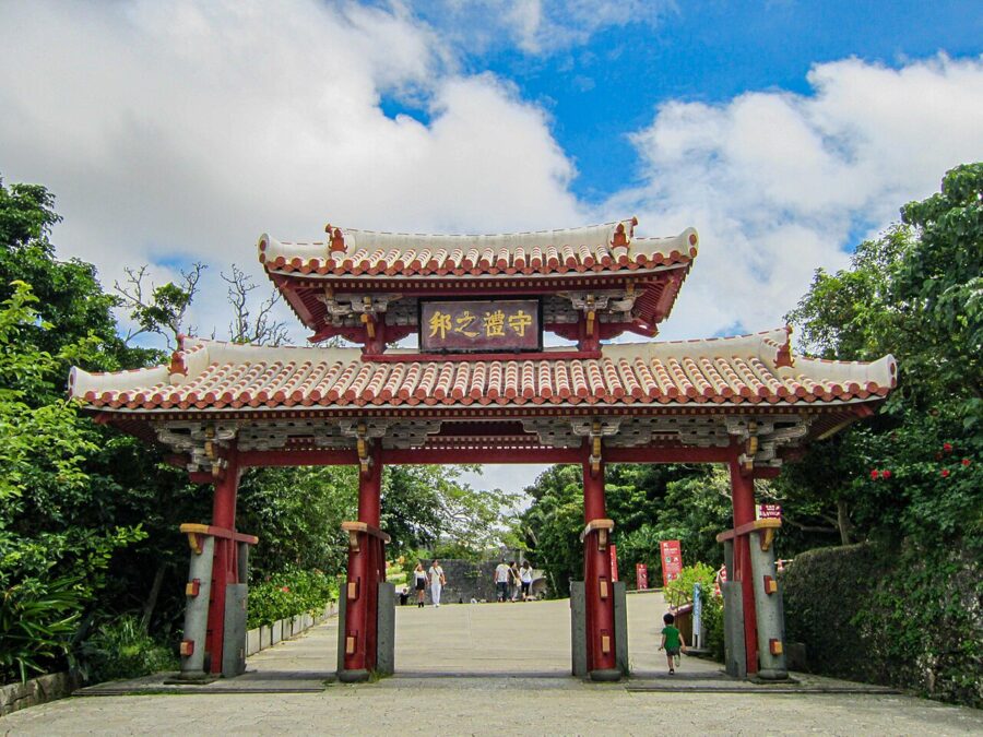
Walk up from Shuri station through Shureimon, the gate printed on the 2,000-yen note, past Sonohyan-utaki, the stone gateway to a sacred grove where kings prayed before setting out on a journey, and through the curving walls to the terraces at the top. From the western terrace the view runs over Naha to the sea.

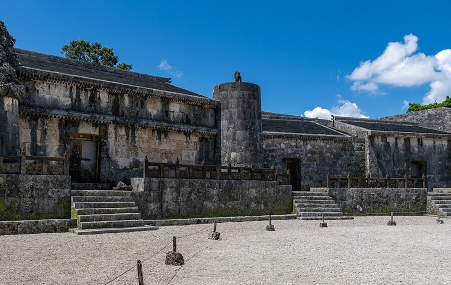
Below the castle, Tamaudun holds the royal tombs, and the Kinjo-cho stone path drops down the hillside to the south between old walls and houses, one of the few streets in Naha that came through the war.

The south: memorials, caves and the sacred grove
The Battle of Okinawa began with American landings on the Kerama Islands on 26 March 1945 and on the main island’s west coast on 1 April. Organised Japanese resistance ended in the south in late June, and Okinawa marks 23 June as Irei no Hi, its day of remembrance. Civilians died in the tens of thousands, caught in the shelling, sheltering in caves and in some places driven to mass suicide, and by common estimates a quarter of the island’s people did not survive.
The south of the island, where the last fighting happened, is where the memorials stand, and they deserve a full day without a beach added on. Okinawa’s memorial is not Hiroshima‘s: it remembers a land battle fought through villages and caves, and it names the dead of every side.
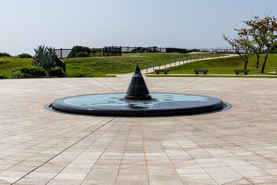
The Peace Memorial Park sits on the cliffs at Mabuni in Itoman, near the southern tip. At its centre is the Cornerstone of Peace, rows of black granite walls engraved with the name of everyone known to have died in the battle: Okinawan, Japanese, American, British, Korean and Taiwanese. Names are still added each June, and the total stood at 242,659 after the additions of 2026.
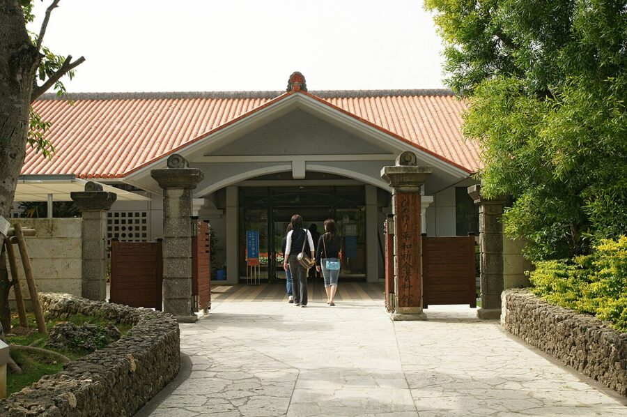
The Okinawa Prefectural Peace Memorial Museum beside the walls tells the battle from the civilians’ side, through survivors’ testimony and the things they carried. Admission is ¥300 (about £1.50 / $2) for adults (as of November 2026).
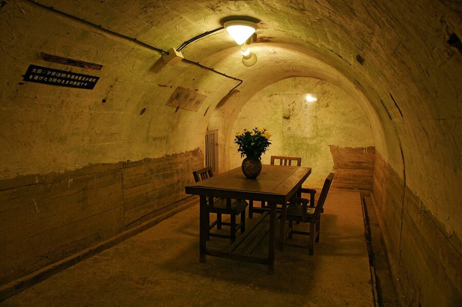
A few minutes’ drive west is the Himeyuri Peace Museum, beside the cave where students and teachers from two girls’ schools, mobilised as army nurses, died in the last days of the battle. Closer to Naha, the Former Japanese Navy Underground Headquarters in Tomigusuku is a tunnel complex dug by hand. Rear Admiral Ota Minoru killed himself there in June 1945, after sending Tokyo a telegram that asked for the people of Okinawa to be given special consideration for what they had endured.


The south also holds the kingdom’s holiest place. Sefa-utaki (斎場御嶽), in Nanjo on the south-east coast, is a forest shrine with no buildings at all. Stone paths lead between limestone outcrops to Sangui, a triangular gap between two leaning rocks, and from the far side the view opens to Kudaka Island, where the Ryukyuan creation story says the gods first came down.
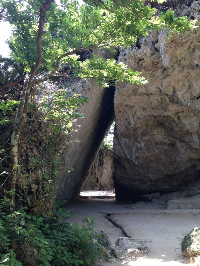

Treat it as a place of worship. The usual rules of Japanese etiquette apply, plus a few more: keep to the paths, do not touch the stones or the incense burners, and keep your voice down. The grove closes for a few days twice a year for rituals, so check before you go.
For the south I would hire a car for a day; buses from Naha reach the Peace Park, but changes eat the hours.
The middle of the island: bases, castles and causeways
Between Naha and Ishikawa lies the most crowded part of the prefecture, and the part most people only drive through. Kadena Air Base and Camp Foster take up great blocks of it. Chatan, beside them, has the seafront shops and restaurants of American Village, and Okinawa City, formerly Koza, keeps the bars of Gate 2 Street that grew up to serve the soldiers.
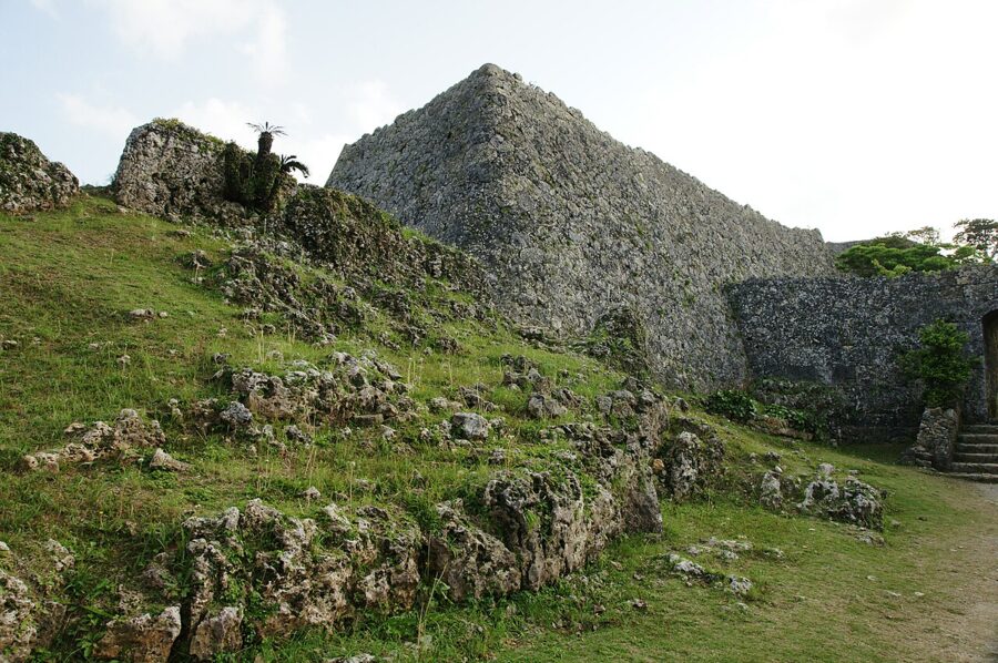
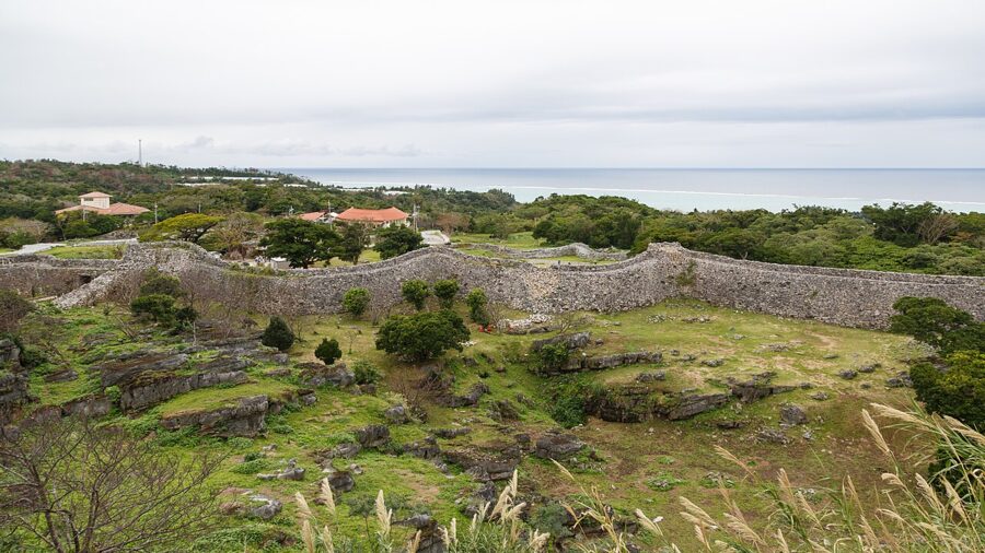
The gusuku are the reason to stop. Nakagusuku Castle, on a ridge above the east coast, is the best preserved: six enclosures of curving limestone wall that members of Commodore Perry’s expedition surveyed and admired in 1853. Katsuren Castle in Uruma climbs to a summit with the Pacific on one side and Kin Bay on the other, and Zakimi Castle in Yomitan is small and almost always quiet. All three are part of the World Heritage listing.

East of Uruma a sea road, the Kaichu-doro, crosses the shallows to Henza, and bridges carry on to Miyagi, Ikei and Hamahiga: a quiet half-day by car.
The north: Motobu, Churaumi and Yanbaru
North of Nago the island changes character. The Okinawa Expressway ends at Kyoda, just short of Nago, and from there Route 58 and the roads of the Motobu Peninsula take over. I would base myself in Nago or on the Motobu coast for two nights rather than drive back to Naha each evening.
The Motobu Peninsula juts west from Nago, and on its far side is Ocean Expo Park, built for the international ocean exposition of 1975, with the Okinawa Churaumi Aquarium (美ら海水族館) at its heart. The centrepiece is the Kuroshio Sea tank, 7,500 cubic metres of water behind an acrylic panel 8.2 metres high and 22.5 metres wide, where whale sharks and manta rays swim.
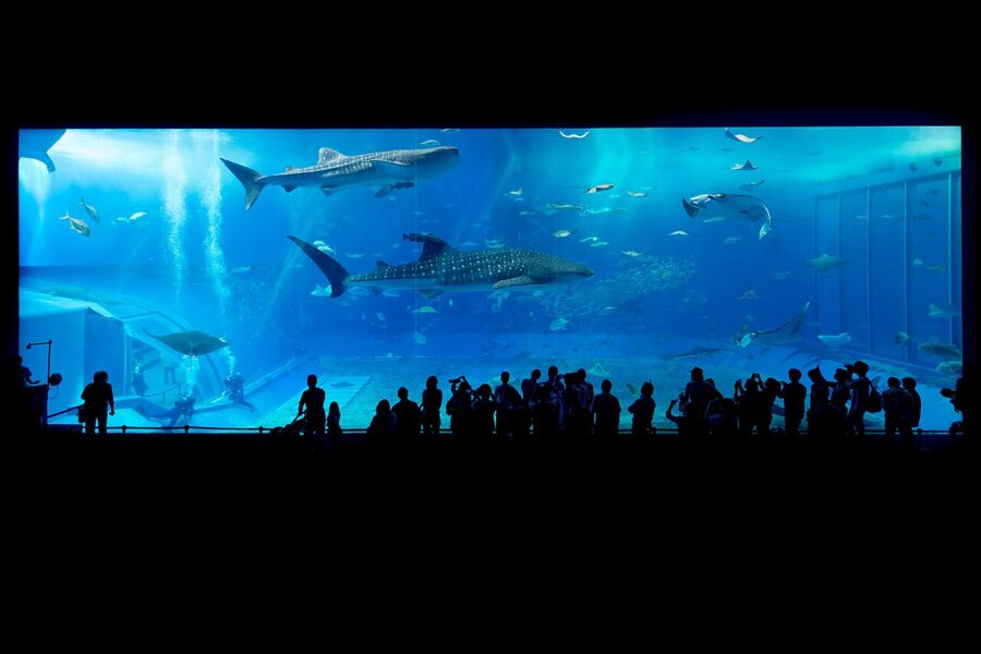

Admission is ¥2,180 (about £11 / $14) for adults, ¥1,440 (about £7 / $10) for high-school students and ¥710 (about £3.50 / $5) for younger children. Outside the busy weeks of late April, late July and August, the aquarium opens 8.30 to 18.30 with last entry at 17.30, and it has no scheduled closing days until the end of March 2027 (as of November 2026). Arrive at opening or late in the afternoon; the drive from Naha takes about an hour and a half.
Junglia Okinawa, a theme park in the hills behind Nakijin, opened in July 2025; it needs a day of its own.
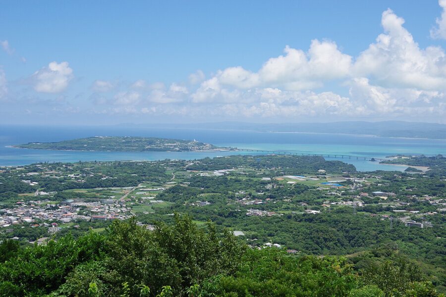

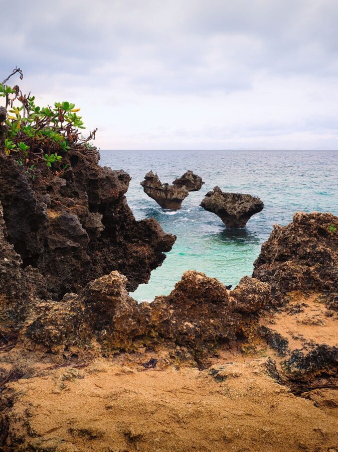
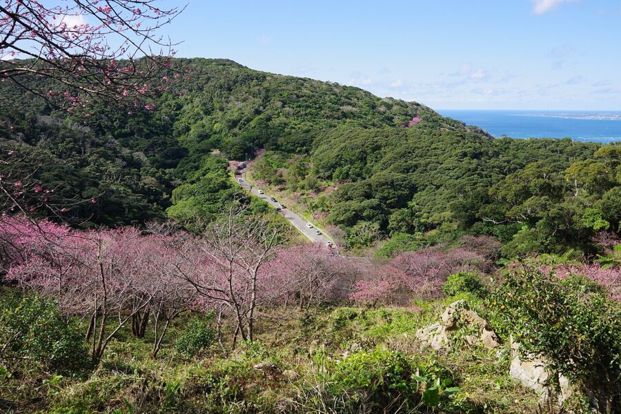
From the peninsula’s north coast, Kouri Bridge crosses shallow turquoise water to Kouri Island, with beaches by the landing and a heart-shaped pair of rocks at Tinu beach. Nakijin Castle, the old seat of the northern kings, stands on the peninsula’s north side; its walls run for about 1.5 kilometres along the ridge, and in late January the cherry trees on the approach are among the first in Japan to flower.

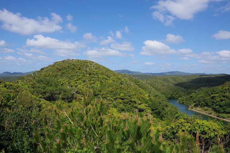
Beyond Ogimi the north is forest. Yanbaru, written with the characters for mountain and field, is a subtropical evergreen forest of chinquapin oaks and tree ferns. It became a national park in 2016 and a World Natural Heritage site in July 2021, together with Amami-Oshima, Tokunoshima and Iriomote.

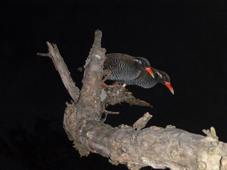
The forest is home to species found nowhere else, the best known of them the Okinawa rail, yanbaru kuina, a flightless bird first described only in 1981. Signs along the roads warn that rails cross, and cars kill some every year, so drive slowly.
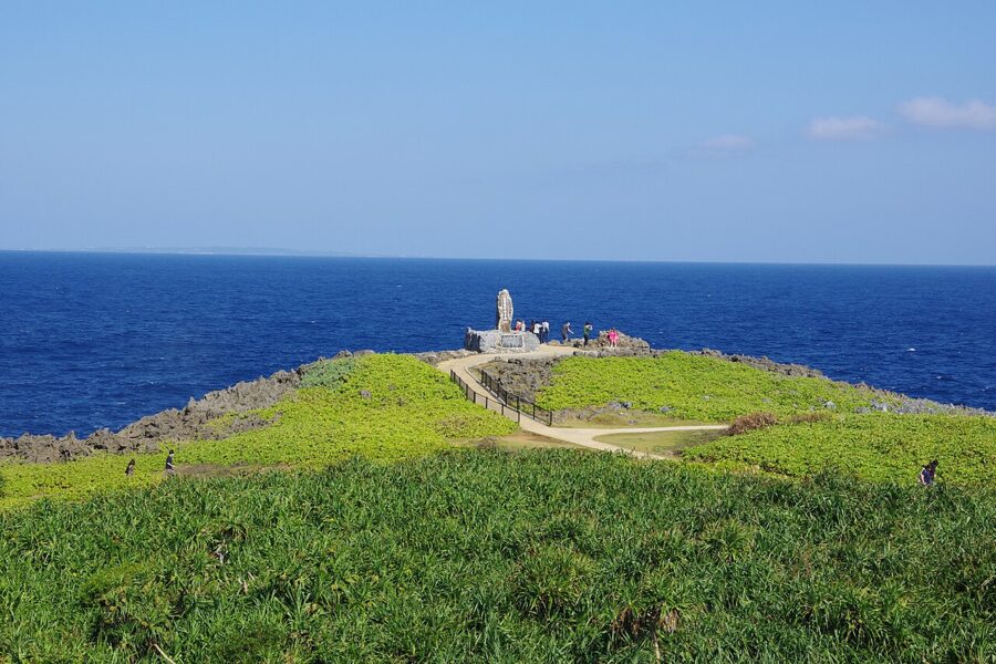
The road ends at Cape Hedo, the northern tip, a grassy headland of limestone above a rough sea. On clear days Yoron Island, already part of Kagoshima Prefecture, shows on the horizon 23 kilometres away.

The outer islands, and how to choose
The white sand and the water that shades from turquoise to navy across the reef belong to the outer islands. For a first visit there are four realistic choices, and they suit different trips.
Kerama: a day or a night from Naha
The Kerama Islands (慶良間諸島) are the closest, about 40 kilometres west of Naha. Boats leave from Tomari port: the high-speed Queen Zamami reaches Zamami in about 50 minutes, and the slower Ferry Zamami takes about two hours, calling at Aka. Tokashiki has its own fast boat and ferry, also from Tomari. The fast boats fill up in busy periods, so book ahead through Zamami or Tokashiki village.
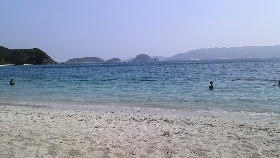

The water is the draw. Kerama Shoto became a national park in 2014 for its reefs, and the clarity has a local name, Kerama blue. Furuzamami on Zamami and Aharen on Tokashiki are the classic beaches; Aka is smaller and quieter, with wild Kerama deer wandering the village. From late winter into early spring, humpback whales come to these waters to breed, and boats go out from Zamami to watch them.
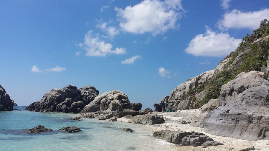

The islands have a hard history too. In March 1945, as American troops landed, hundreds of islanders on Tokashiki and Zamami died in mass suicides, and memorials on both islands mark it. A day trip works, but stay a night if you can: the beaches empty once the afternoon boats have gone.
Miyako: bridges and beaches
Miyako (宮古島) is flat limestone ringed by reef, about 50 minutes by air from Naha, with direct flights from Tokyo too; the neighbouring island of Shimoji has a second airport. There are no mountains, and with no rivers to carry silt into the sea, the water stays exceptionally clear.
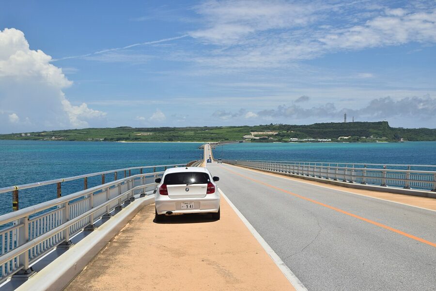

Bridges have turned Miyako into a small archipelago you can drive. Irabu Bridge, 3,540 metres long and opened in 2015, is the longest toll-free bridge in Japan, and the Ikema and Kurima bridges reach the other islands. Yonaha Maehama, a long run of fine white sand on the south-west coast, is the beach the posters show.
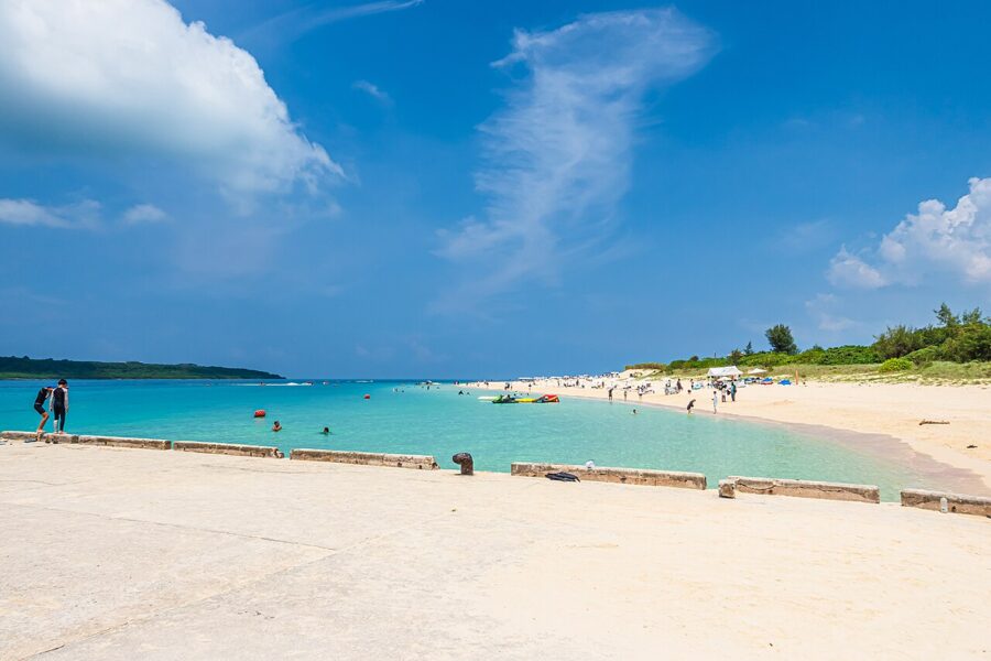

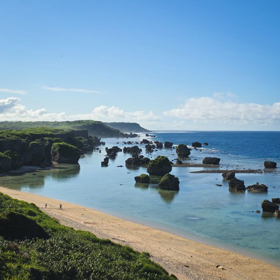
Miyako is the easiest outer island for a beach week. Hire a car at the airport, since the buses are infrequent, and you can reach a different beach each day.
Ishigaki and Taketomi: the Yaeyama hub
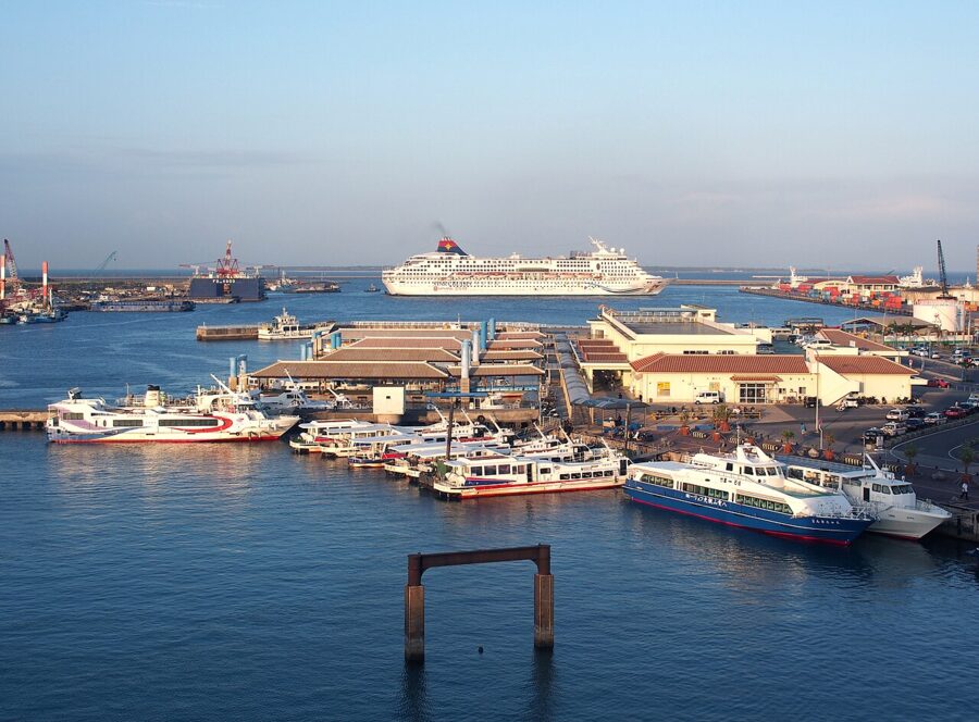
Ishigaki (石垣島) is the hub of the Yaeyama islands, about an hour’s flight from Naha and a little over three hours direct from Tokyo Haneda. It is a real town, with hotels, restaurants and the island ferry terminal from which boats leave for every other island in the group. Ishigaki beef, from the island’s own cattle, is the dinner to look for.

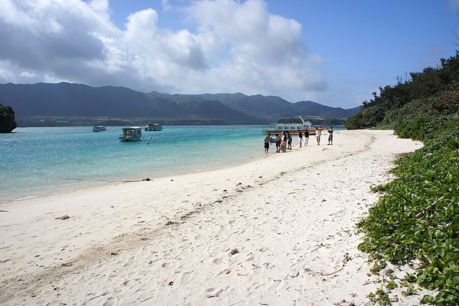
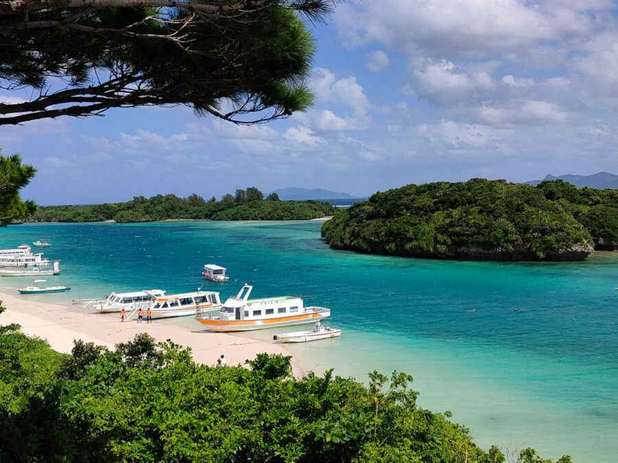
Kabira Bay on the north-west coast is the island’s famous view, a sheltered lagoon of islets where black pearls are farmed. Swimming is not allowed, so you see it from the glass-bottom boats instead.
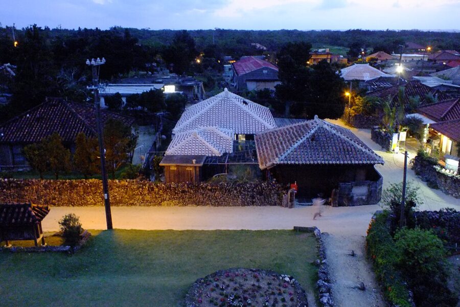
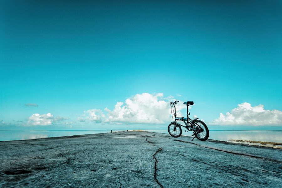
Taketomi (竹富島) is 10 to 15 minutes by boat from Ishigaki and could not be more different: a flat coral island with one village of red-tiled houses behind coral-stone walls, sand lanes swept each morning, and carts pulled by water buffalo. The village is a protected preservation district, and the island is small enough to cycle round in an hour.

Iriomote: the jungle island
Iriomote (西表島) is the second-largest island in the prefecture and about nine-tenths forest, with mangroves along its rivers and a single road that runs around part of the coast and then stops. No flights land here. Boats from Ishigaki take about 40 to 50 minutes to Uehara in the north or Ohara in the south-east, and the Uehara crossing is the more exposed one in rough weather.
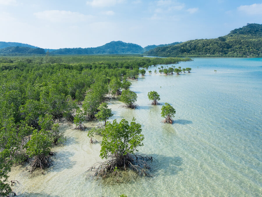

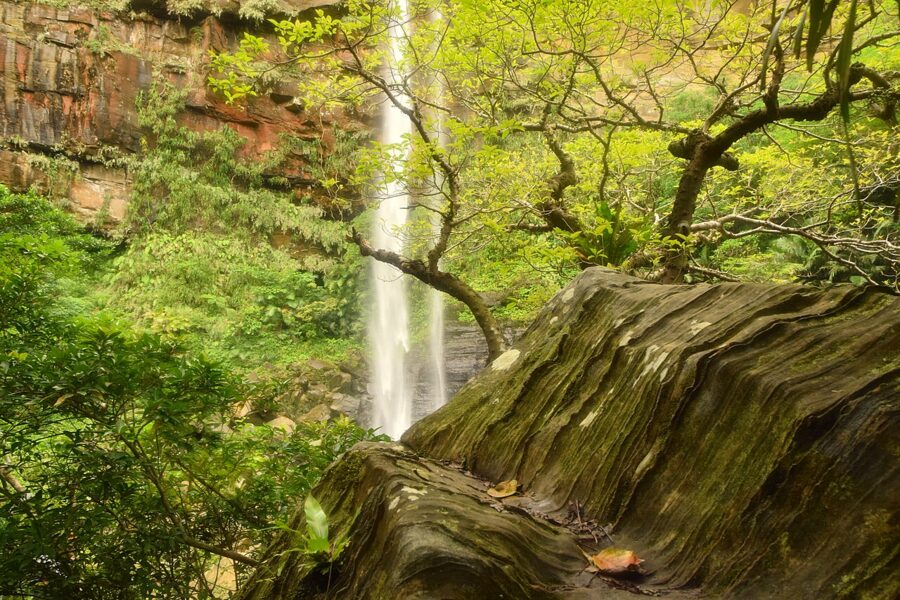
Iriomote is part of the 2021 World Heritage site and home to about a hundred Iriomote cats, a wildcat found nowhere else. Since 1 March 2025, five inland areas, including the Hinai River route to Pinaisara Falls and the Nishida River, have a daily cap on visitors (200 a day on the Hinai River) and need approval from Taketomi Town in advance. You go with a registered guide or after a town-run course, so book jungle walks through a registered guide.

Taketomi Town, which takes in Iriomote, Taketomi and the other small Yaeyama islands, voted in June 2025 for a visit tax of ¥1,000 per person, aimed for the 2026 financial year. Check whether it is being collected before you travel.
How to choose
| Island group | From Naha | Best for | Car | Nights |
|---|---|---|---|---|
| Kerama | Boat from Tomari, about 50 minutes fast or two hours slow | Snorkelling, whales in late winter, a short escape | Not needed | Day trip or 1 to 2 |
| Miyako | Flight, about 50 minutes | Beaches and bridges by car | Yes | 3 to 4 |
| Ishigaki and Taketomi | Flight, about an hour | A town base with island day trips | Useful on Ishigaki | 3 to 4 |
| Iriomote | Via Ishigaki, then 40 to 50 minutes by boat | Forest, rivers, guided kayaking | Useful | 2 to 3 |
With a week in total, I would pair the main island with Kerama and skip the long flights. With ten days or more, add Ishigaki and give two of those days to Iriomote and a night to Taketomi. If you want the main island or Ishigaki for a single trip, choose the main island for history and food, and Ishigaki for the sea.
When to go: rain in May, typhoons in late summer
Okinawa is subtropical. Naha’s coldest month, January, averages about 17°C, and the sea is warm enough for most swimmers from about April to November.
The rainy season comes earlier than on the main islands of Japan, starting on average around 10 May and ending around 21 June, and it brings heavy showers rather than steady rain. Summer is hot, humid and the peak of the beach season. Typhoons can arrive from June to October, with August and September the most likely months; when one passes, boats and flights stop, and a storm that lingers can strand you for two or three days.
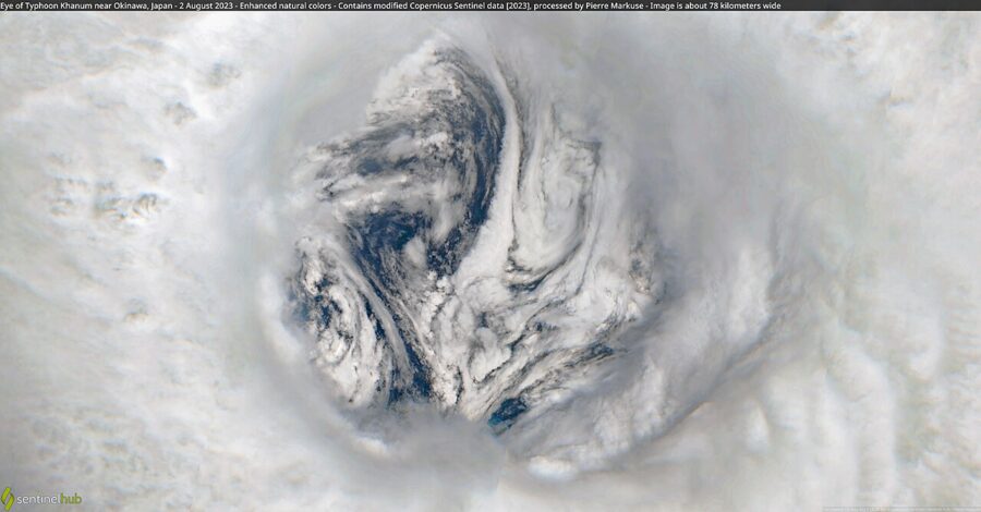

The months I would choose are April, before the rains, and October into early November, after the worst of the typhoons, when the sea is still warm and the crowds are thinner. Avoid Golden Week at the start of May and the Obon week in August, when Japanese families fill the flights and hotels.
Winter is mild, cheaper and good for walking, though grey, windy days are common and few people swim. It is also whale season in the Kerama Islands, and the cherry season: the deep pink hikanzakura opens in late January, first in the north on Mount Yae and around Nago.

Getting there and getting around
Almost everyone arrives by air at Naha Airport. From Tokyo Haneda the flight takes about two and a half hours, from Osaka about two and from Fukuoka about an hour and three-quarters. Ferries also run from Kagoshima to Naha by way of the Amami islands, a voyage of about a day.
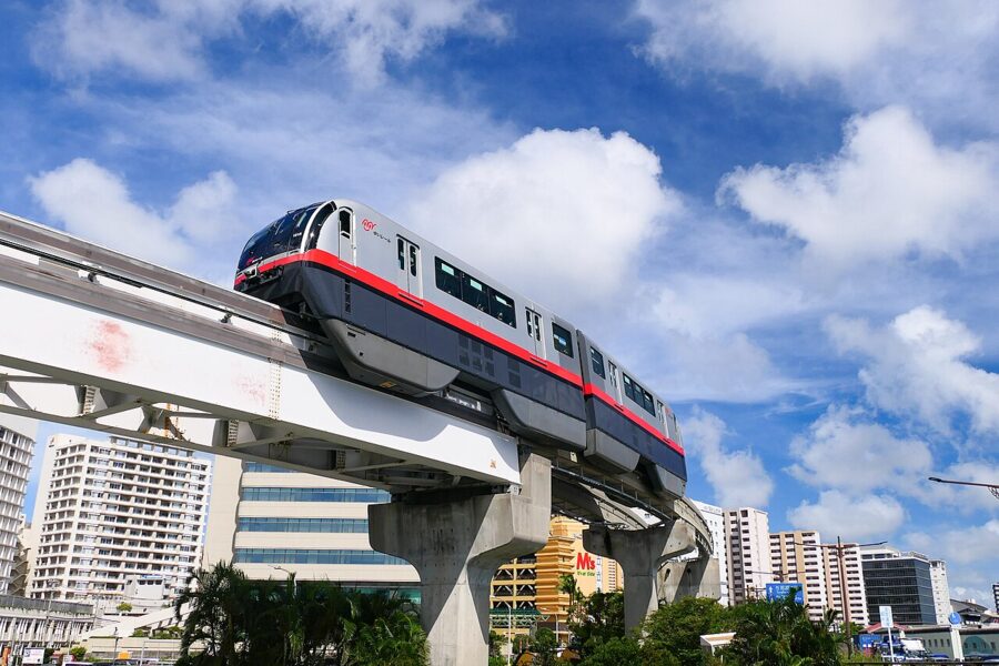
Inside Naha, use the Yui Rail. The monorail runs 19 stations from Naha Airport through the city centre and Shuri to Tedako-Uranishi in Urasoe, and it takes Suica and the other national IC cards as well as its own OKICA card.
Beyond Naha, buses reach almost everywhere, including express services from the airport to Nago and the Motobu Peninsula, but away from the main roads they are slow and infrequent.
I would hire a car for the south and the north. Japan drives on the left, and Okinawa has done so since 30 July 1978, six years after it returned to Japan. You need an International Driving Permit under the 1949 Geneva Convention, or for a handful of countries an official Japanese translation of your licence, alongside your own licence. Hire companies collect you from the airport by shuttle bus.
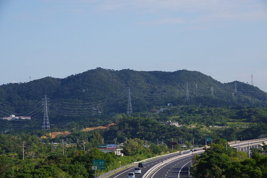

The Okinawa Expressway runs 57 kilometres from Naha to Kyoda near Nago. The toll saves a good deal of time over Route 58, which is slow through the towns and has bus-only lanes at weekday rush hours around Naha. The rest of the practical information for Japan applies here unchanged, though you should carry some cash for island boats and small shops.
On your last evening, go back up to the terrace at Shuri. The new hall stands behind you, Naha spreads out below, and the sea runs west towards the Kerama Islands, where the outer islands begin.