
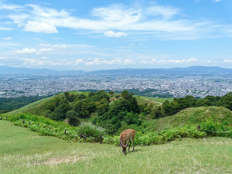
Nara Prefecture (奈良県) has no coastline, and most of it is mountain. Nearly everyone who comes sees only its flat northern corner, usually for an afternoon: the deer, the Great Buddha, a train back to Kyoto or Osaka before dark. That corner deserves the fame, but it is the smaller part of the story.
The basin was where the Japanese state took shape. The court sat in Asuka through most of the seventh century, moved a few kilometres north to Fujiwara in 694 and then to Heijo, today’s Nara City, in 710. South of the basin the ground rises into the Yoshino hills and then the Omine range, where mountain ascetics still walk a ridge route between Yoshino and Kumano.


I would give Nara Prefecture three days at the least: one for Nara Park, one for Horyu-ji and the temples west of the city, one for Asuka. Add a night in Yoshino in spring, or two more days in the mountains at any other season, and you will have seen the prefecture rather than its front door.
Contents
- The shape of Nara Prefecture
- Nara Park and the deer
- Todai-ji and the Great Buddha
- Kasuga Taisha and the forest
- Kofuku-ji: a pagoda under wraps
- Naramachi, the merchant town
- West of the city: Heijo Palace, Yakushi-ji and Toshodai-ji
- Horyu-ji and the Ikaruga temples
- Asuka and the earliest capitals
- Yoshino: cherry blossom and Zao-do
- The Omine and Kii mountains
- Getting there: JR or Kintetsu
- Seasons in Nara Prefecture
- How many days, and where to stay
The shape of Nara Prefecture
Nara Prefecture covers about 3,691 square kilometres and had 1,269,180 residents at the October 2025 census, a fall of 4.2 per cent in five years. Most of them live in the Nara basin, a flat floor in the north-west roughly 30 kilometres from north to south. The rest of the prefecture, well over half its area, is the Kii mountains: forested ridges, narrow river gorges and villages strung along roads that follow the water.
Hills close the basin on three sides: the Ikoma and Kongo ranges to the west, facing Osaka; low hills to the north, towards Kyoto; and to the east the ridge behind Mount Wakakusa, with the Uda uplands beyond. Its rivers gather in the Yamato River and leave through a gorge for Osaka Bay.
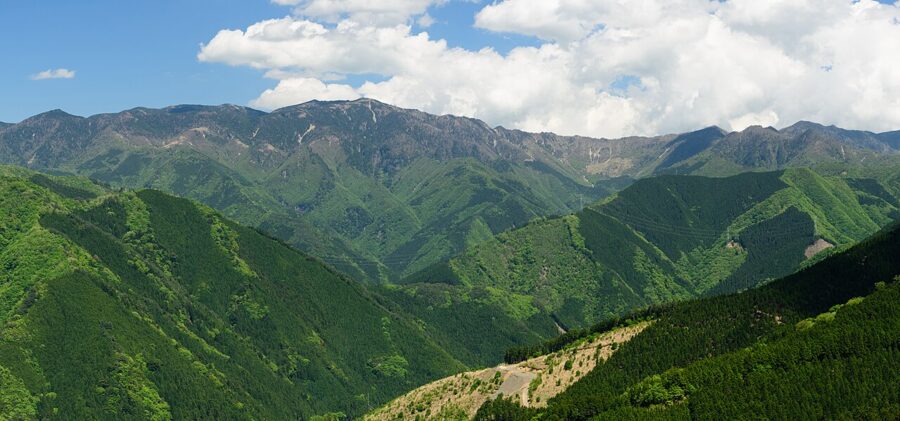

South of the basin the country changes within a few kilometres. Beyond the Yoshino River the Omine range climbs to Mount Hakkyo, at 1,915 metres the highest summit in Kansai, and further south the Totsukawa and Kitayama rivers cut gorges towards the Pacific.
Four World Heritage listings fall wholly or partly inside the prefecture: the Buddhist monuments of the Horyu-ji area (1993), the historic monuments of ancient Nara (1998), the sacred sites and pilgrimage routes of the Kii mountains (2004), and, since July 2026, the ancient capitals of Asuka and Fujiwara. They also make a fair order of travel: the city, its western temples, the older capitals, then the mountains.
Nara Park and the deer
Nara Park was laid out in 1880 and covers roughly 500 hectares on the east side of Nara City, running from Kintetsu-Nara Station uphill to the forested slopes of Mount Kasuga. It is lawns, woods and temple grounds with no fences between them. Todai-ji, Kasuga Taisha, Kofuku-ji and the Nara National Museum all sit inside it, within half an hour’s walk of each other.
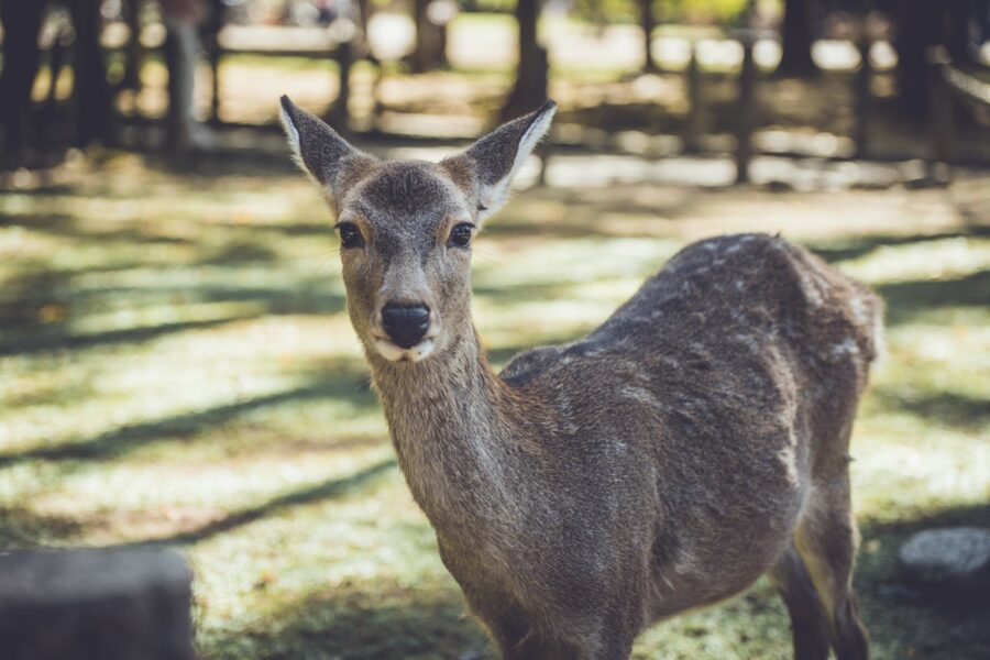
The deer, and how to behave around them
The deer are wild sika deer. Shrine legend says the god of Kasuga arrived on Mount Mikasa riding a white deer, and the animals were treated as his messengers. Since 1957 the deer of Nara have been a national natural monument, and the Nara Deer Preservation Foundation counted a record 1,465 of them in the park area in July 2025, 140 more than the year before.
Feed them only shika senbei, the plain rice-bran crackers sold at stalls around the park. Nara Prefecture’s rules ban other food, and plastic bags and paper are a real danger: a deer that swallows a bag can die of it. Hold the crackers out of sight until you mean to give one, keep children’s hands clear, and stop when you have run out, showing your empty palms.
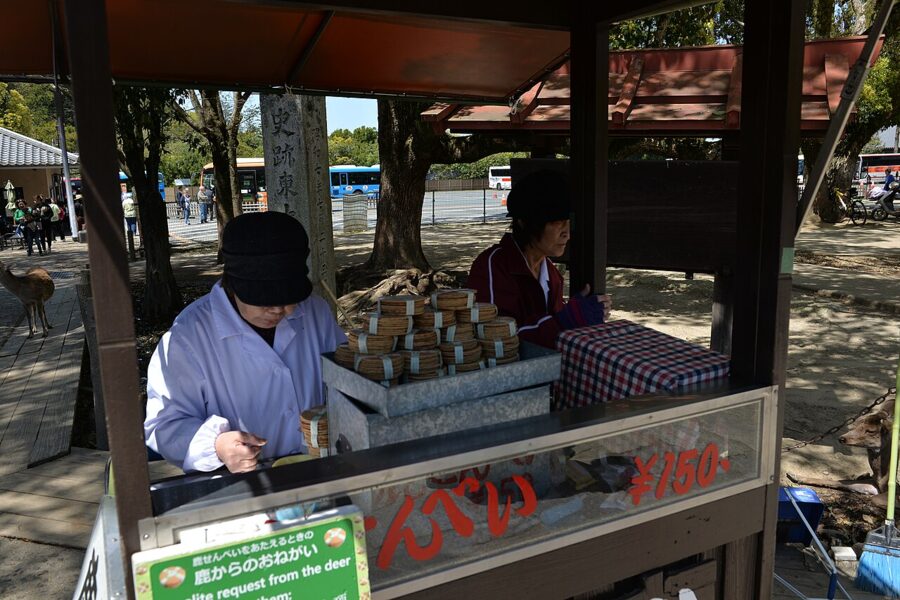

Many deer bow before taking a cracker, and many people bow back, which is the right instinct. They also butt, nip at clothing and kick, and bites and falls are reported every year. Stags are at their touchiest in the autumn rut, and from late spring into summer the does guard newborn fawns, so give a hiding fawn a wide berth. The same courtesy applies to the deer of Miyajima in Hiroshima Prefecture, though there feeding is not allowed at all.
Todai-ji and the Great Buddha
Emperor Shomu ordered the Great Buddha in 743, and the statue was dedicated in 752 in a ceremony attended by monks from as far away as India. The bronze figure has been damaged and recast in parts more than once, and the hall around it has burned twice.
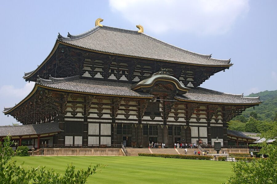

You approach through the Nandaimon, the great south gate, rebuilt around 1200 with two wooden guardian kings carved by the workshops of Unkei and Kaikei. The gate and the temple grounds are free. Inside the Daibutsuden the seated Buddha is about 15 metres tall, and the scale only registers when you notice the people at its base.
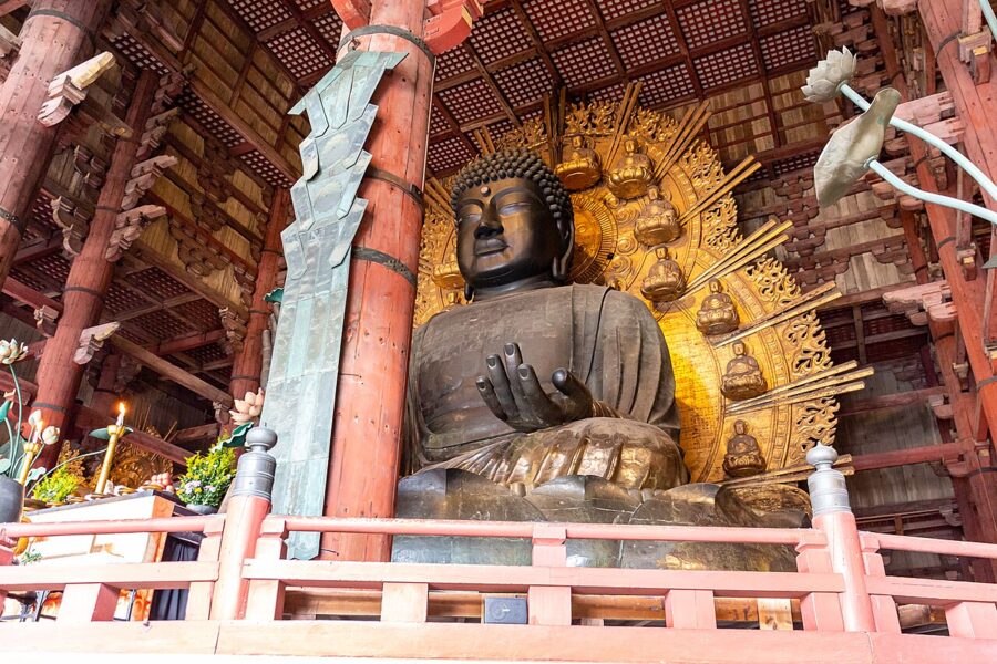
Admission to the Daibutsuden is ¥800 (about £4 / $5), or ¥1,200 (about £6 / $7.50) with the Todai-ji Museum, as of November 2026. The hall opens 7:30 to 17:30 from April to October and 8:00 to 17:00 from November to March. Arrive at opening: by mid-morning on a weekend the interior fills with school groups.
Nigatsu-do and the hillside halls
Most people leave after the Great Buddha, which is a mistake. A stone lane climbs east past old earthen walls to Nigatsu-do, a hall on stilts with a long balcony looking back over the roofs of the Daibutsuden to the whole basin. It is free, open late, and at sunset it is the best viewpoint in the city.
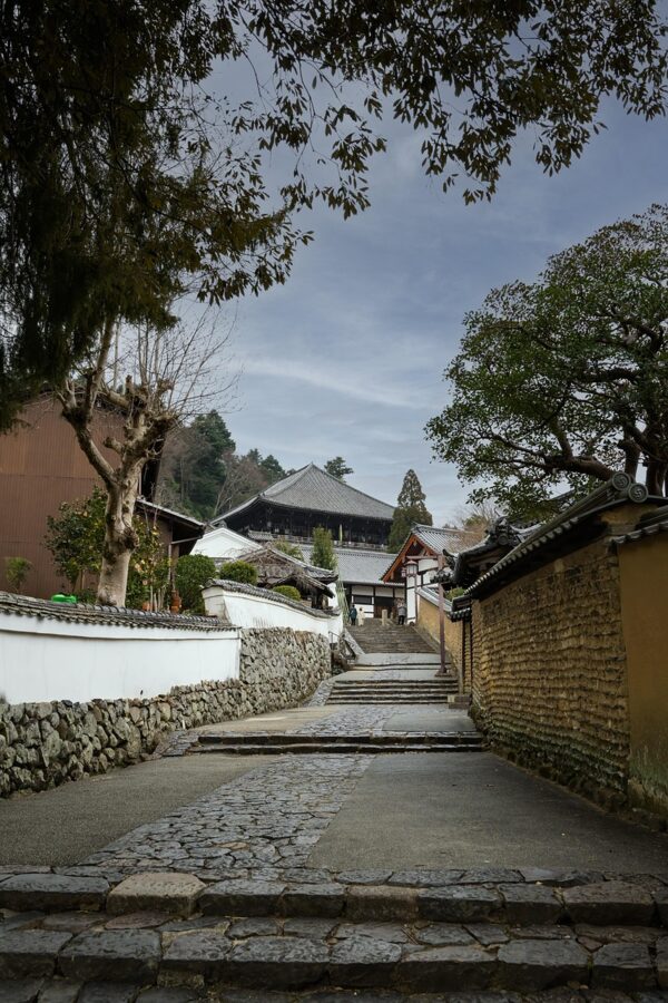
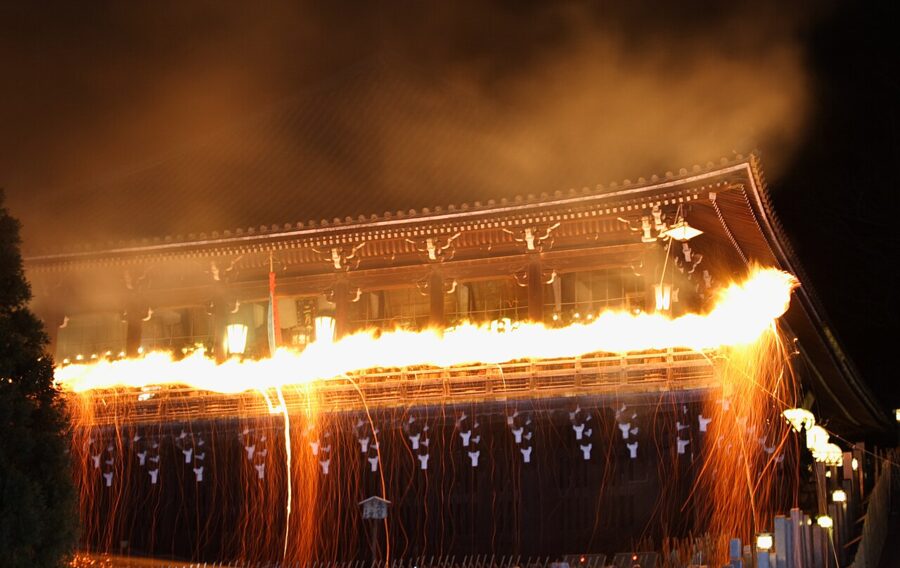
Nigatsu-do is the stage for Shuni-e, better known as Omizutori, a rite of repentance that Todai-ji says has been held every year without a break since 752. It runs from 1 to 14 March. Each evening monks carry huge burning torches along the balcony and shake sparks over the crowd below, and the ash is taken home as a charm against illness.

Next door, Hokke-do (Sangatsu-do), one of Todai-ji’s oldest buildings, keeps a crowd of eighth-century statues and opens 8:30 to 16:00. From here a path runs south through the woods to Kasuga Taisha in about twenty minutes.
Kasuga Taisha and the forest
Kasuga Taisha was founded in 768 as the shrine of the Fujiwara, the family that dominated the court for centuries, and it sits where the park turns into old forest. The approach is lined with stone lanterns, and the corridors around the main sanctuary are hung with bronze ones, some 3,000 in all, given by worshippers over the centuries.
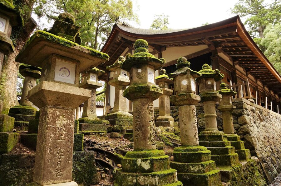
Behind the shrine, the Kasugayama Primeval Forest has been protected from logging for over a thousand years. Twice a year every lantern is lit for the Mantoro festivals, at Setsubun in early February and on 14 and 15 August, which is worth planning a trip around.
The outer grounds are free. As of November 2026 the shrine opens 6:30 to 17:30 from March to October and 7:00 to 17:00 from November to February. The inner area around the main sanctuary costs ¥700 (about £3.40 / $4.40), 9:00 to 16:00, and the Kokuhoden treasure hall and the Manyo botanical garden are ¥700 each. Buses from either Nara station take about a quarter of an hour; the walk from Kintetsu-Nara is about 25 minutes.
Kofuku-ji: a pagoda under wraps
Kofuku-ji was the Fujiwara family temple, and at its height it controlled much of Yamato province, as Nara was then known, with its own armed monks. Its five-storey pagoda, rebuilt in 1426 and about 50 metres tall, is the image on half the postcards of Nara. Be ready for disappointment: you will not see it for some years.
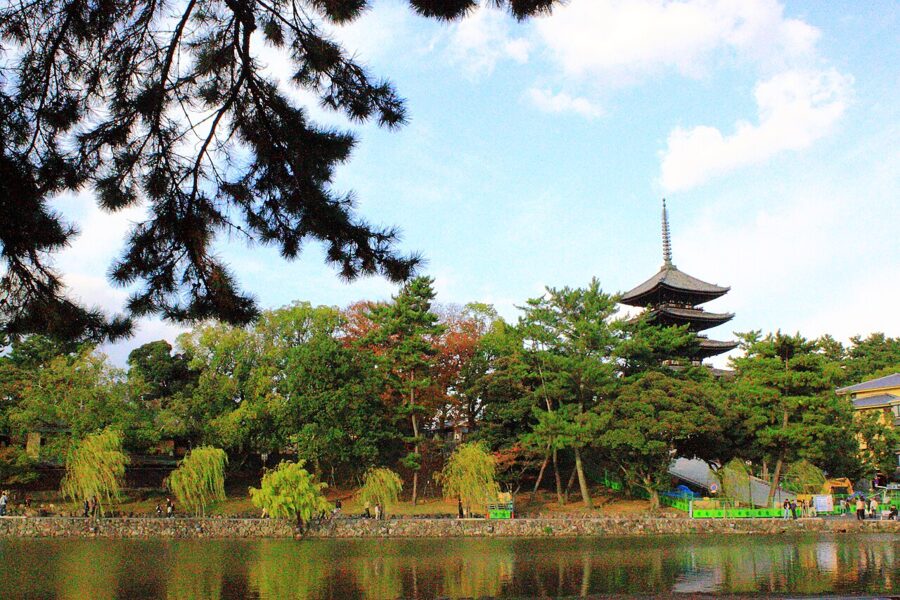

Nara Prefecture began a full repair in June 2022, with new roof tiles, woodwork repairs and fresh plaster. A covering structure went up between July 2023 and March 2025, and the work is planned to run into the early 2030s.
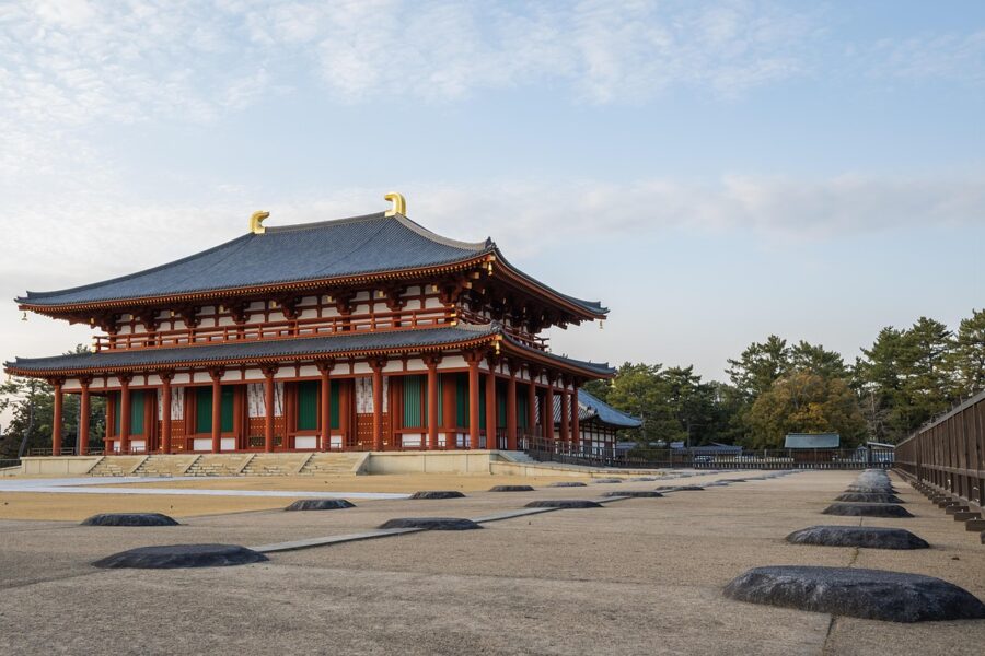
The rest of Kofuku-ji is open. The Central Golden Hall was rebuilt to its eighth-century scale and finished in 2018, and the National Treasure Museum holds the temple’s best-known sculpture, the slender three-faced Ashura. As of November 2026 the museum costs ¥900 (about £4.30 / $5.70), the Central and Eastern Golden Halls ¥500 (about £2.40 / $3.15) each, and a combined ticket ¥2,000 (about £10 / $13); all open 9:00 to 17:00, and payment is cash only.
Naramachi, the merchant town
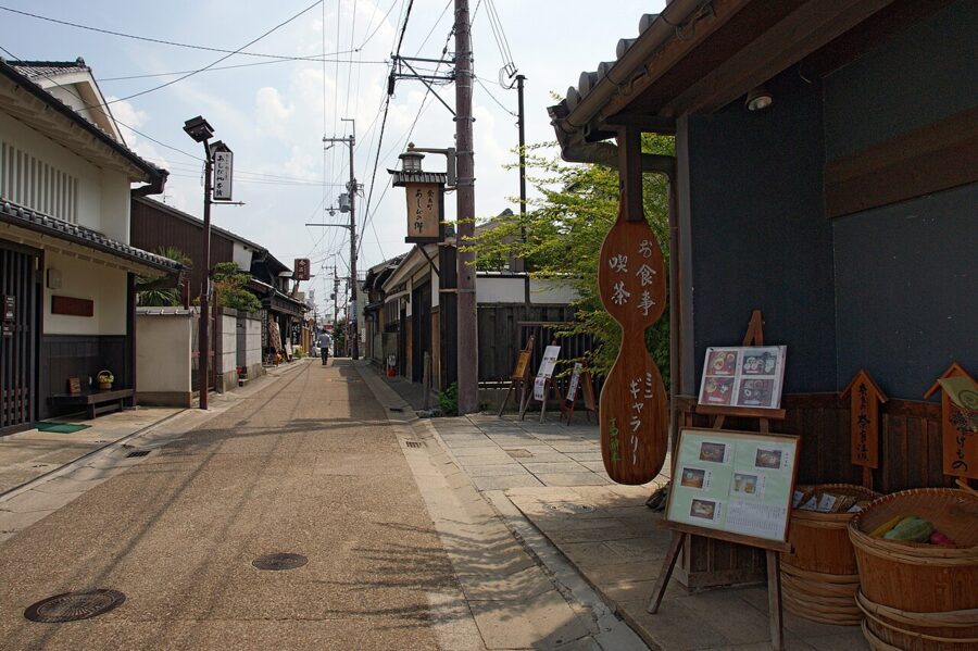
South of Sarusawa-ike, the lanes of Naramachi keep the shape of the town that grew up around Gango-ji after the court left. In the Edo period this was a district of merchants and craftsmen making ink, sake, mosquito netting and bleached cloth, and many of their long, narrow townhouses survive. It is the place to eat lunch and walk off the temples.

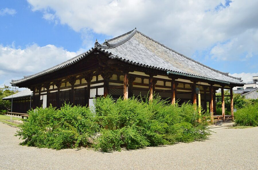
Gango-ji is the oldest temple in the story. It began as Asuka-dera, the first full-scale Buddhist temple in Japan, and was moved to the new capital in 718; the World Heritage listing for ancient Nara includes what is left of it. Part of the roof of the Gokuraku-bo hall is still covered with tiles made for Asuka-dera at the end of the sixth century, said to be the oldest roof tiles in Japan still doing their job.
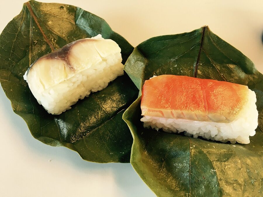
Nara’s own food is plain and old. Kakinoha-zushi, pressed mackerel or salmon sushi wrapped in persimmon leaves, began as a way to carry salted fish from the coast into the mountains, and you will find it in shops around both Nara stations. Miwa, near Sakurai, is known for thin somen noodles, and the Yoshino hills for kuzu, the starch in clear summer sweets.

West of the city: Heijo Palace, Yakushi-ji and Toshodai-ji
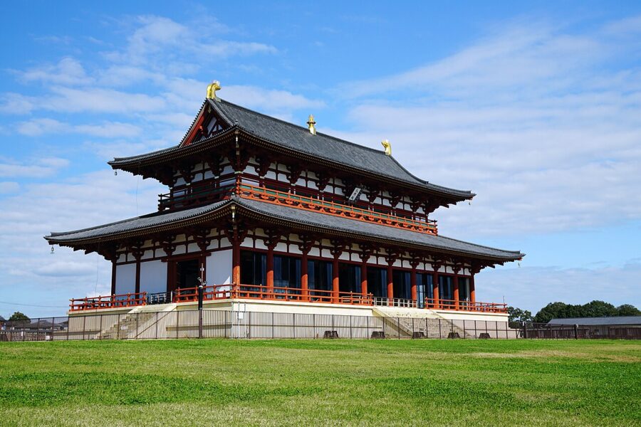
The capital of 710 was a grid of streets laid out on the Chinese model, and its palace stood at the north end, about 4 kilometres west of the park. The site is now a broad open field crossed by the Kintetsu line, with two reconstructions for scale: the Suzaku Gate and the Former Audience Hall, finished in 2010. The emptiness is the point.

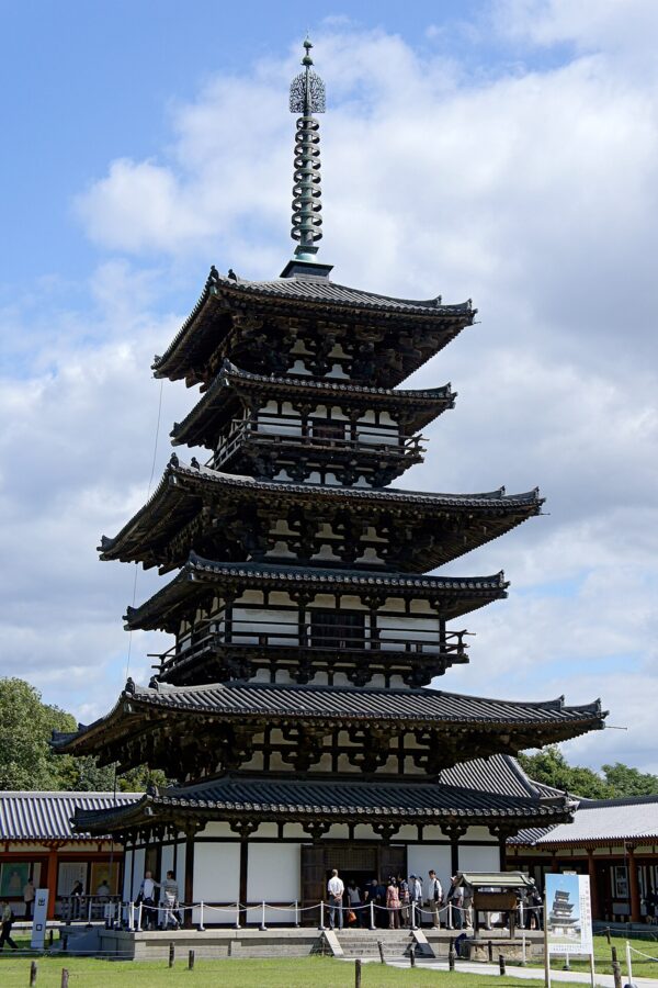
In Nishinokyo, south of the palace, two great temples stand ten minutes’ walk apart near Nishinokyo Station on the Kintetsu Kashihara Line. Yakushi-ji was founded by Emperor Tenmu for his ailing empress and moved here from Fujiwara. Its East Pagoda, from about 730, looks as if it has six storeys because each of its three has a smaller roof beneath the main one; it came out of a full dismantling repair in 2020.

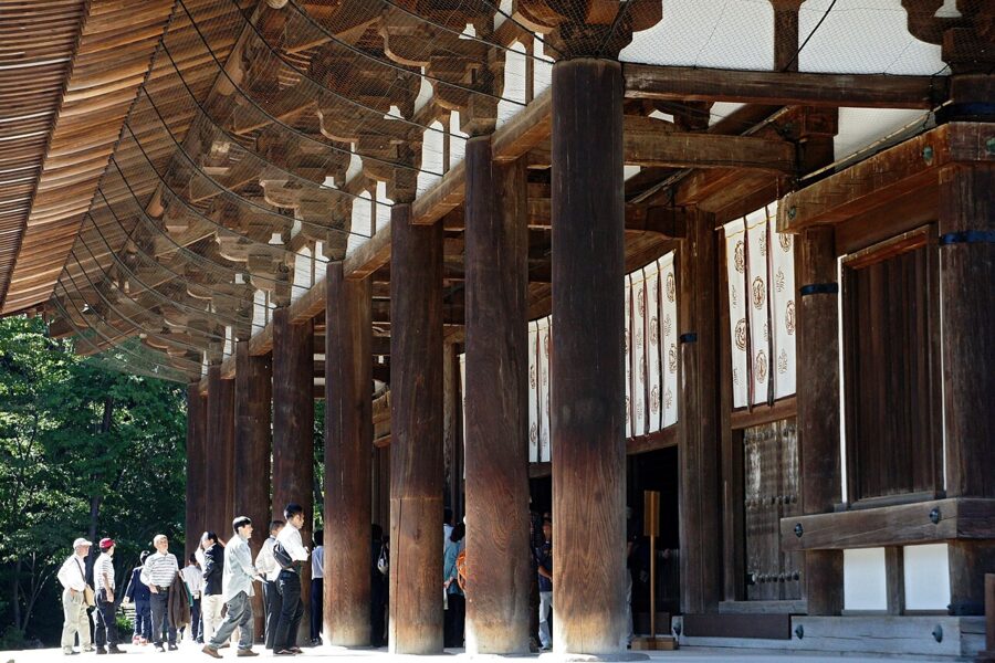
Toshodai-ji was founded in 759 by Jianzhen, known in Japan as Ganjin, a Chinese monk who failed five times to cross the sea and lost his sight before he finally arrived. Its Golden Hall, with a row of eight columns across the front, is the best surviving main hall of the period. I find it the most moving place in Nara: quiet, set among pines, and a direct line back to one stubborn man.

Horyu-ji and the Ikaruga temples
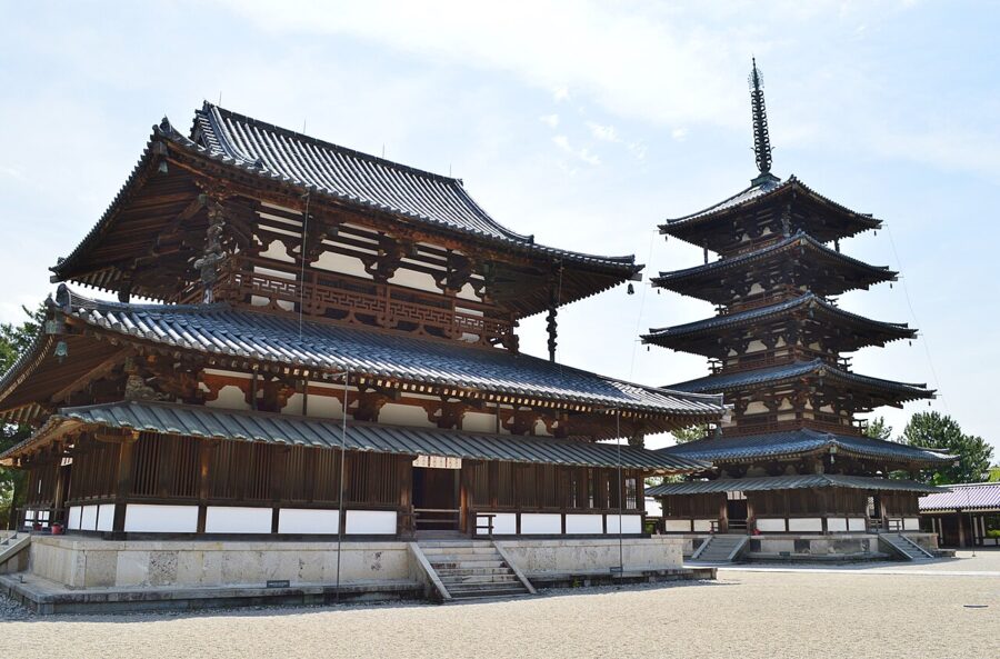
Horyu-ji stands in the town of Ikaruga, 12 kilometres south-west of Nara City, and its western precinct holds the oldest wooden buildings in the world. The temple is traditionally dated to 607 and linked to Prince Shotoku, the regent who did more than anyone to plant Buddhism at court. The present Golden Hall and five-storey pagoda were rebuilt after a fire in 670, and timber in the pagoda’s central pillar has been dated to 594.
Give Horyu-ji half a day. The western precinct, the Daihozoin treasure galleries and the eastern precinct around the octagonal Yumedono hall are all on one ticket, ¥2,000 (about £10 / $13) since March 2025, cash only. The temple opens 8:00 to 17:00 from 22 February to 3 November and 8:00 to 16:30 the rest of the year, with tickets sold until half an hour before closing.
The Yumedono’s hidden statue, the Kuze Kannon, is shown only in spring and autumn, from 11 April to 18 May and from 22 October to 22 November. Beyond the eastern precinct, the nunnery of Chugu-ji keeps a seated wooden bodhisattva with one hand raised to its cheek, and a twenty-minute walk north across the fields brings you to Hokki-ji, whose three-storey pagoda dates from the early eighth century.
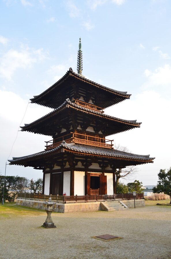
JR Horyuji Station is about 11 minutes from JR Nara on the Yamatoji Line, and the temple is a 20-minute walk from the station or a short bus ride to the Horyuji Sando stop. From Kintetsu, buses run from Tsutsui Station.
Asuka and the earliest capitals
Before Nara City there was Asuka (明日香), a valley of rice fields and low hills at the southern end of the basin. From the late sixth century through most of the seventh, the court sat here, in a series of palaces, while the Soga clan and then the imperial house built the first Buddhist temples and the great stone tombs. In 694 the capital moved to Fujiwara, a planned grid city just north.
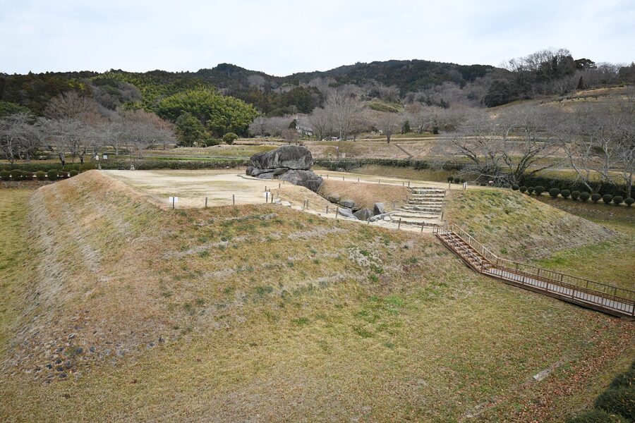
On 26 July 2026 the World Heritage Committee inscribed the Ancient Capitals of Asuka and Fujiwara: 19 sites across Asuka, Kashihara and Sakurai, including the Asuka palace site, the Fujiwara palace site and the painted tombs of Takamatsuzuka and Kitora. Asuka is still fields and farm roads, far quieter than Nara Park.
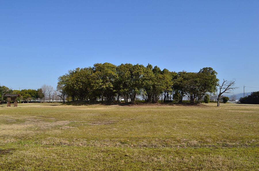
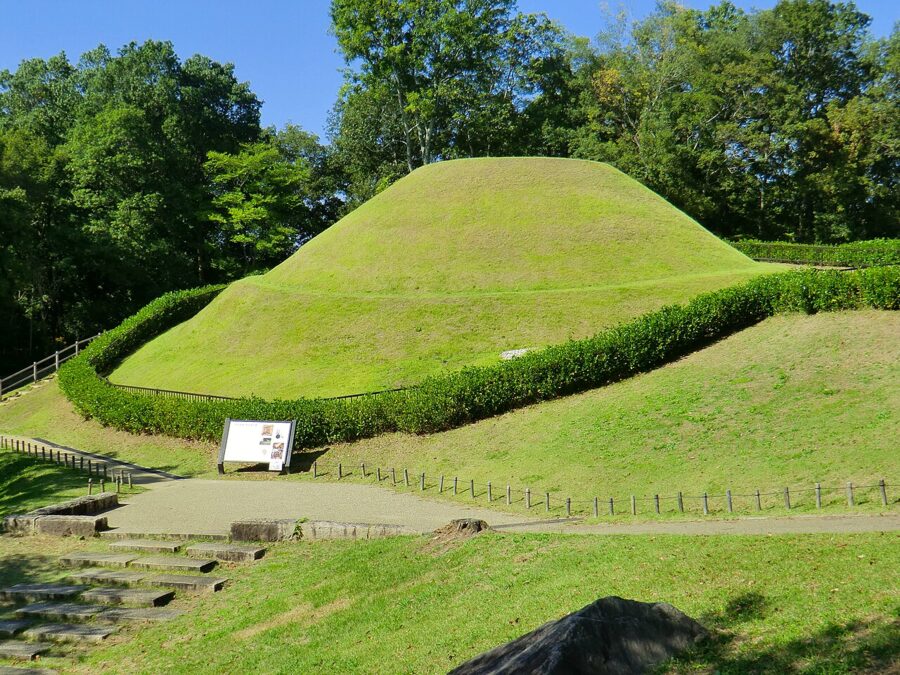

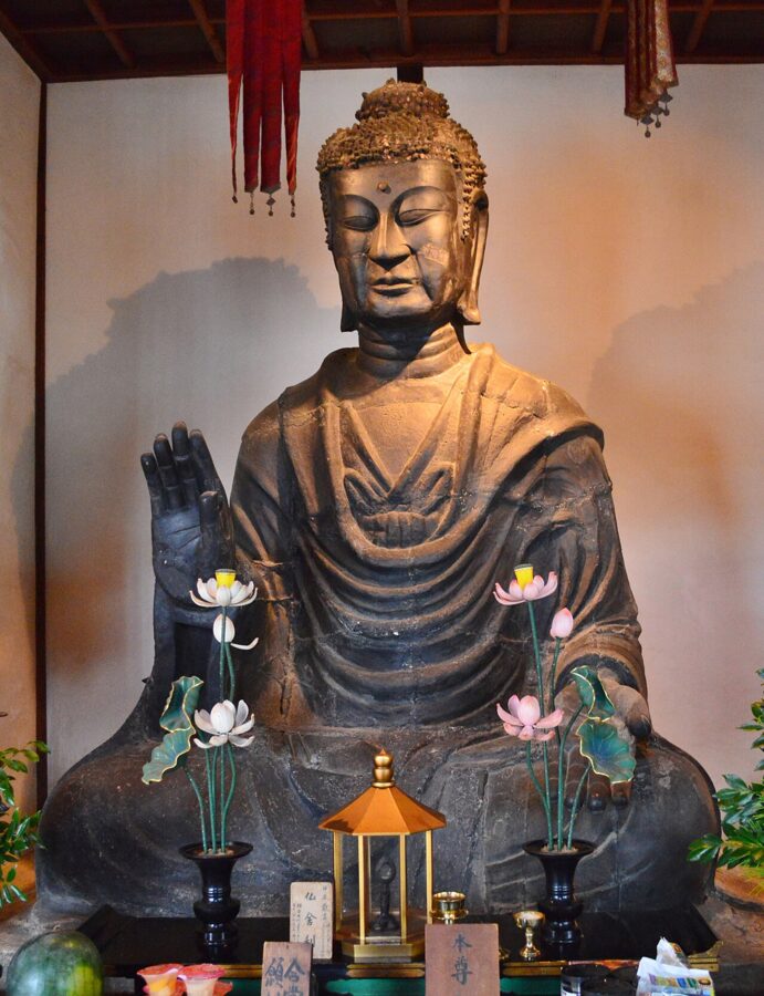
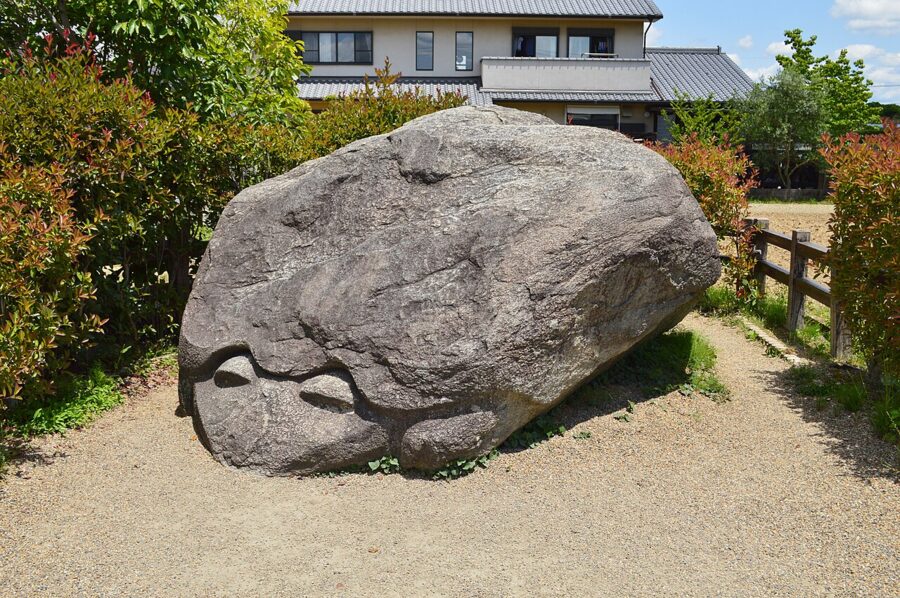
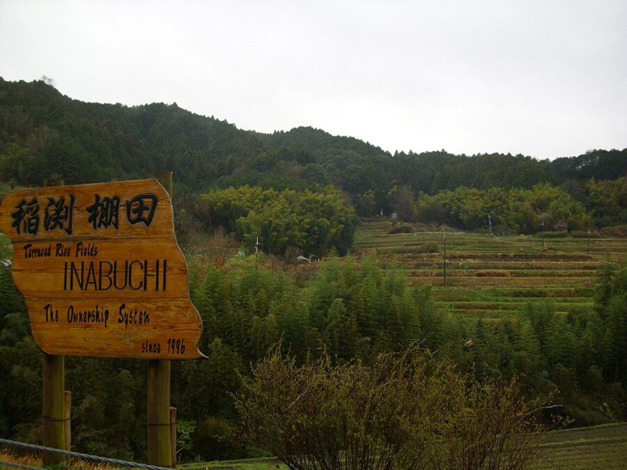
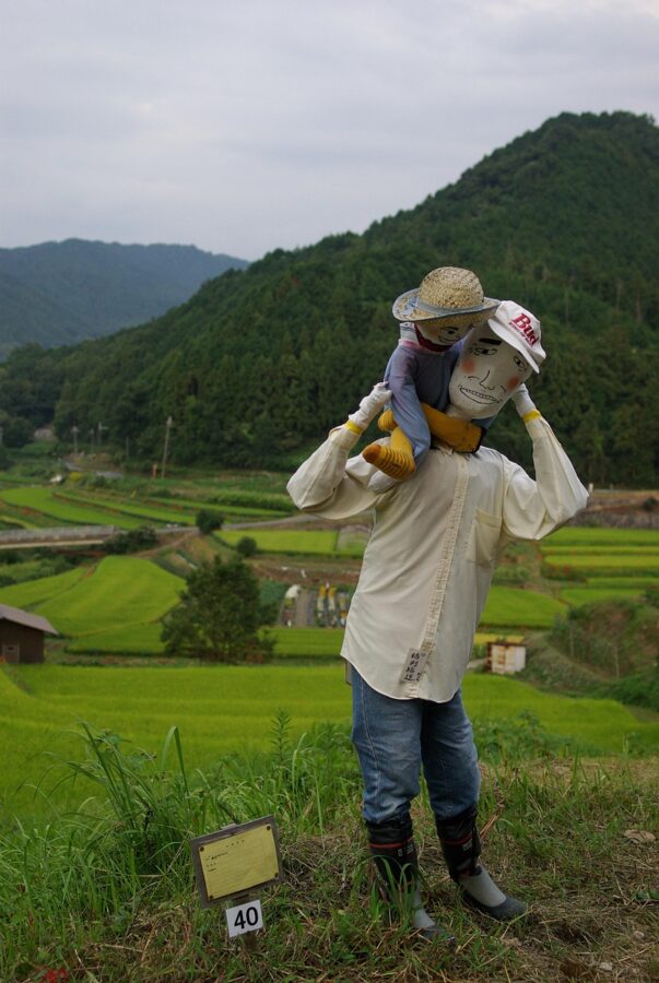
Asuka-dera, founded in 588, keeps the Asuka Daibutsu, a bronze Buddha cast in 609 and the oldest datable Buddhist statue in Japan, much patched after a fire but still in its original spot. The stone oddities scattered around the valley, the turtle-shaped Kameishi and the carved Sakafuneishi among them, have no agreed explanation. In autumn the terraced fields at Inabuchi, up the valley to the south, are edged with red spider lilies.
The sites are spread over several kilometres, so the sensible way round is by bicycle from Kintetsu Asuka or Kashihara-jingumae Station, both on the Kintetsu lines from Osaka-Abenobashi. The roads are gentle except for the climb to Inabuchi and Ishibutai. Allow a full day.

Miwa and Hase on the eastern edge
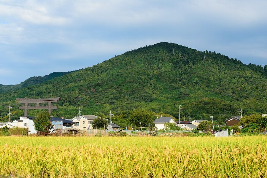
On the eastern side of the basin, the cone of Mount Miwa is itself the sacred body of Omiwa Shrine, which has no main hall: you pray through a gate towards the mountain. The Yamanobe-no-michi, an old road along the foot of the hills from Miwa north towards Tenri, makes a good half-day walk through orchards and shrines. Further east, Hase-dera in Sakurai climbs a valley side on a long covered stairway, and its peonies in late April and early May draw crowds.


Yoshino: cherry blossom and Zao-do
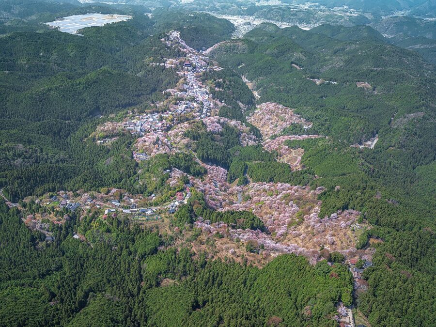
Yoshinoyama is a ridge rather than a peak, a single street of inns, temples and shops running uphill for several kilometres above the Yoshino River. Its slopes carry some 30,000 cherry trees, most of them shiro-yamazakura, the native mountain cherry, which flowers alongside its new red leaves. They were planted over centuries as offerings, because the cherry was held sacred to Zao Gongen, the fierce deity of the mountain sect.
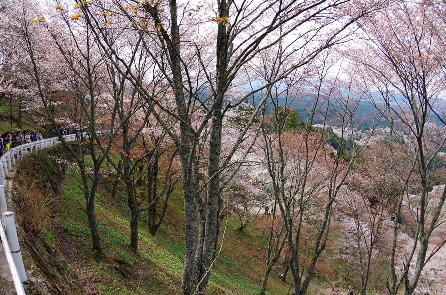

The trees are divided into four bands by altitude: Shimo Senbon near the station, then Naka Senbon, Kami Senbon and Oku Senbon near the top. Because they bloom from the bottom up, the season on the mountain lasts two to three weeks, usually from early to mid-April. The crowds on peak weekends are enormous and the single street jams; a weekday, an early start or a night on the mountain changes everything.
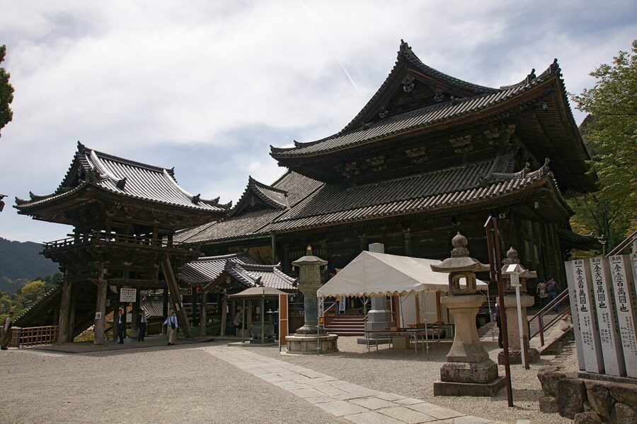
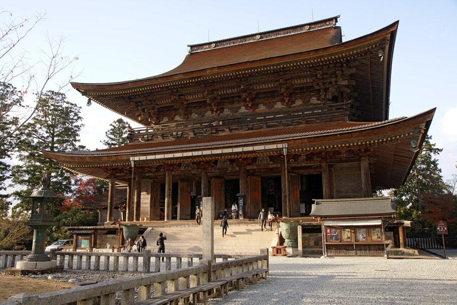
Kinpusen-ji’s Zao-do is the centre of the town and a head temple of Shugendo, the mountain religion that mixes Buddhism with older worship of the peaks. Inside stand three great blue Zao Gongen figures, hidden except during special openings. As of November 2026, entry is ¥800 (about £4 / $5) at ordinary times and ¥1,600 (about £7.70 / $10) during the openings, with hours of 8:30 to 16:00; the temple announces the opening dates each season.

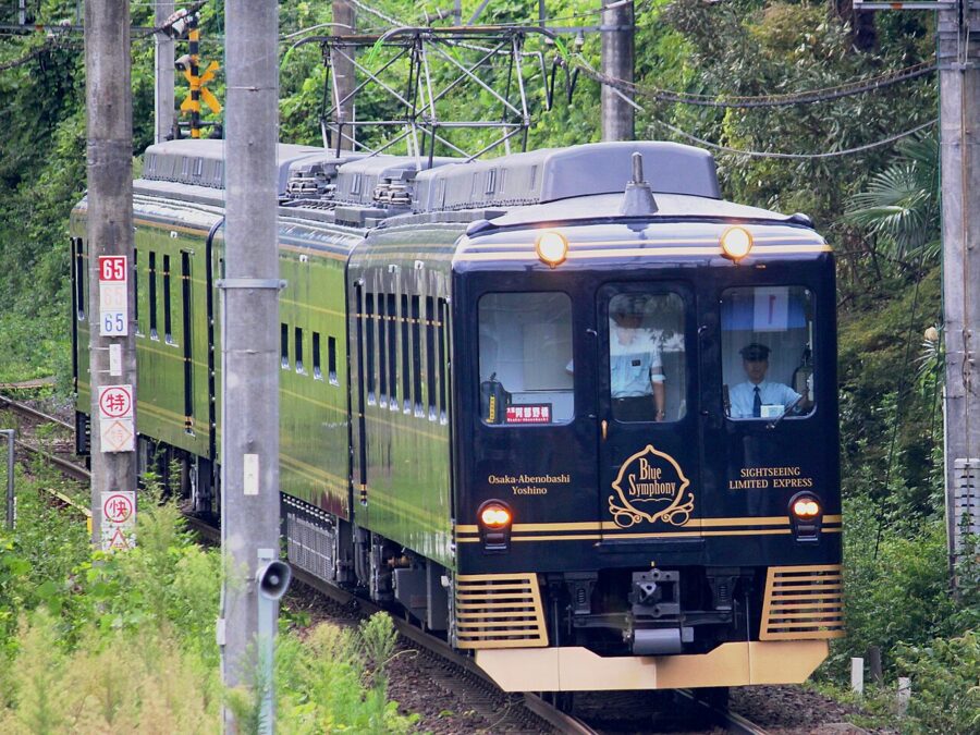
Kintetsu limited expresses run to Yoshino from Osaka-Abenobashi in about an hour and a quarter, including the Blue Symphony sightseeing train, and from Kyoto with a change at Kashihara-jingumae. From Yoshino Station the walk up to the Zao-do takes half an hour or more; check locally whether the old Yoshino ropeway is running, and expect buses and traffic controls in blossom season. Out of season the mountain is quiet and the inns are easy to book.

The Omine and Kii mountains
South of Yoshino the Omine range runs on towards the Kumano country, and the Okugake-michi, the ascetics’ path along its crest, links Yoshino to Kumano Hongu. The route is part of the Kii mountains World Heritage listing, shared with Wakayama and Mie. Shugendo practitioners still walk it, and stretches of it are serious mountain trails with chains and exposed rock.
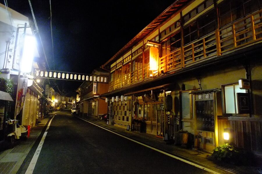
Mount Omine itself, the summit called Sanjogatake (1,719 metres), remains closed to women: gates on each approach trail mark the boundary, and the temple at the top keeps the rule. Below it, the hot-spring village of Dorogawa is where pilgrims stay before the climb, with inns lining a single street and limestone caves and springs in the hills around it.

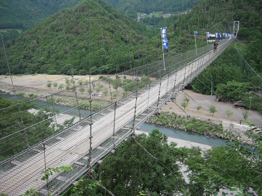
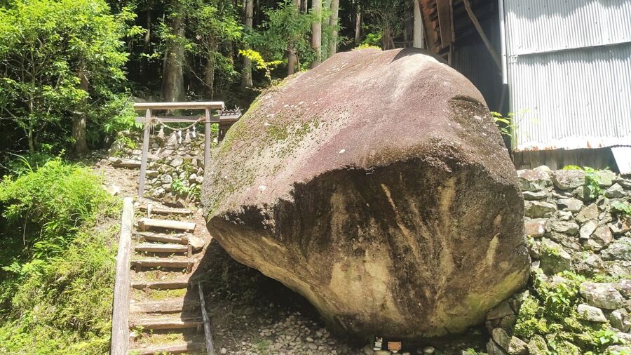
Further south, Totsukawa is the largest village in Japan by area and about as remote as the main island gets, with hot springs and the long Tanize suspension bridge over its river. Tamaki Shrine, on a mountain top near the border with Wakayama, is reached by a narrow road through ancient cedars. Beyond Totsukawa the Kumano river flows on to Hongu and Shingu, and the Kumano pilgrimage country begins.
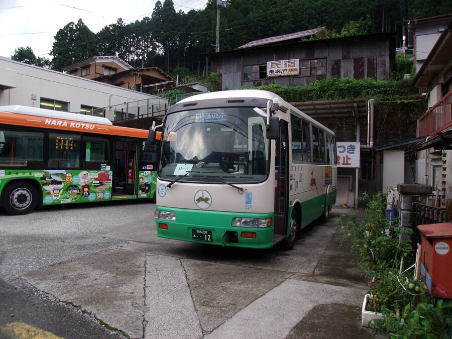
Public transport here is thin. The Nara Kotsu route bus from Yamato-Yagi Station to Shingu, the longest ordinary bus route in Japan that uses no expressway, takes about six and a half hours end to end and runs only a few times a day. Beyond Dorogawa or Totsukawa’s main village a hired car makes sense; the roads are narrow, winding and sometimes closed after heavy rain.

Getting there: JR or Kintetsu
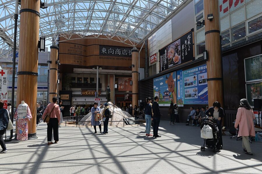
Nara has two main stations about 15 minutes’ walk apart. Kintetsu-Nara sits at the edge of the park, five minutes from Kofuku-ji; JR Nara is further west, and from there you walk up Sanjo-dori or take a bus. For Nara Park, Kintetsu is the better choice from both Kyoto and Osaka unless you hold a JR Pass.

| Route | Line and train | Time | Notes |
|---|---|---|---|
| Kyoto to Kintetsu-Nara | Kintetsu Kyoto Line, limited express | about 35 minutes | Fare ¥760 (about £3.60 / $4.80) plus a ¥520 (about £2.50 / $3.30) seat charge; cheaper expresses take 45 minutes or more |
| Kyoto to JR Nara | JR Nara Line, Miyakoji rapid | about 45 minutes | Fare ¥720 (about £3.50 / $4.50); covered by the JR Pass |
| Osaka-Namba to Kintetsu-Nara | Kintetsu Nara Line, rapid express | about 40 minutes | No change; the line runs straight under the Ikoma hills |
| Osaka to JR Nara | JR Yamatoji Line, rapid | about 50 minutes | About 30 minutes from Tennoji; covered by the JR Pass |
| Tokyo to Nara | Tokaido Shinkansen to Kyoto, then Kintetsu | about 3 hours | Change at Kyoto Station |
Fares are as of November 2026. The Kintetsu Rail Pass for overseas visitors costs ¥1,900 (about £9 / $12) for one day or ¥3,700 (about £18 / $23) for two; it pays off on a long day to Asuka or Yoshino, not on a return to Nara Park.
From Nara the prefecture’s lines fan south. The JR Yamatoji Line runs to Horyuji, the Kintetsu Kashihara Line through Nishinokyo to Kashihara-jingumae, and from there the Kintetsu Yoshino Line continues through Asuka to Yoshino. If you are staying in Kyoto Prefecture, Kintetsu limited expresses reach Kashihara-jingumae directly. For how Kansai connects with the rest of the country, see the map of Japan and its main routes.
Seasons in Nara Prefecture
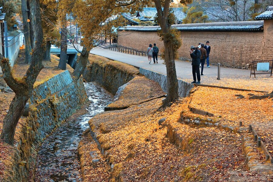
Spring is the busiest season. The cherries in Nara Park open in late March or early April, a little ahead of Yoshino’s upper slopes, and Golden Week at the start of May brings domestic crowds. June is the rainy season, and July and August in the basin are hot and humid, so do the park at opening time and save the afternoon for the museum or the cooler air of Dorogawa.
Autumn is the best time overall. The maples in the park and on the hills turn in November, and each autumn the Nara National Museum holds the Shosoin exhibition, a short showing of eighth-century treasures from the imperial storehouse at Todai-ji; in 2026 it ran from 24 October to 9 November, with timed tickets.

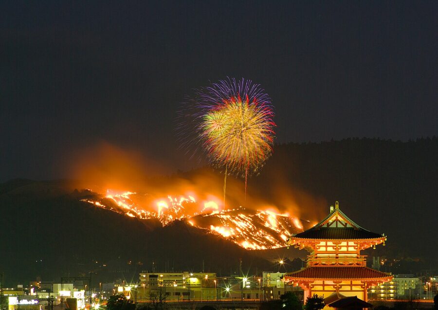

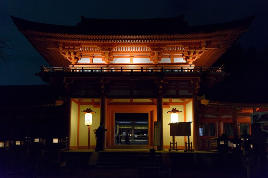
Winter is cold, bright and quiet. On a Saturday evening in late January the dead grass of Mount Wakakusa is set alight after a fireworks display, and the whole hillside burns for half an hour or so. Then come the Setsubun lanterns and Omizutori, so the coldest months hold three of Nara’s best evenings. Snow is rare in the basin but common on the Omine ridge.

How many days, and where to stay
One day covers Nara Park properly: Todai-ji at opening, Nigatsu-do, the forest path to Kasuga Taisha, Kofuku-ji’s halls and museum, and Naramachi for lunch and the late afternoon. That is the trip most people make from Kyoto or Osaka, and it is a good one, provided you start early.
Two days let you add Horyu-ji and the Nishinokyo temples; three add Asuka by bicycle. With four or five, take the train south to Yoshino for a night on the ridge, then go on by bus or car to Dorogawa or Totsukawa, or carry on to Kumano. For money, safety and the other basics, see the practical information guide, and for the temple and shrine manners that matter here more than almost anywhere, the notes on Japanese etiquette.
Sleeping in Nara City rather than commuting from Kyoto pays off. The park empties after 17:00, the deer settle on the lawns, and the evening walk from Sarusawa-ike up to Nigatsu-do is the city at its best. In the morning you are at the Nandaimon before the first train from Kyoto arrives.
Then go south. The basin is where Japan’s state began, but the old roads out of it lead into the mountains, and from the balcony of Nigatsu-do you can see the line of hills that the rest of the prefecture lies behind.