
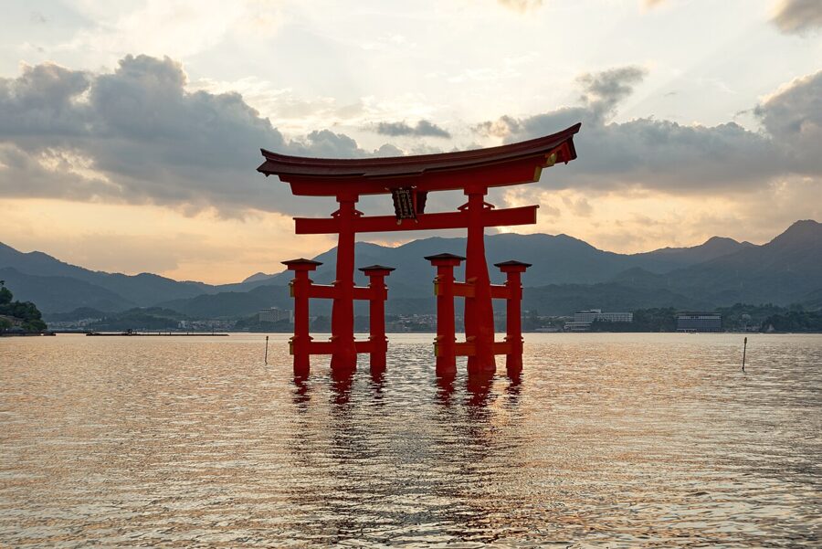
Most people give Hiroshima Prefecture (広島県) a single day: the Peace Memorial Park in the morning, the floating torii of Miyajima in the afternoon, the bullet train out by dark. Both places earn that day and more. But the prefecture runs on east for nearly a hundred kilometres of Inland Sea coast, past a naval port, a sake town, a salt-merchant town and a hillside of temples, to the start of the bridges that carry a cycle path across the islands to Shikoku.
About 2.7 million people live here, nearly half of them in Hiroshima city, and almost all on the thin strip of flat land between the mountains and the sea. Behind it the Chugoku Mountains rise in forested ridges to the Shimane border. In front of it the sea is so crowded with islands that from any hill it looks like a lake.



Contents
- The shape of Hiroshima Prefecture: a coast, a sea of islands and the mountains behind
- Hiroshima city (広島市)
- Miyajima (宮島): the shrine, the tides and Mount Misen
- Kure (呉): the navy port
- Takehara (竹原): salt, sake and the rabbit island
- Onomichi (尾道): the slope town
- The Shimanami Kaido: the Hiroshima half
- Further out: Tomonoura and the mountain gorges
- Getting there and getting around
- Seasons
- How many days, and in what order
The shape of Hiroshima Prefecture: a coast, a sea of islands and the mountains behind
On a map of Japan’s regions, Hiroshima sits in the middle of the Inland Sea side of Chugoku, the five prefectures of western Honshu, with Okayama to the east and Yamaguchi to the west. The Sanyo Shinkansen and the Sanyo Expressway run along the coast, and every coast town sits on or near them. You can base yourself in one or two places and reach almost everything by train.
Rivers come off the mountains in short, steep valleys and meet the sea at small deltas; Hiroshima city is built on the largest, the delta of the Ota River, split by six channels. Offshore lie well over a hundred islands, from Miyajima in the west through Etajima and the Kure islands to Innoshima and Ikuchijima in the east. The sheltered water between them is why oyster rafts fill the bays, and why Hiroshima grows around 60 per cent of Japan’s farmed oysters.
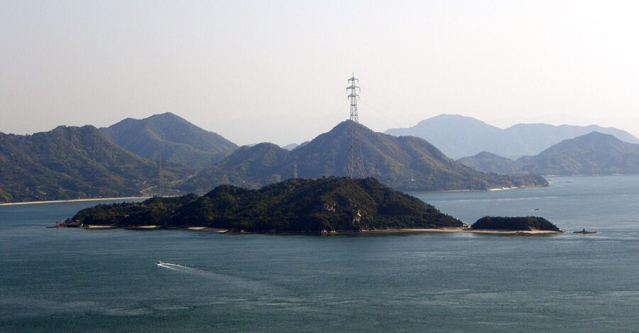
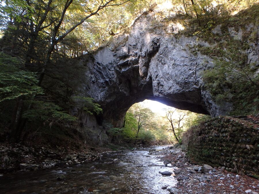
The Inland Sea climate is the driest and mildest on Honshu, with mountains on either side blocking the winter snow and the worst of the Pacific rain, which is why the islands grow citrus. The north of the prefecture is another country: a cool upland of rice terraces, limestone gorges and small ski slopes, reached by bus or car.
Hiroshima city (広島市)
At 8:15 on the morning of 6 August 1945 an atomic bomb exploded about 600 metres above the centre of the city. The city’s own estimate is that around 140,000 people had died by the end of that year. What you see now is a flat, green regional capital of about 1.2 million people, with wide boulevards and trams, and the memory of that morning kept deliberately at its centre.
The Peace Memorial Park and the Atomic Bomb Dome
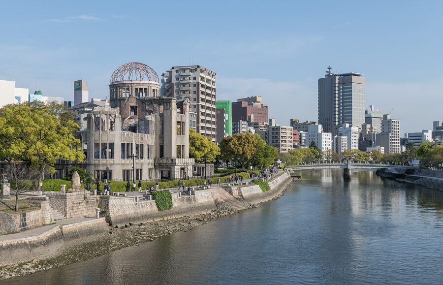
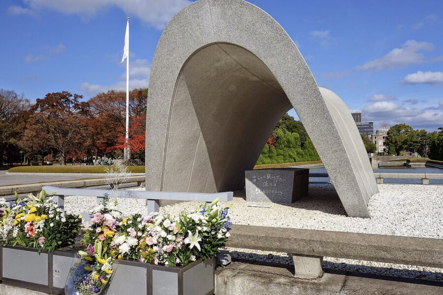
The park fills the northern tip of an island between the Motoyasu and Ota rivers, the old Nakajima district that the blast erased. Kenzo Tange designed it on a single line: from the museum, through the arched Cenotaph and the Flame of Peace, across the river to the Atomic Bomb Dome. Stand at the Cenotaph and look north, and the three line up.

The Dome was built in 1915 to a design by the Czech architect Jan Letzel as the prefecture’s commercial exhibition hall. It stood about 160 metres from the hypocentre, and because the blast came from almost directly overhead, some walls and the steel frame of the dome survived. You cannot go in, but you can walk all round it. With Itsukushima Shrine, it joined the World Heritage list in 1996.
Can you visit the spot the bomb was aimed at? Yes: the hypocentre is marked by a plain plaque a short walk southeast of the Dome, outside Shima Hospital, rebuilt on the same ground. Most people walk straight past it.
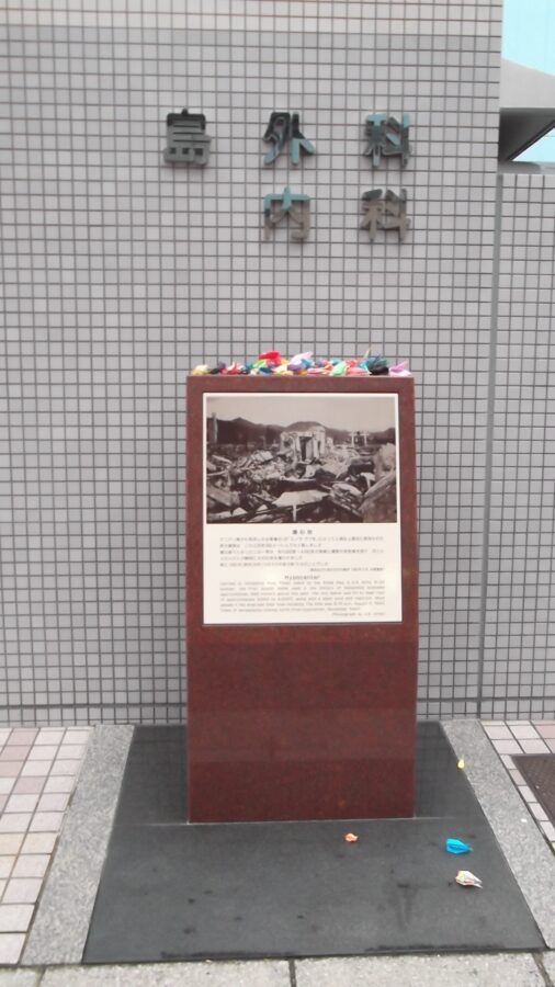

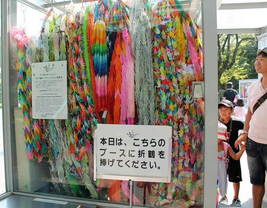

Give the park an hour on top of the museum. The Peace Bell you are free to ring, the mound holding the ashes of tens of thousands of unidentified dead and the memorial to Korean victims are all a few minutes apart. On the evening of 6 August, paper lanterns are floated on the river beside the Dome.
The Peace Memorial Museum: hours and tickets
The museum is the reason to come, and it is hard going. The main building, reopened in 2019 after renovation, is built around the belongings of people who died: a tricycle, a school uniform, a lunch box with its rice burnt black. The photographs are graphic, so think before bringing young children, and allow at least 90 minutes.
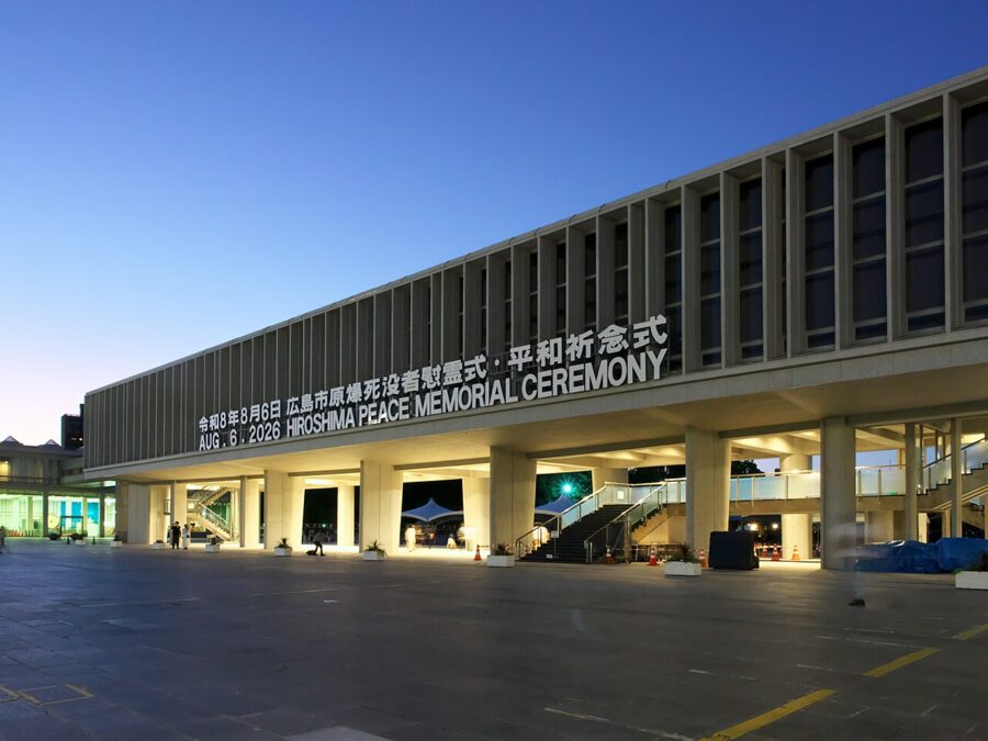
The fee is ¥200 (about £1 / $1.30) for adults, ¥100 (about 50p / 70¢) for high school students and over-65s with ID, and free for younger children, as of November 2026. Cards are accepted. Hours change with the season:
| Months | Open | Timed online booking needed to enter |
|---|---|---|
| March to July | 7:30 to 19:00 | 7:30 to 8:30 and 17:30 to 18:30 |
| August | 7:30 to 20:00 (21:00 on 5 and 6 August) | 7:30 to 8:30 and 18:30 to 19:30 (to 20:30 on 5 and 6 August) |
| September to November | 7:30 to 19:00 | 7:30 to 8:30 and 17:30 to 18:30 |
| December to February | 7:30 to 18:00 | 7:30 to 8:30 and 16:30 to 17:30 |
It closes on 30 and 31 December and for a few days in mid-February. Outside the booked windows you simply queue and buy a ticket. Midday brings the tour groups, so the early slot is worth booking.
Hiroshima Castle and Shukkeien
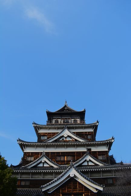
Hiroshima Castle stands a 15-minute walk north of the Peace Park. Mori Terumoto began it in 1589; the keep was flattened in 1945 and rebuilt in concrete in 1958. That rebuilt keep closed for good on 22 March 2026 because the concrete had aged past safe use. You can still walk the moats, walls and grounds and see the keep from outside, but you can no longer climb it.
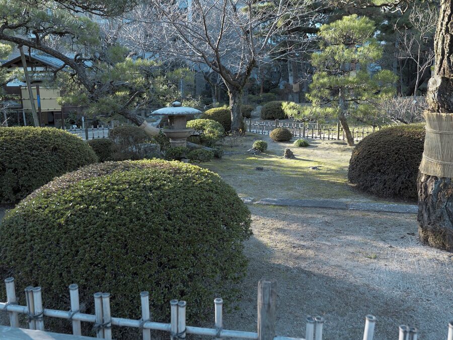
East of the castle, Shukkeien is a strolling garden from 1620, built round a pond with miniature islands, bridges and tea houses. Entry is ¥350 (about £1.75 / $2.30), free for school-age children since April 2025. It opens 9:00 to 18:00 from mid-March to mid-September and 9:00 to 17:00 otherwise, last entry 30 minutes before closing (as of November 2026). After the museum it is the quietest hour you will find.

Okonomiyaki, oysters and what to bring home
Hiroshima’s okonomiyaki is built, not mixed. A thin crepe goes on the griddle, then a heap of shredded cabbage, bean sprouts and pork, then a layer of yakisoba or udon noodles and an egg, the whole thing flipped, pressed and finished with sweet brown sauce. You eat it at the counter straight off the hot plate. The Osaka version, batter and cabbage stirred together, is a different dish, and people here will tell you so.
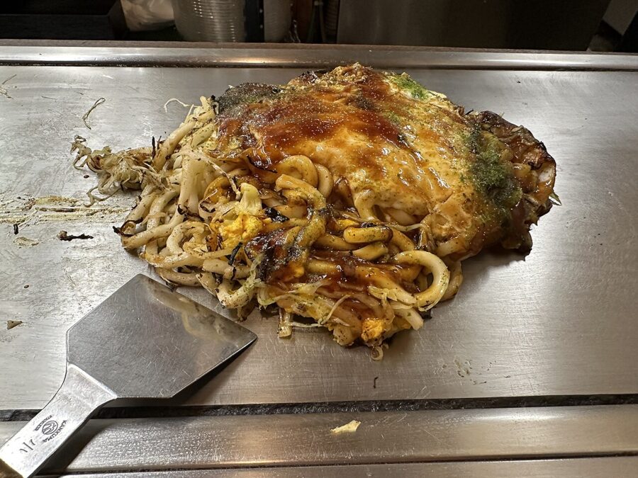

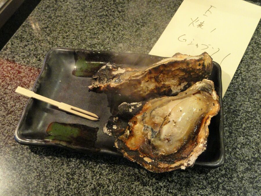
Okonomimura, a building in the Shintenchi district off Hondori with floor after floor of small okonomiyaki counters, is the obvious place to start. Any neighbourhood counter with a lunchtime queue will be as good. Oysters are the winter food, from about November to February, grilled, fried in breadcrumbs or in miso hotpot.
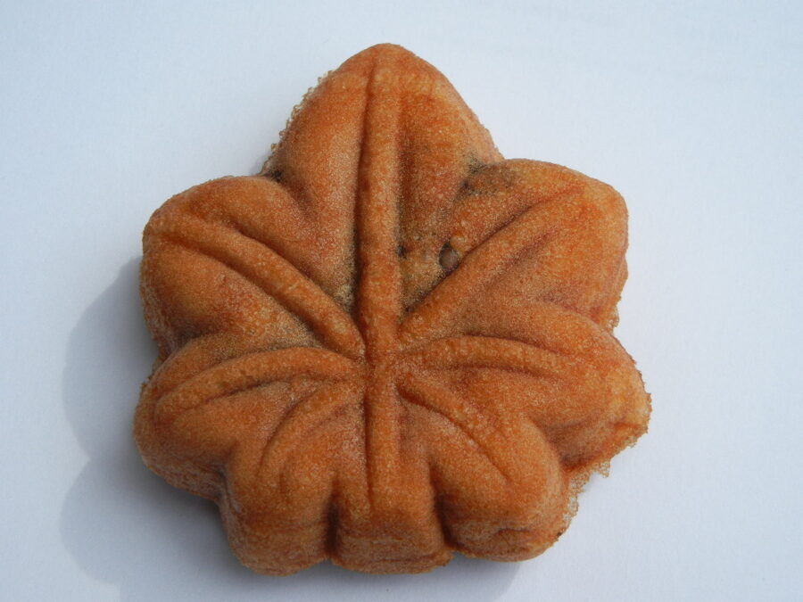
What should you buy? Momiji manju, maple-leaf cakes filled with red bean paste, are the standard gift, baked fresh on Miyajima’s main street. Kumano, a town in the hills east of the city, makes most of Japan’s calligraphy and make-up brushes. Lemon sweets come from the islands, and sake from Saijo.

Getting around the city
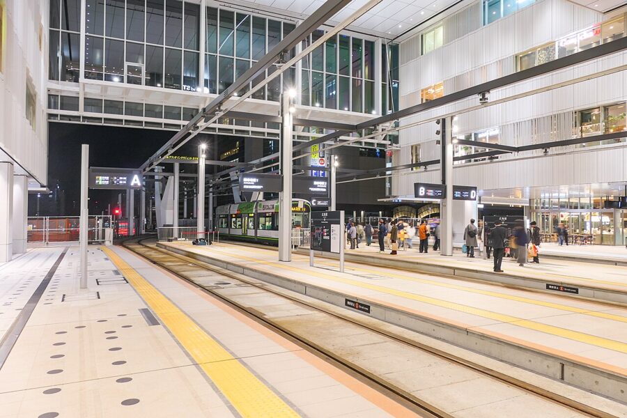
Hiroshima runs one of Japan’s largest tram networks, and inside the city the fare is a flat ¥240 (about £1.20 / $1.60) as of November 2026. Since August 2025 the trams have run straight into the second floor of the rebuilt Hiroshima Station. Trams from the station stop at Genbaku Dome-mae for the Peace Park, and one line carries on west across the city to Miyajimaguchi for the ferry.
Miyajima (宮島): the shrine, the tides and Mount Misen
Miyajima, properly Itsukushima, is a mountain standing in the sea: 30 square kilometres of forest rising to Mount Misen, 535 metres, with one small town on its northern shore. It is one of the Three Views of Japan, with Matsushima in Miyagi and Amanohashidate in Kyoto Prefecture. The island was sacred long before the shrine was built, and for centuries births and burials were kept off it.
Getting there, and the visitor tax
From Hiroshima Station the JR Sanyo Line reaches Miyajimaguchi in about 25 to 30 minutes; the tram takes over an hour. Two companies, JR and Matsudai, run ferries across in about ten minutes for ¥200 (about £1 / $1.30) one way, as of July 2026. The JR boat is covered by the Japan Rail Pass and swings closer to the torii.
Since 1 October 2023 Hatsukaichi city has charged a Miyajima visitor tax of ¥100 per person per visit, added to the ferry fare, so the crossing costs ¥300 (about £1.50 / $2) in practice. Frequent visitors can pay ¥500 (about £2.50 / $3.30) for a year at the city office instead. A direct boat from the Peace Park pier costs far more but skips the train.
Itsukushima Shrine (厳島神社)
The shrine was founded, by its own account, in 593, and took its present form in 1168 under Taira no Kiyomori, the warlord who made the Inland Sea his power base. Its halls stand on posts over a tidal flat, joined by long vermilion corridors, so that at high tide the whole complex sits on the water and at low tide on wet sand. There is a Noh stage over the sea and an arched bridge used only for ceremonies.
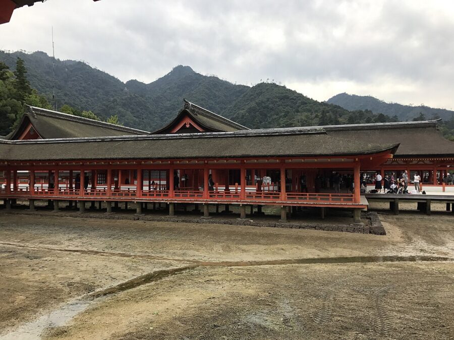

Entry is ¥300 for adults, ¥200 for high school students and ¥100 for younger children; ¥500 buys a combined ticket with the Treasure Hall (as of July 2026). The gates open at 6:30 all year and close at 18:00 from March to mid-October, at 17:30 from mid-October to November and from early January to February, and at 17:00 in December. The usual shrine etiquette applies: rinse at the water basin, bow at the gate, keep to the route.
On the hill above, Senjokaku is a huge hall started by Toyotomi Hideyoshi in 1587 and left without walls when he died. It costs ¥100 (about 50p / 70¢) and makes a breezy place to sit. The five-storey pagoda beside it has been under scaffolding for repairs through 2026.
The tides and the great torii
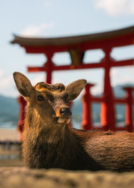
The torii is the eighth on this spot, raised in 1875, about 16 metres high, with main pillars of camphor wood. It is not sunk into the seabed but stands under its own weight, its top beam packed with stones. A long restoration finished in December 2022.
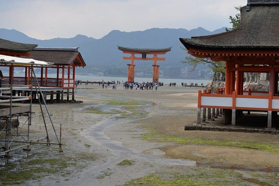

See it at both tides if you can. The shrine and gate seem to float when the tide stands above roughly 250 centimetres, and you can walk out to the torii when it drops to about 100 centimetres. The tide turns about every six hours and the Miyajima tourist association publishes a daily table, which matters more than any train time. A night on the island lets you see both, and the torii is lit after dark.
Mount Misen (弥山)
The Miyajima Ropeway climbs in two stages from Momijidani, a 15-minute walk behind the shrine or a free shuttle bus, to Shishiiwa station. A return is ¥2,000 (about £10 / $13) and a single ¥1,100 (about £5.50 / $7.30), as of July 2026. The first car goes up at 9:00, the last comes down at 16:30, and at busy times you must book a slot online.
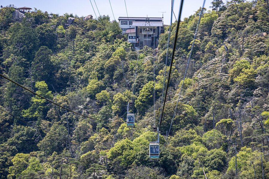

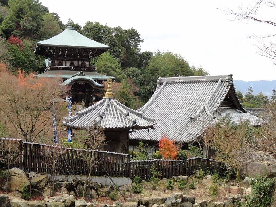
From Shishiiwa a path climbs past the halls of Misen’s old mountain temple. The Reikado hall keeps a fire said to have burned since Kobo Daishi trained here in 806, and it was one of the flames used to light the Flame of Peace in Hiroshima. The summit is a pile of granite boulders, and on a clear day the islands spread south to Shikoku.
Three paths climb from the town, each about 1.5 to 2 hours up and steep with steps. My choice is the ropeway up and the Daisho-in path down, ending at that temple (open 8:00 to 17:00), with its rows of small stone Jizo and staircases lined with prayer wheels.
Kure (呉): the navy port
Kure is 35 to 50 minutes southeast of Hiroshima on the JR Kure Line, which runs along the shore with the islands close outside the window. It became the main base of the Imperial Navy in 1889 and grew into its biggest arsenal, and it is still a naval port and shipbuilding town. Grey warships tie up a short walk from the station.
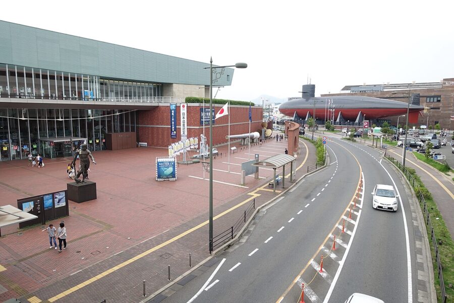

The battleship Yamato, the largest ever built, was completed here in 1941 and sunk with most of her crew on her way to Okinawa in April 1945. The Yamato Museum reopened on 23 April 2026 after more than a year of renovation, with a corrected 1/10 scale model of the ship at its centre and about 300 more objects, including aircraft engines. Adults pay ¥1,000 (about £5 / $7); it opens 9:00 to 18:00, last entry 17:30, and closes on Tuesdays outside the main holidays (as of November 2026).
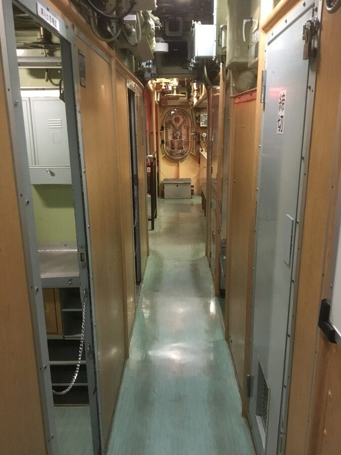
Across the road, the JMSDF Kure Museum has a decommissioned submarine, the Akishio, set on land, and you walk through its cramped interior. Inside, the exhibits cover the minesweeping that went on in these waters for decades after the war. With time for only one, I would choose the submarine for the experience and the Yamato for the story.

South of Kure, the Akinada Tobishima Kaido links a string of islands by bridge. At its end, Mitarai on Osakishimojima was a port where sailing ships waited for wind and tide, and its lanes of merchant houses are now a preserved district. Go by car; the buses are slow.

Takehara (竹原): salt, sake and the rabbit island
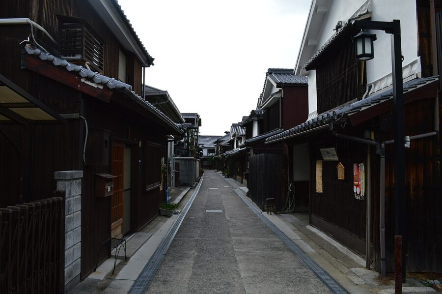
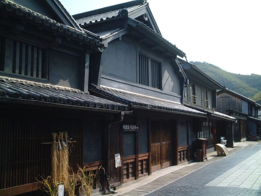
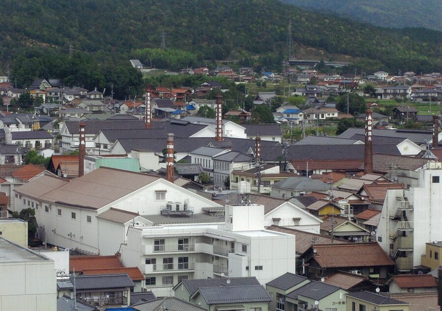
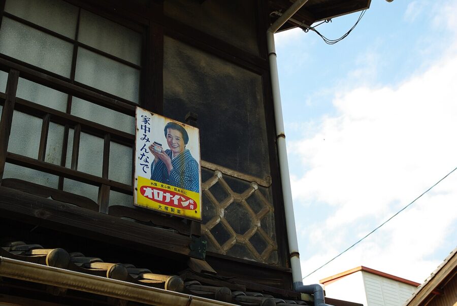
Takehara made its fortune from salt pans in the Edo period, and the merchants put the money into tall houses with latticed fronts and heavy tiled roofs. The old town became a nationally preserved district in 1982, and people still live in it. Its nickname is the Little Kyoto of Aki, after the old name of western Hiroshima.
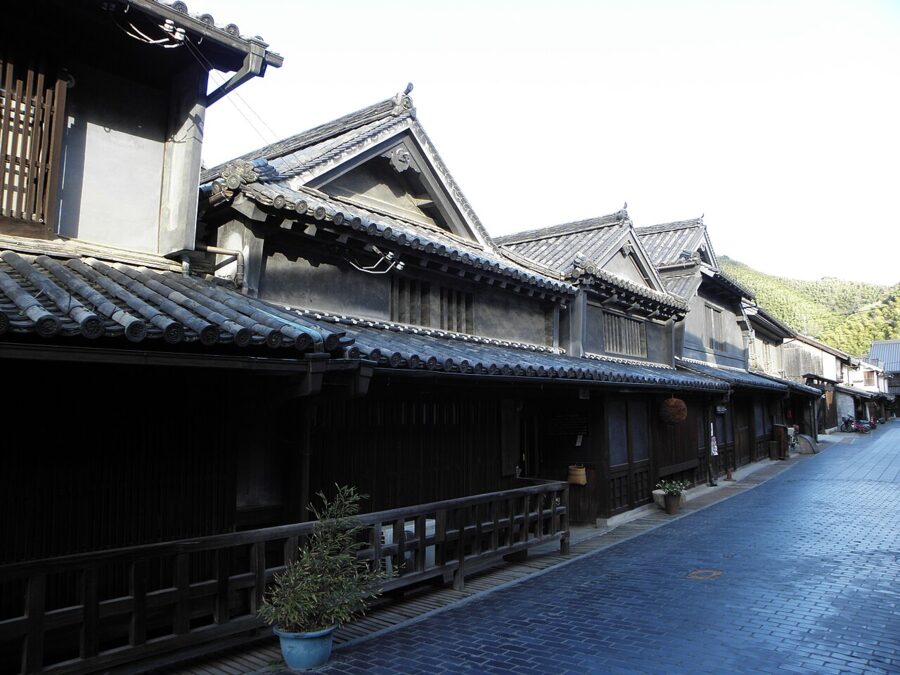
Masataka Taketsuru, who learned whisky-making in Scotland, came home with a Scottish wife and founded Nikka, was born here into a sake-brewing family whose brewery still stands in the old town. The district is about 15 minutes’ walk from Takehara Station. From Hiroshima allow about an hour and 40 minutes by local train, or take the Shinkansen to Mihara and the Kure Line back west.

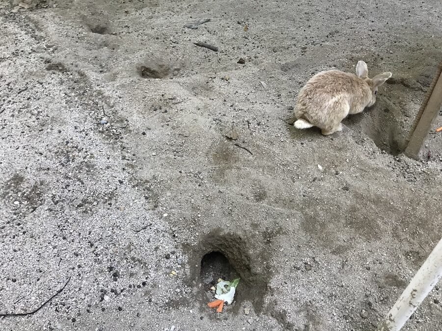
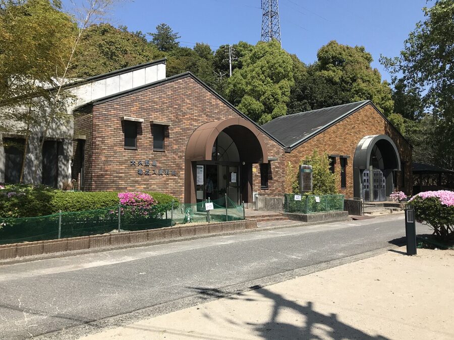
From Tadanoumi, two stops east, a ferry of about 15 minutes runs to Okunoshima. The island is known now for hundreds of wild rabbits, but between 1929 and 1945 it held a secret army factory making poison gas, and it was left off maps. The ruins of the plant and the small Poison Gas Museum, a short walk from the pier, are why the day is worth taking.


Between Hiroshima and Takehara, Saijo in Higashi-Hiroshima is a sake town on an upland basin with soft water and cold winters. Seven or so breweries stand within a short walk of Saijo Station, several of them pouring tastings, and the town ranks with Nada and Fushimi among Japan’s great sake centres.

Onomichi (尾道): the slope town
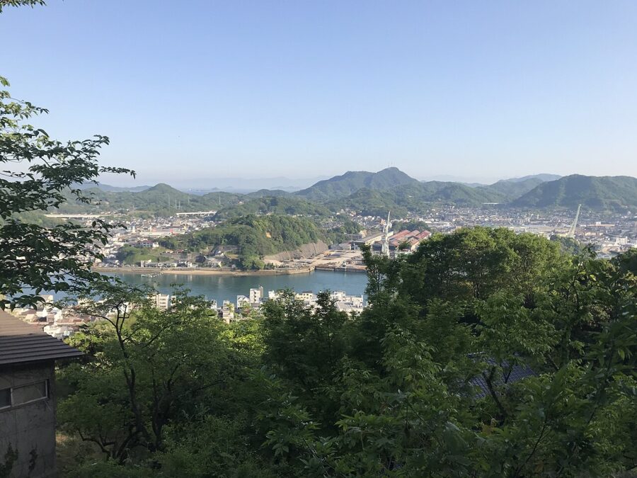
Onomichi is a port on a narrow strait, squeezed between the water and a steep hill. Its temples climb the hill, joined by stone lanes and stairways too narrow for cars, with views across to Mukaishima and its shipyard cranes. Yasujiro Ozu set the opening of Tokyo Story here in 1953, and the town still looks much as it does in the film.
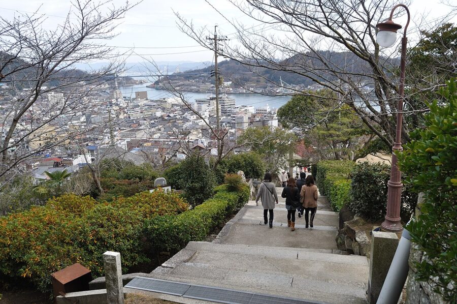

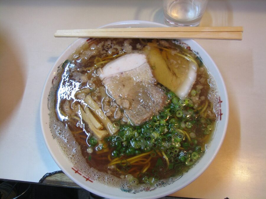
The temple walk takes in some 25 temples along the foot and face of the hill, and the main stretch takes two or three hours, past cafes in old houses and the cats the town is known for. Onomichi ramen is the local bowl: a soy-sauce broth made with fish and chicken, flat noodles, and small lumps of pork back fat floating on top.

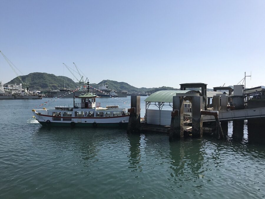
Little ferries cross the channel to Mukaishima every few minutes from several piers, a few minutes each way with your bicycle on board. This is how the Shimanami Kaido starts on two wheels: the first road bridge, the Shin-Onomichi Bridge, has no cycle lane.

The Shimanami Kaido: the Hiroshima half
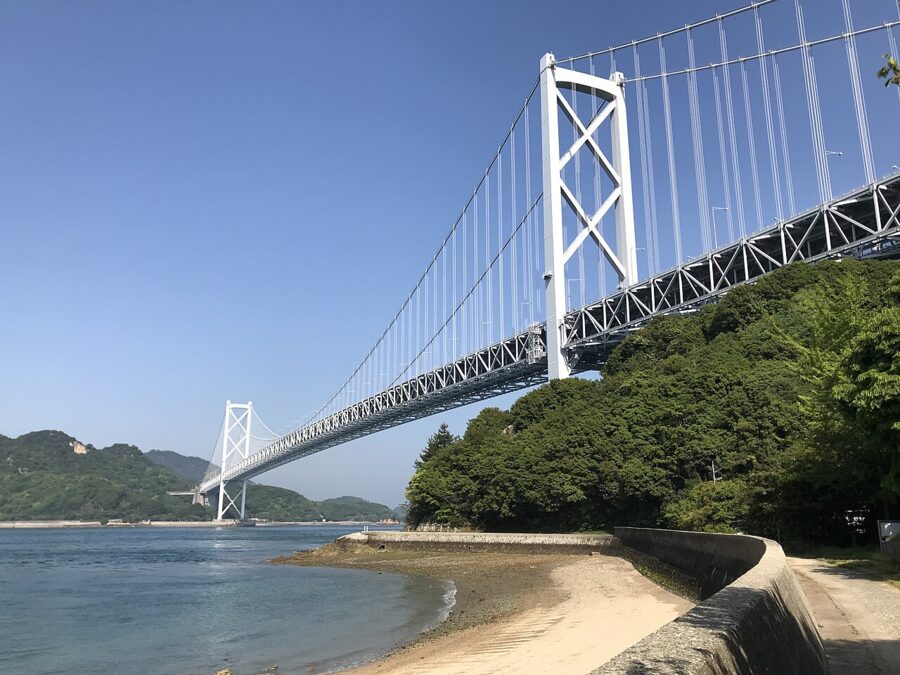
The Shimanami Kaido is an expressway from Onomichi to Imabari on Shikoku, crossing six main islands by a chain of bridges, with a cycle and walking path all the way. The signed route is about 70 kilometres, and the climbs are all onto the bridges, by long, gentle ramps. A fit rider can do it in a day, but two days with a night on an island is better.
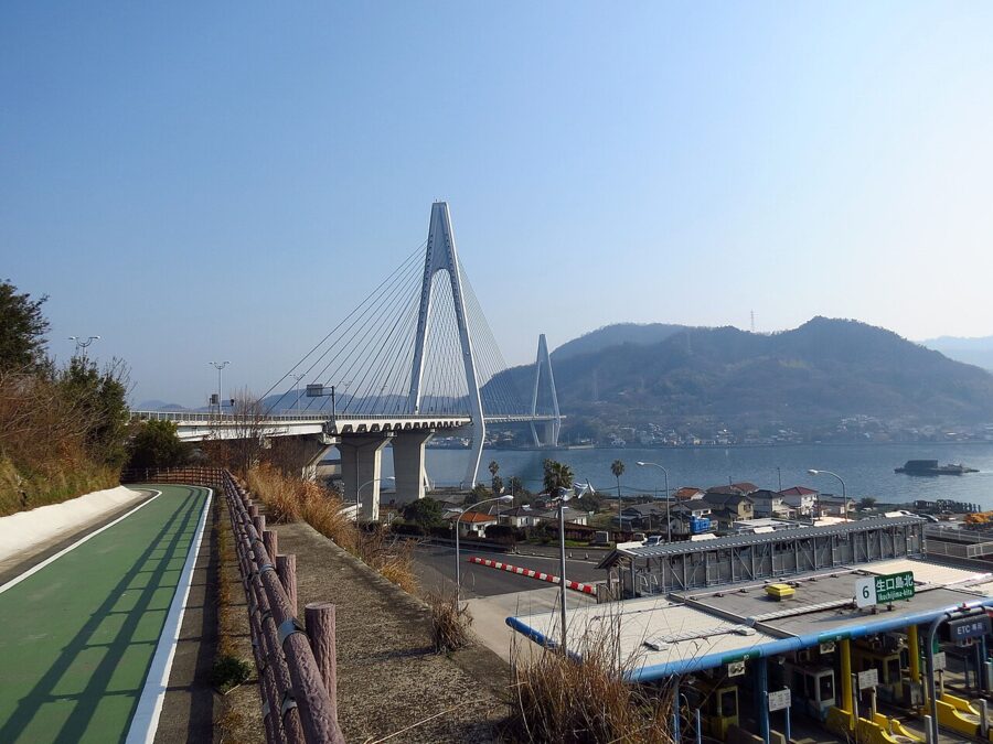

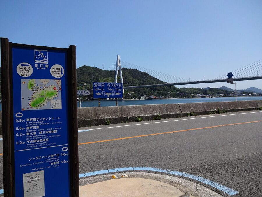
The first half is in Hiroshima Prefecture. After the ferry to Mukaishima comes Innoshima Bridge, ridden on a lower deck under the cars, then Innoshima, once a base of the Murakami pirates who ruled these straits, then the Ikuchi Bridge to Ikuchijima. Hiroshima grows more lemons than any other prefecture, many of them around Setoda on Ikuchijima. The prefectural border crosses the Tatara Bridge to Omishima, and from there the route is in Ehime.

The official rental bikes cost ¥3,000 (about £15 / $20) a day for a cross bike or city bike, ¥4,000 (about £20 / $27) for an electric-assist bike and ¥8,000 (about £40 / $53) for an e-bike, helmets included (as of November 2026). Most can be returned at any of the ten terminals for an extra ¥1,000. The Onomichi terminal, outside the station, opens 8:00 to 19:00 from March to November and 8:00 to 18:00 in winter; most island terminals close at 17:00.
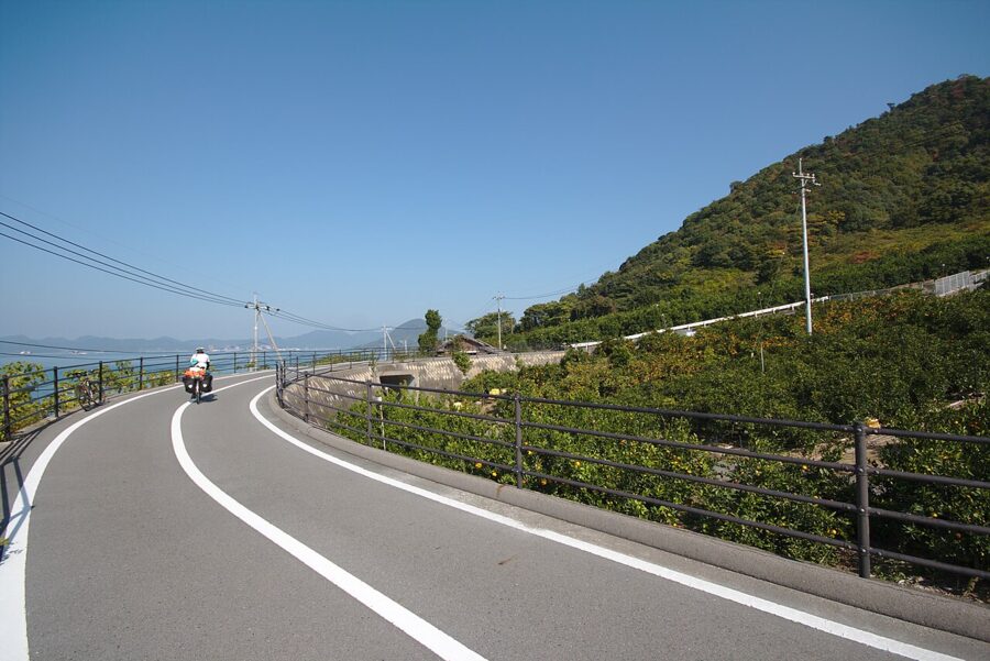

Cycling across the bridges is free until at least 31 March 2028, after the toll waiver was extended again in March 2026. Rental bikes may not be ridden after dark. If you ride only to Setoda and take a ferry back to Onomichi, the Hiroshima half makes a fine single day.

Further out: Tomonoura and the mountain gorges
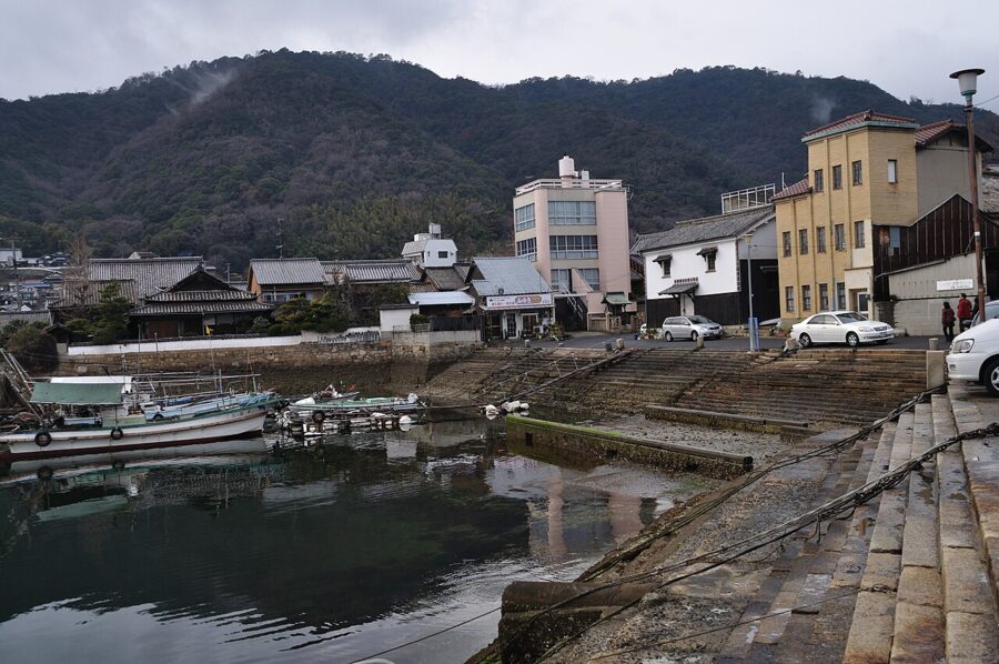
Tomonoura, at the southern tip of Fukuyama, was the harbour where boats crossing the Inland Sea waited for the tide to turn, since the currents from east and west meet just offshore. It keeps its stone lantern, its stepped quays and a tangle of old lanes. Buses take about half an hour from Fukuyama Station, a stop for the fastest Shinkansen.


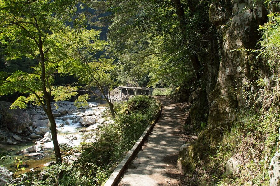
Inland, the two big gorges are Sandankyo in Akiota, in the northwest, and Taishakukyo near Shobara, in the northeast. Sandankyo is a deep, narrow valley with a path along the river past falls and pools, best in autumn. Buses run from Hiroshima Bus Centre, but both gorges are easier by car, and I would only go with a full spare day.

Getting there and getting around
The Sanyo Shinkansen is the spine. From Tokyo the fastest Nozomi reaches Hiroshima in about three hours and 45 minutes, and a reserved seat costs ¥19,760 (about £100 / $130) as of 2026. From Shin-Osaka it is about an hour and a half, and from Hakata in Fukuoka just over an hour. Hiroshima Airport is in the hills about 50 kilometres east of the city, an hour from the station by airport bus.
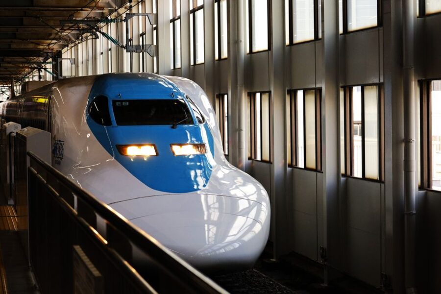
For the coast the local lines do the work: the Sanyo Line west to Miyajimaguchi, and the Kure Line along the shore through Kure and Takehara to Mihara. For Onomichi, take the Nozomi to Fukuyama and change to the Sanyo Line for about 20 minutes; Shin-Onomichi station is a bus ride from town and served only by slower trains. A car pays off only for the islands south of Kure and the northern gorges.
Seasons
Cherry blossom in the Peace Park and round the castle comes in late March or early April. The rainy season runs from early June into July, and the summer after it is hot and humid, with typhoons possible from August into October that can stop ferries for a day. Early August brings the anniversary on the 6th, moving to see and hard on hotel prices.
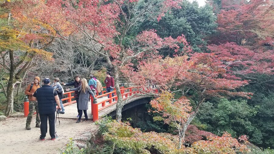
Autumn is the season I would choose. The heat breaks in October, the air clears over the islands, and the maples of Momijidani on Miyajima turn red in the middle to end of November. Winter is mild on the coast, with cheaper rooms and fat oysters, though snow closes some roads in the northern mountains.

How many days, and in what order
How many days do you need? Two for Hiroshima city and Miyajima, and four to see the prefecture. Spend the first day on the Peace Park, the museum and Shukkeien, and the evening on okonomiyaki. Give the second to Miyajima, timed to the tide, and stay on the island if you can.
On the third day take the Kure Line east, stopping at Kure for the museums and going on to Takehara, or swapping Kure for Okunoshima, and sleep in Onomichi. On the fourth, walk the temples early, then ferry to Mukaishima and ride the Hiroshima half of the Shimanami Kaido to Setoda. With a fifth day, carry on across Tatara Bridge to Imabari and Shikoku.
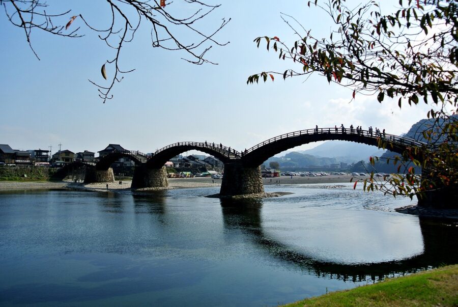
East on the Shinkansen is Okayama, 40 minutes from Hiroshima, with the canal quarter of Kurashiki just beyond. West, the five-arched Kintai Bridge at Iwakuni is a short hop past Miyajima, over the border in Yamaguchi, and highway buses cross the mountains north to Izumo and Matsue on the Sea of Japan. South, the bridges you have been riding keep going to Shikoku, and so should you.