
The Ogasawara Maru leaves Takeshiba Pier on Tokyo Bay at 11:00 and docks at Chichijima at 11:00 the next morning, a full day at sea, and it never leaves Tokyo. Tokyo Prefecture (東京都) is the 23 wards that most people mean by the name, but it is also the forested Tama hills running west to a 2,017-metre summit, and two chains of volcanic islands strung some 1,000 kilometres down the Pacific. The city takes up less than a third of the land.
That shape decides how you plan. The wards are a dozen neighbourhoods tied together by rail, and four days there will still leave whole districts untouched. Tama is a day trip by suburban train: a temple mountain, a lake behind a dam, caves, cedar forest. The islands are separate journeys, from under two hours by jetfoil to Izu Oshima up to six days for the round trip to Ogasawara.


I would give the wards four days and the hills one more, then decide whether the islands fit.
Contents
The shape of Tokyo Prefecture
Tokyo Prefecture covers about 2,200 square kilometres and had an estimated 14,288,867 residents on 1 October 2026, according to the Tokyo Metropolitan Government. It is one of the 47 prefectures but runs as a metropolis, which is why the name ends in “-to” rather than “-ken”. The City of Tokyo itself was abolished in 1943; the 23 special wards took its place, each with its own mayor and its own town hall.
The ward area fills the eastern lowlands at the head of Tokyo Bay. East of the Imperial Palace the ground is flat, reclaimed and laced with rivers and canals, the old merchant town that Tokyoites call shitamachi. West of the palace the land rises onto the Musashino terrace, a plateau of gravel and volcanic ash that once grew woodland and dry fields. Roughly two in three of the prefecture’s people live in the wards.
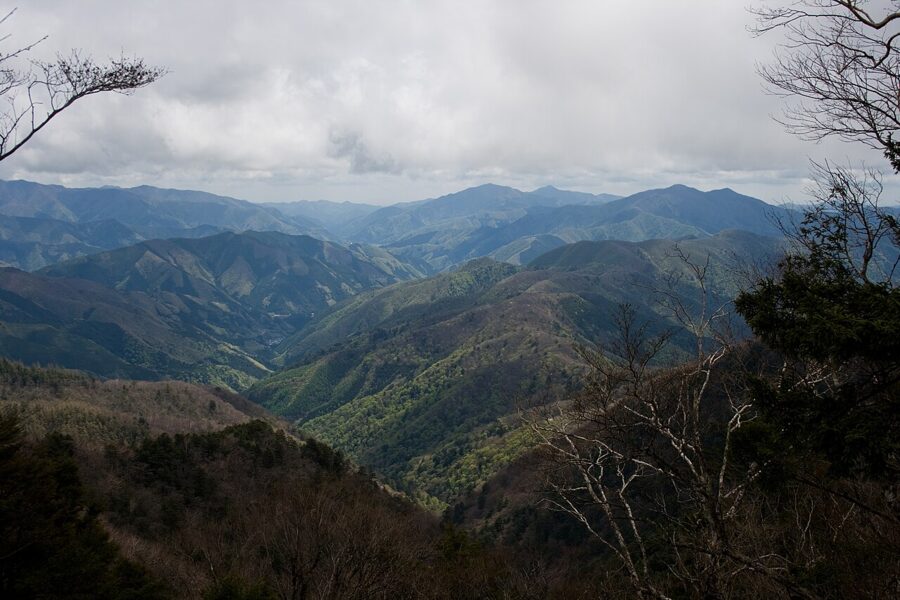
Tama is the long western strip, 26 cities plus the towns of Mizuho, Hinode and Okutama and the village of Hinohara. It starts as commuter suburb at Mitaka and Musashino and ends in steep, wooded mountains that run into Saitama and Yamanashi. Mount Kumotori, the highest point in Tokyo at 2,017 metres, stands on that western edge. The Tama River (多摩川) flows out of these hills and forms the prefecture’s southern border with Kanagawa on its way to the bay.

The islands make up the rest: the Izu Islands (伊豆諸島), whose inhabited members run about 250 kilometres south between Oshima and Aogashima, and the Ogasawara Islands (小笠原諸島), around 1,000 kilometres south of the city. Between them they hold two towns and seven villages. On the map of Japan, Tokyo sits in the Kanto region on the Pacific side of Honshu, but Chichijima, its main southern island, lies at roughly the latitude of Okinawa.
The 23 wards, area by area
The JR Yamanote Line is the frame. It runs a loop of 30 stations around central Tokyo, and most of what a first visit wants lies on it or within a few subway stops. Think of the city as east, centre, west and the bay, and give each its own day; crossing town twice in an afternoon is how Tokyo eats time.
East: Asakusa, Ueno and Yanaka
Asakusa grew around Senso-ji (浅草寺), Tokyo’s oldest temple. By temple tradition two fishermen pulled a small gold image of Kannon from the Sumida River in 628, and the temple was built to house it. You enter through the Kaminarimon with its huge red lantern, walk the 250 metres of Nakamise-dori past shops selling rice crackers and fans, and reach the main hall. The grounds are free; the main hall is open 6:00 to 17:00, from 6:30 between October and March (as of November 2026).
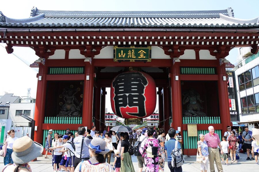

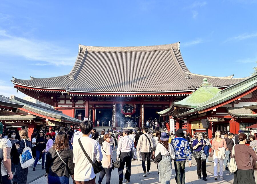
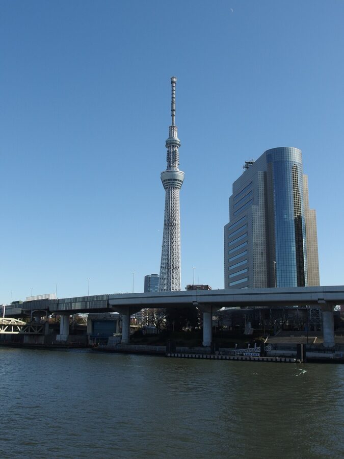
Go early. By mid-morning Nakamise moves at the pace of the slowest tour group, but before 8:00 the temple belongs to joggers and people on their way to work. Afterwards, the streets behind the temple hold the old Asakusa: the Hanayashiki amusement park, opened in 1853, the kitchenware shops of Kappabashi-dori to the west, and the river.

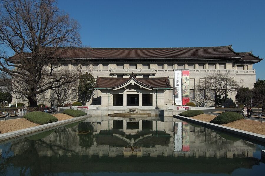
Ueno, ten minutes away on the Ginza Line, is the museum quarter. Ueno Park holds the Tokyo National Museum, founded in 1872 and the oldest museum in Japan, with the largest collection of national treasures anywhere. Next door, Le Corbusier’s National Museum of Western Art has been a World Heritage Site since 2016, and Ueno Zoo, opened in 1882, is the oldest zoo in the country. Ameyoko, the market street under the tracks south of the station, sells dried fish, cut fruit and cheap trainers in roughly equal measure.

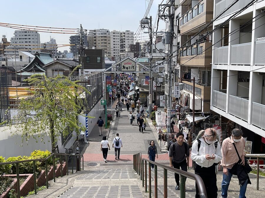
Yanaka, a short walk north of the park, is the neighbourhood I would choose if I had one hour of old Tokyo. It came through the 1923 earthquake and the 1945 fire raids largely standing, so its lanes still hold wooden houses, small temples by the dozen and a large cemetery shaded by cherry trees. Yanaka Ginza, the short shopping street at the bottom of the Yuyake Dandan steps, sells croquettes and rice crackers to people who live there.

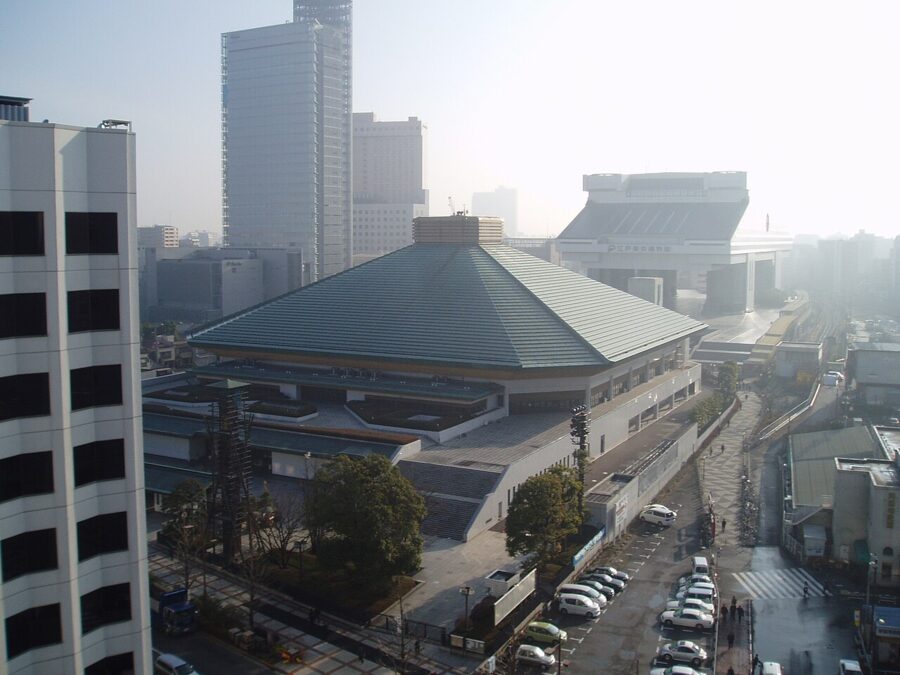
Ryogoku, across the river to the south-east, is sumo’s home. The Kokugikan hosts three of the six annual grand tournaments, in January, May and September, and the stables nearby send wrestlers into the streets in their cotton robes. The Edo-Tokyo Museum beside the hall reopened in 2026 after a long renovation and is open again as of November 2026, with its full-scale replica of part of the old Nihonbashi bridge.

The centre: Marunouchi, the Imperial Palace and Ginza
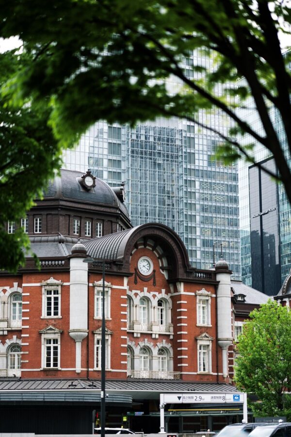
Tokyo Station is the centre in every sense: the Shinkansen terminus and the hub of the JR network. Its red-brick Marunouchi building opened in 1914, lost its domes in 1945 and had them restored in 2012. Walk out of the Marunouchi exit and the road runs straight to the moats of the Imperial Palace, past office towers that sit on the site of samurai mansions.
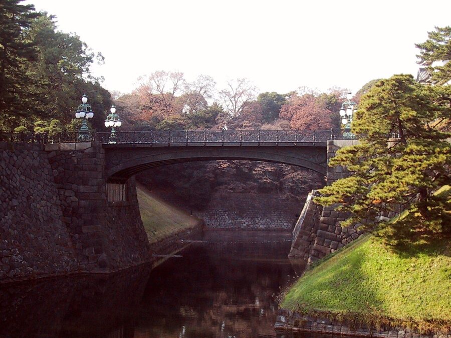
The palace itself stands on the site of Edo Castle, the seat of the Tokugawa shoguns from 1603. You can walk the outer gardens and look across the moat to Nijubashi, but the part to see is the East Gardens, where the castle’s keep once stood. They are free, closed on Mondays and Fridays, and open 9:00 to 16:00 from November to the end of February with last entry at 15:30 (as of November 2026). Bags are checked at the gate, so travel light.

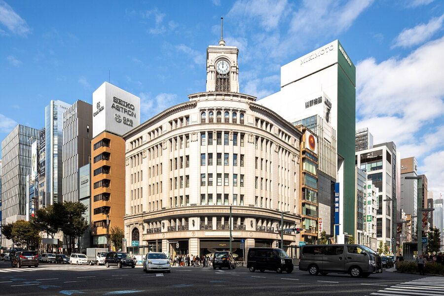
Ginza starts ten minutes’ walk south-east. It is the old shopping street of the Meiji era, and the clock tower of the Wako building at the 4-chome crossing has marked its centre since 1932. A few minutes north, Nihonbashi is the bridge from which every national road distance in Japan is measured; the expressway that has shadowed it since 1963 is being moved underground.

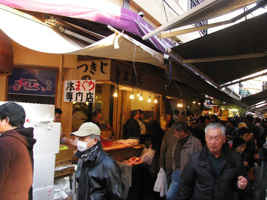
Tsukiji, south of Ginza, lost its wholesale fish market to Toyosu in 2018, but the outer market stayed behind. Its lanes of knife shops, tea dealers, tamagoyaki stalls and sushi counters open early and wind down by early afternoon. Come for breakfast, not lunch.

West: Shinjuku, Harajuku and Shibuya
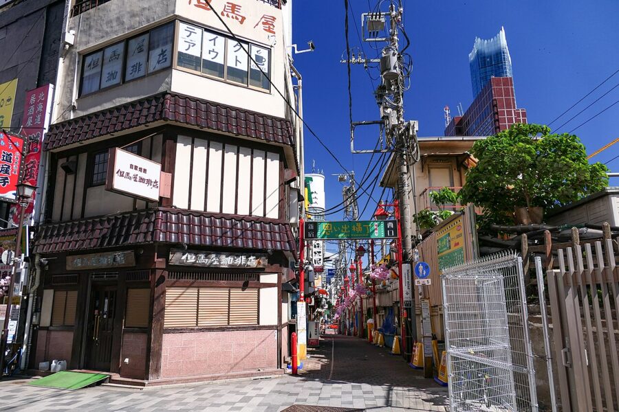
Shinjuku Station handles more passengers than any other on earth, and the district around it is several towns at once. West of the tracks rise the government towers, including the twin-towered Tokyo Metropolitan Government Building with its observation floors. East is Kabukicho, the city’s biggest nightlife district. Between them, on the station’s north-west corner, Omoide Yokocho squeezes yakitori counters and tiny bars into two lanes that date from the black markets after 1945.

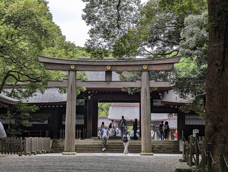
Harajuku, two stops south, holds the city’s two moods side by side. On one side of the station is Meiji Jingu (明治神宮), the shrine to Emperor Meiji completed in 1920, in a planted forest of roughly 100,000 trees that now feels as old as the city. On the other is Takeshita-dori, a narrow street of fashion shops and crepe stands, and beyond it the broad avenue of Omotesando with its architect-designed boutiques.
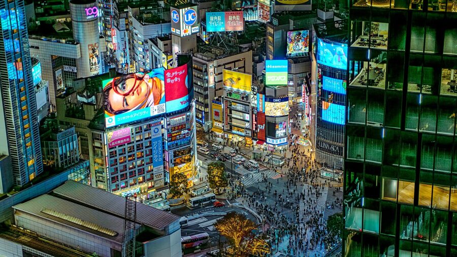
Shibuya is the next stop. The crossing is the one you have seen, and it works best from above: the Shibuya Sky deck on top of Shibuya Scramble Square, 229 metres up, looks straight down on it. Daikanyama, Nakameguro and Shimokitazawa, one or two stops out on private lines, are where Tokyo shops for second-hand clothes and records.
The bay: Odaiba, Toyosu and Takeshiba
The bay shore is mostly reclaimed land, built out from the Edo period onwards. Odaiba, an island of malls, exhibition halls and a small beach, is reached by the driverless Yurikamome line across the Rainbow Bridge. Toyosu, its neighbour, holds the wholesale fish market that replaced Tsukiji; the tuna auction can be watched from a viewing gallery if you arrive in the early morning.
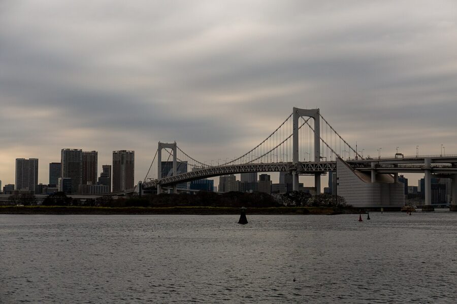
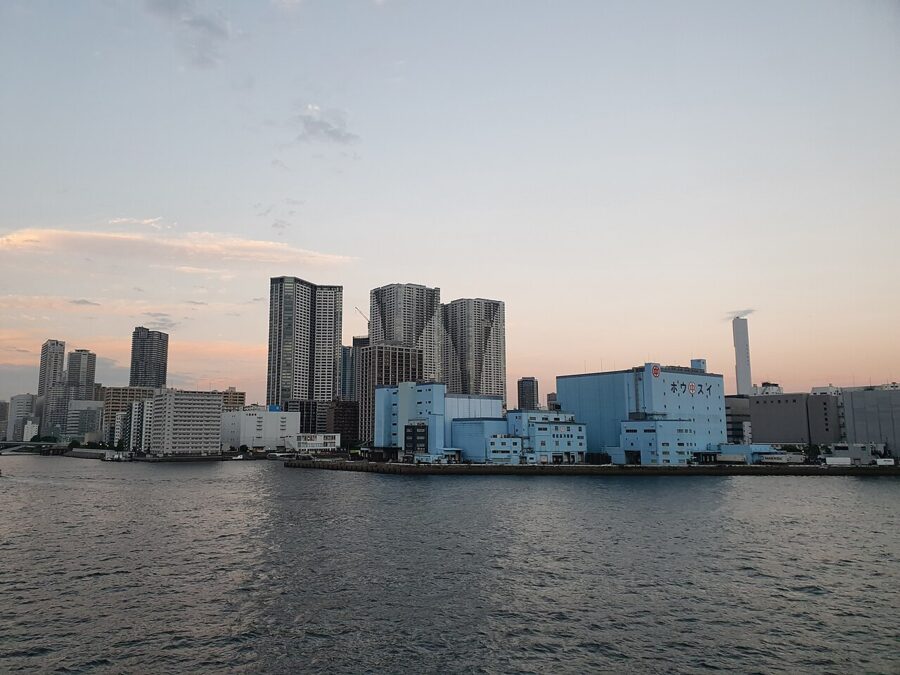
Takeshiba Pier, a short walk from Hamamatsucho Station, matters for another reason. It is where the ships to the Izu Islands and to Ogasawara leave. Haneda Airport, the city’s main domestic airport and an international one too, also sits on the bay, in Ota Ward.
Tama: Mitaka, Mount Takao and Okutama
Tama covers more than half of Tokyo’s land, and most visitors see none of it. The Chuo Line and the private Keio and Odakyu lines run west from Shinjuku through it, so every place below is a day trip, back in the wards for dinner.
Mitaka, Kichijoji and Jindaiji
Mitaka is 20 minutes west of Shinjuku on the Chuo Line, and it is where most people take their first step into Tama, for the Ghibli Museum. Tickets are sold only in advance through Lawson Ticket online, for a set date and entry time, and go on sale at 10:00 Japan time on the 10th of the month before; adults pay ¥1,000 (about £5 / $6.50), as of November 2026. Nothing is sold at the door.
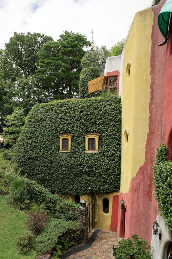

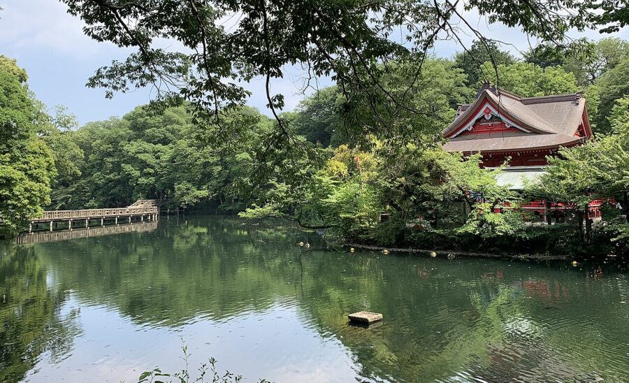
The museum backs onto Inokashira Park, a long pond and wooded park that runs to Kichijoji, one stop back towards the city. Kichijoji regularly comes near the top when people in Tokyo are asked where they would most like to live, and its lanes near the station, especially the narrow Harmonica Yokocho, explain why.

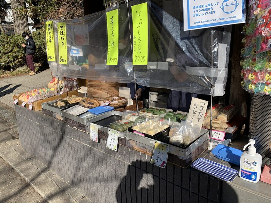
South of Mitaka, in Chofu, Jindaiji (深大寺) dates by its own tradition from 733, which makes it the second-oldest temple in Tokyo after Senso-ji. Spring water from the slopes around it made the area known for buckwheat noodles, and some 20 soba shops still line its approach. Combine it with the Jindai Botanical Garden next door and you have a slow, green half-day that feels nothing like the city.


Mount Takao
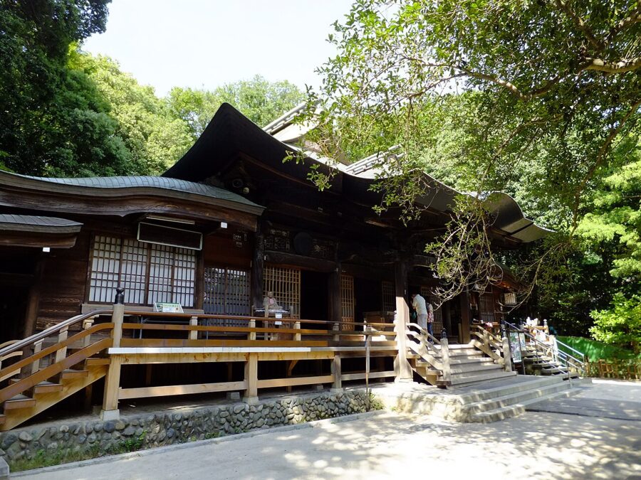
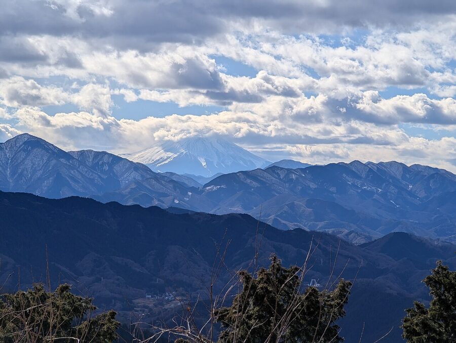
Mount Takao (高尾山) is 599 metres high, about 50 minutes from Shinjuku on the Keio Line to Takaosanguchi, and climbed by more people each year than almost any mountain in the world. The reason is how easy it is: a paved trail, a cable car and a chairlift, temple buildings near the top, and a view of Mount Fuji from the summit on a clear day. On a weekday the forest is quiet; on a Saturday in November it is a queue.
The cable car climbs to the midway station in about six minutes on a track that reaches 31 degrees, the steepest cable railway gradient in Japan. Fares are ¥490 (about £2.50 / $3) one way and ¥980 (about £5 / $6.50) return as of November 2026, the same for the chairlift. The chairlift closes for equipment renewal and earthquake strengthening from 12 January to 28 March 2027, so use the cable car or walk in that window.
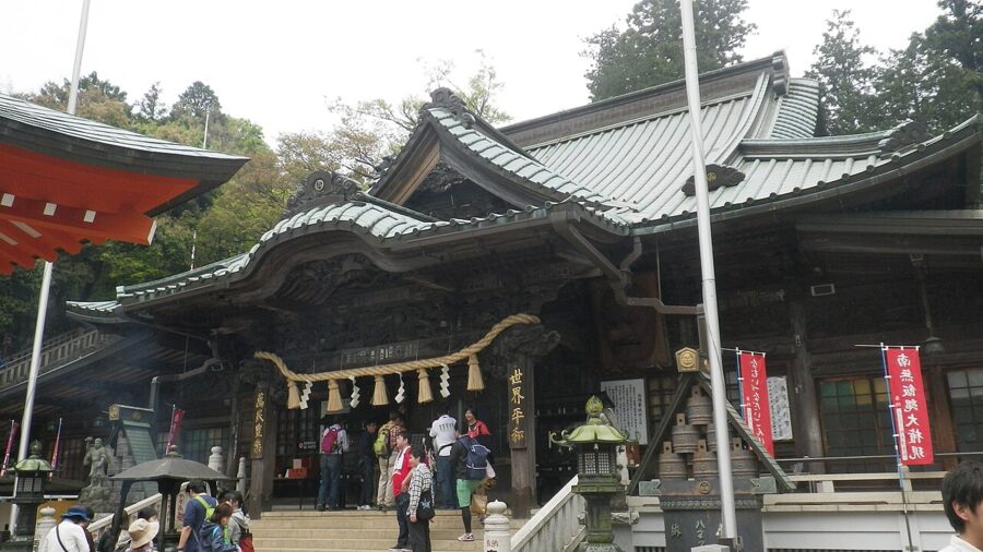

From the top of the cable car it is about 40 minutes on foot to the summit, past Yakuoin. Walk down by Trail 6, a stream path through the woods, if you want to skip the crowds on the paved route. In winter, the summit’s view west is often clear enough to see Fuji above the Tanzawa ridges.
Okutama and Mitake
The JR Ome Line climbs the Tama River valley to Okutama, the last station, about two hours from Shinjuku with a change of train at Tachikawa or Ome. Beyond Ome the line runs through gorges and cedar plantations, and Okutama town at the end is a small place with a river, hiking trailheads and buses into the hills. The upper section has infrequent trains, so check the times back before you set out.
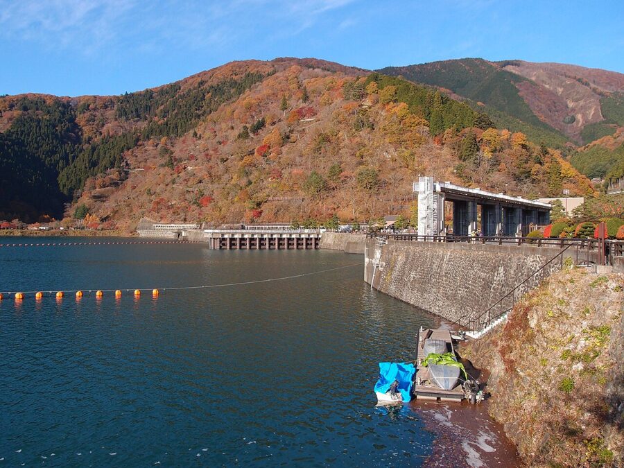
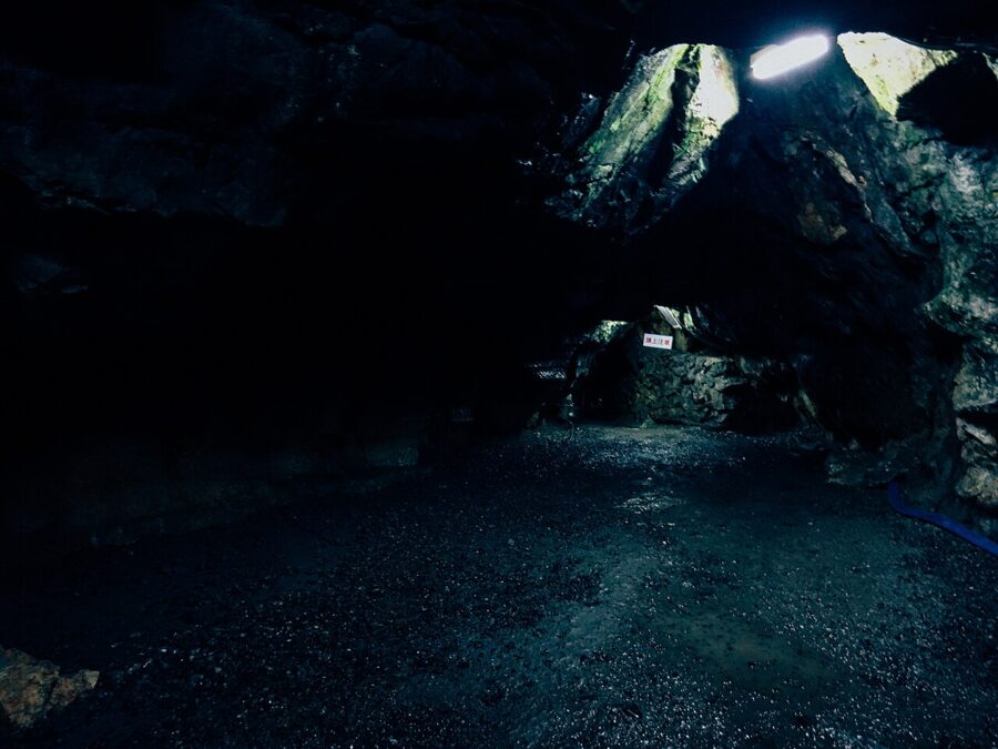
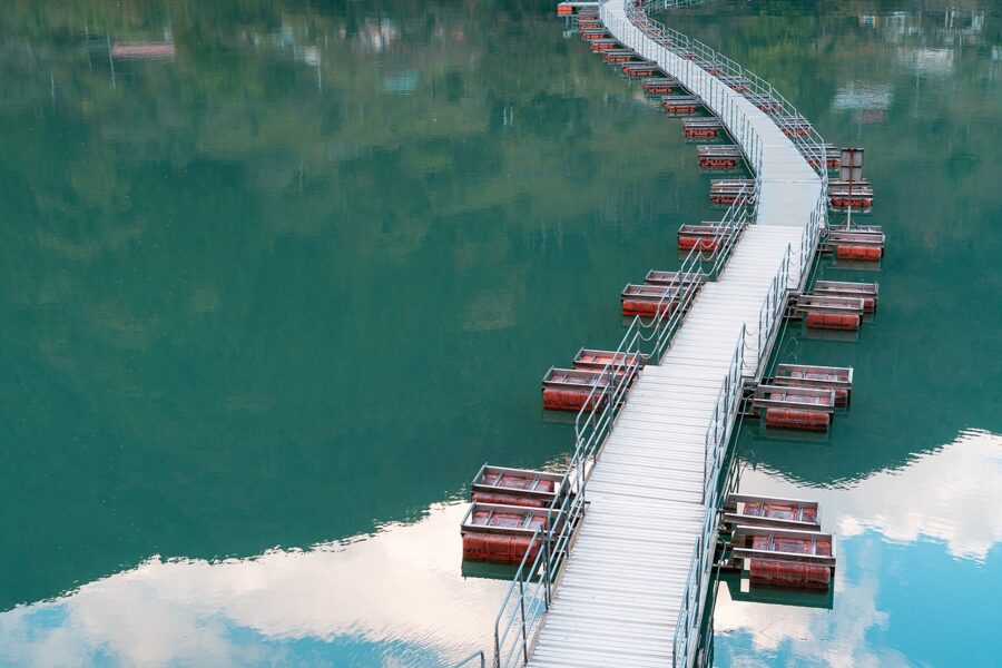
Two bus rides from Okutama Station shape a day here. One heads up the Nippara valley to the Nippara Limestone Cave (日原鍾乳洞), the largest cave in the Kanto region, with a walking route of about 800 metres that stays around 11°C all year. Admission is ¥900 (about £4.50 / $6), cash only, with hours of 9:00 to 17:00 and earlier closing in winter, as of the latest Tokyo listing. The other runs west to Lake Okutama, the reservoir behind the Ogochi Dam.

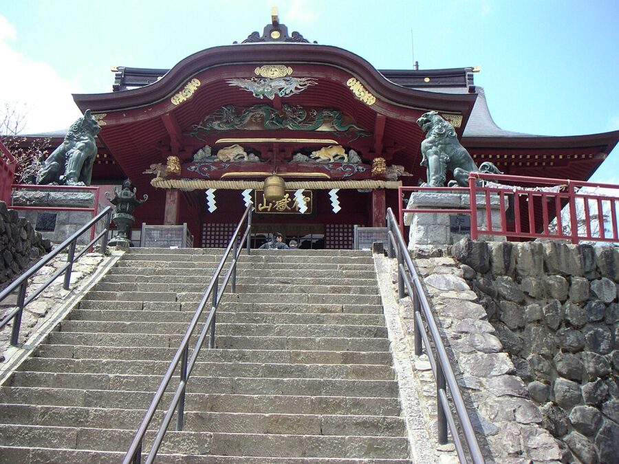
Mitake, a few stations short of Okutama, is the other choice. A bus and a cable car lift you to Mount Mitake, where Musashi Mitake Shrine has stood above the valley for centuries and pilgrim lodges still take guests. The walk from Mitake across to the Rock Garden, a mossy stream gorge, takes about an hour and is the best short hike in Tokyo.

If you have two days and a good pair of boots, the long trail from Okutama to Mount Kumotori, Tokyo’s highest summit, is the most serious walk in the prefecture. Most hikers stay a night in the hut below the top.
The Izu Islands
The Izu Islands are the tops of volcanoes that run south from Sagami Bay, and nine of them are inhabited. Tokai Kisen runs two kinds of ship from Takeshiba Pier. The jetfoil reaches Oshima in 1 hour 45 minutes and the northern islands of Toshima, Niijima and Shikinejima in under two and a half hours. The large ship sails overnight, reaching Oshima at dawn and Hachijojima about ten hours out, so you sleep on board and wake in port.
As of November 2026, one-way adult fares from Tokyo are ¥9,980 (about £50 / $65) to Oshima by jetfoil, ¥6,160 (about £31 / $40) by the large ship in second class, and ¥11,620 (about £58 / $75) to Hachijojima by the large ship in second class, fuel surcharge included. Seas around the islands are rough in winter, and sailings are cancelled or turned back more often than visitors expect; the operator posts each sailing’s status on its website. Build a spare day into any island trip.
There are flights too. ANA flies from Haneda to Hachijojima in under an hour, and the small New Central Air service from Chofu airfield in western Tokyo reaches Oshima, Niijima, Kozushima and Miyakejima.
Izu Oshima
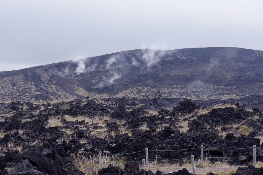
Oshima is the nearest and largest of the chain, and the easiest island day trip from Tokyo. Its volcano, Mount Mihara (三原山), last erupted in 1986, when the whole population of about 10,000 was evacuated by ship within a day. The walk around the summit crater crosses black lava fields that still steam in places. The island is also known for camellias, which flower across it in late winter.

Niijima and Shikinejima
Niijima, about two hours 20 minutes out by jetfoil, is a surf island with long beaches of white sand and a local volcanic rock, koga-ishi, which the island turns into green glass. Shikinejima, a short boat ride away, is small enough to walk across and has hot springs set into the rocks at the water’s edge, where the sea and the spring water mix.
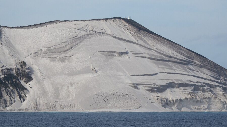

Hachijojima and the far south
Hachijojima, about 290 kilometres south of Tokyo, has a warmer climate and a long history as a place of exile; Ukita Hideie, one of the generals defeated at Sekigahara in 1600, lived out his life here. The island is built from two volcanoes, Hachijo-Fuji to the north and Mihara-yama to the south. Its food is its own: shima-zushi, sushi seasoned with mustard instead of wasabi, and kusaya, salted fish dried in a brine so pungent that islanders warn you before you open the packet.
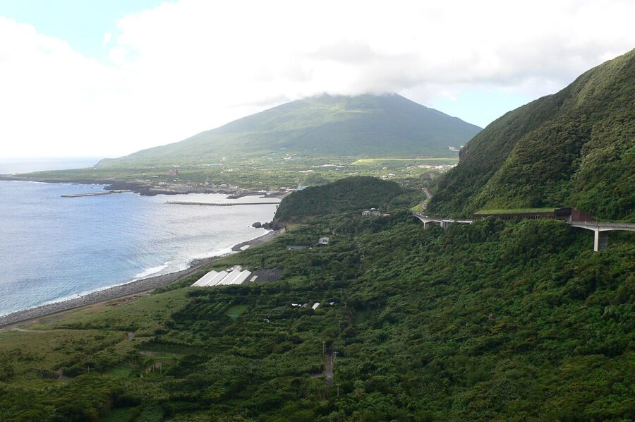

Beyond it lies Aogashima, a double volcano with a village of fewer than 200 people inside its outer rim. It is reached only from Hachijojima, by a small ferry or a helicopter, and both are cancelled often. Miyakejima, between Oshima and Hachijojima, had its whole population evacuated after the eruption of 2000 and only allowed back in 2005; it is now a quiet island for birdwatchers and divers.
Ogasawara: a day each way by sea
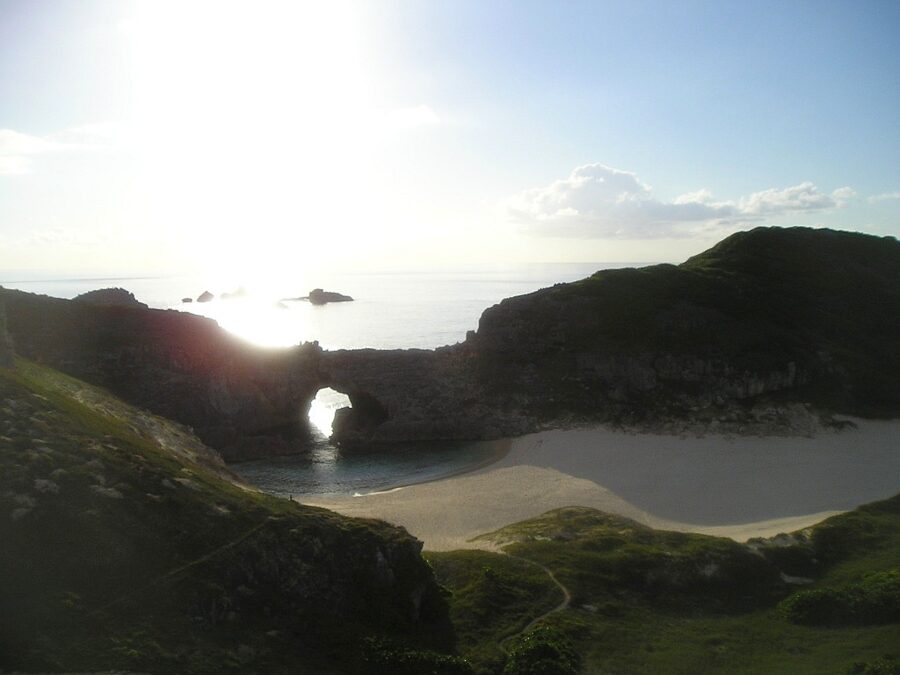
The Ogasawara Islands lie around 1,000 kilometres south of central Tokyo, and they have never been joined to a continent. That isolation produced plants, land snails and insects found nowhere else, and it is why UNESCO listed the islands as a natural World Heritage Site in 2011. People came late: the first settlers, in 1830, were Westerners and Pacific islanders, Japan claimed the islands in 1876, and the United States held them from the end of the war until 1968.
There is no airport. The only public route is the Ogasawara Maru from Takeshiba Pier, which leaves at 11:00 and reaches Futami Port on Chichijima at 11:00 the next day, about 24 hours at sea. In the timetable for November 2026 to February 2027, it sails from Tokyo every six to eight days. The ship spends several days in port before returning, so the usual trip is six days: two nights on board and three on the island.
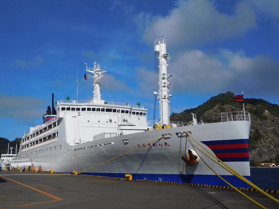
Fares are set month by month and include a fuel surcharge that moves with the oil price. As of November 2026, the cheapest berth, a second-class shared tatami room, costs ¥30,030 (about £150 / $195) one way, rising to ¥32,150 (about £160 / $205) for sailings in January 2027; private cabins run up to ¥89,480 (about £450 / $575) and more. Book your accommodation first: the island’s tourism association says rooms are hard to find locally, and camping is banned by village ordinance.
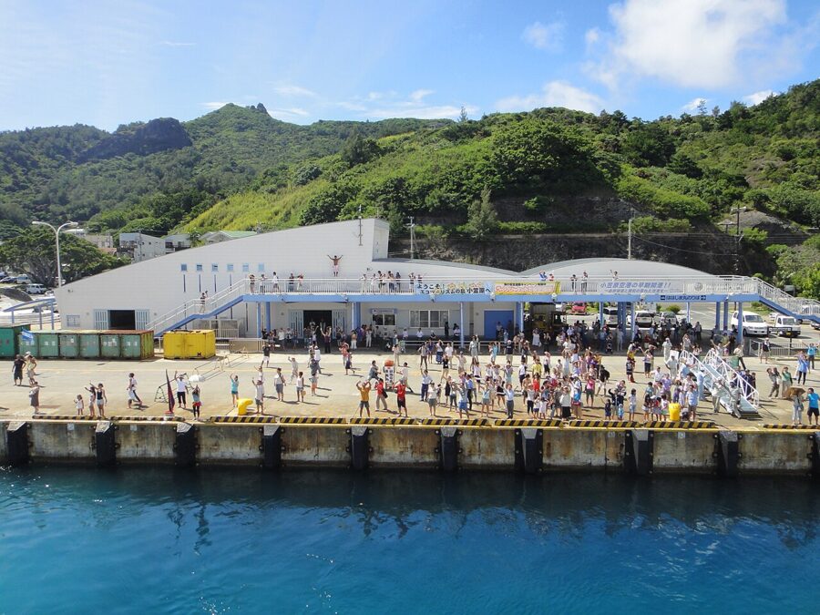

On Chichijima, days are spent on the water. Dolphins swim close to the boats, humpback whales come through in winter and spring, and the water is clear enough to see the reef from the deck. Minamijima, the limestone islet off the south coast, can be landed on only with a guide certified by Tokyo, in limited numbers, which keeps it as it is.
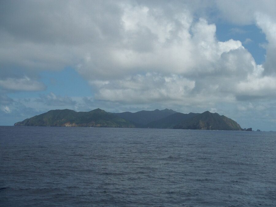
Hahajima, the second inhabited island, is a further ferry ride south on the Hahajima Maru, which connects with the big ship. It is quieter still, with forest trails and a single road. If you are making the long trip, I would give it a night.
Getting around the city
Tokyo’s trains are the easiest in the world to use and the hardest to understand from a map. Two things make them simple: an IC card, and knowing which company runs which line.
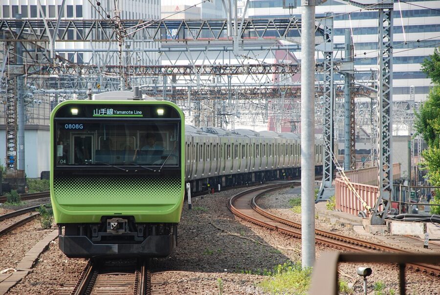
IC cards
Suica and PASMO are rechargeable cards that you tap on the gate; they work on every train, subway and bus in the city and pay at convenience stores and vending machines. A standard card carries a ¥500 (about £2.50 / $3) deposit. Short-term visitors can choose the Welcome Suica or Tourist Pasmo instead, with no deposit, valid for 28 days and sold from ¥1,000, or set up Welcome Suica Mobile on a phone before arriving. As of September 2026, tapping a contactless credit card works on many private and subway lines, but not on JR lines, the Keisei Line or the Tokyo Monorail.
JR East raised its fares on 14 March 2026 and ended the cheaper fare zone inside the Yamanote loop. The shortest JR ride now costs ¥160 (about £0.80 / $1) by ticket or ¥155 by IC card.
The subway and day passes
Tokyo has 13 subway lines run by two operators, Tokyo Metro with nine and Toei with four. They share stations and transfers and both take IC cards, but day passes vary in what they cover. The figures below are for adults, as listed by Tokyo’s official visitor guide in September 2026.
| Pass | Price | Covers |
|---|---|---|
| Tokyo Subway Ticket, 24 hours | ¥1,000 (about £5 / $6.50) | All Tokyo Metro and Toei subway lines |
| Tokyo Subway Ticket, 48 hours | ¥1,500 (about £7.50 / $10) | As above |
| Tokyo Subway Ticket, 72 hours | ¥2,000 (about £10 / $13) | As above |
| Tokunai Pass, one day | ¥870 (about £4.50 / $5.50) | JR lines within the 23 wards |
| Tokyo One-Day Ticket | ¥1,720 (about £8.50 / $11) | Tokyo Metro, Toei and JR lines within the 23 wards, plus Toei buses and trams |
The Tokyo Subway Ticket is sold to visitors and is the one worth buying: four or five subway rides a day cover the cost, and since March 2026 it can be bought as a QR code. It does not cover the Yamanote Line, so on subway-pass days, plan around the subway map and use JR only to reach Tama.
Airports and rush hour
Haneda, inside the ward area, is the easier airport: the Keikyu Line reaches Shinagawa in about 15 minutes and the Tokyo Monorail runs to Hamamatsucho. Narita is not in Tokyo at all but in Chiba Prefecture, 60 kilometres east; the Keisei Skyliner reaches Nippori in about 40 minutes, for ¥2,310 (about £11.50 / $15) when booked online by foreign visitors, as of September 2026. The flights to Japan guide covers which airport to fly into.
Between about 7:30 and 9:30 on weekdays the inner lines are full to the doors. Move hotels outside those hours if you are carrying luggage. Trains are quiet places; phone calls are not made on board, and the rest of the Japanese etiquette that matters on the move is mostly about queues and bags.
When to go and how many days
Tokyo has four clear seasons and one damp one. Cherry trees bloom in late March or early April, when Ueno Park, the Sumida riverside and the Meguro River fill with picnics. The rainy season settles in through June and into July, and July and August are hot and humid, often above 35°C. Autumn colour arrives late: the maples on Mount Takao turn in mid to late November, and the ginkgo avenue at Meiji Jingu Gaien goes gold from late November into early December.
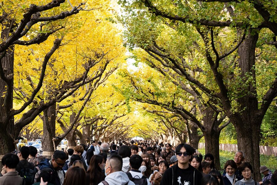

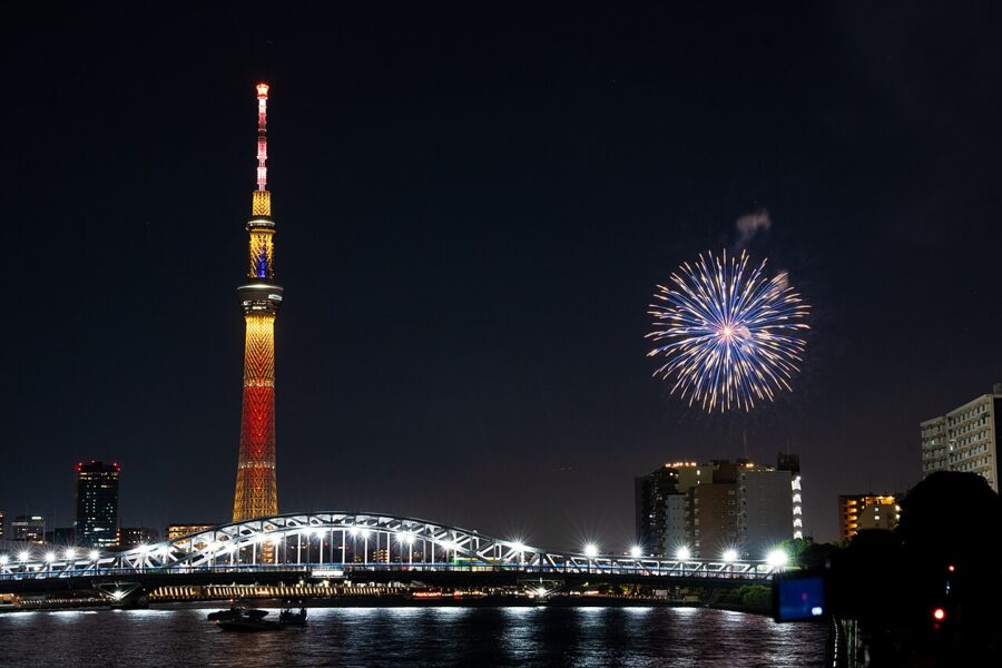
Winter, December to February, is the underrated season: cold, dry and clear, with Mount Fuji visible from high points across the city on many mornings and hotel prices lower outside the New Year week. Summer has the festivals. The Sumidagawa fireworks in late July are the biggest, and many smaller ones fill the evenings of July and August. Golden Week, from late April into early May, and the New Year holiday are when Japan travels, and Tokyo’s hotels and the trains out of it fill accordingly.

For the islands the seasons are different. The Izu Islands are at their best between May and October, when the sea is calm and warm enough to swim. Ogasawara is subtropical and works all year, but whale-watching runs through winter and spring, and the summer holidays fill the ship weeks ahead.
How many days? Four nights in the wards covers the east, centre, west and bay without rushing, plus a day each for Mount Takao and Mitake. An overnight on Oshima or Hachijojima needs two or three days with a buffer for the sea; Ogasawara needs six. For where to base yourself, the guide to hotels in Japan covers the areas, but in short: Ueno or Asakusa for the old city and the Narita trains, Tokyo Station or Ginza for day trips and the Shinkansen, Shinjuku for the west and Tama.
A few mistakes cost visitors more than money. A national rail pass rarely pays for itself on a Tokyo-only stay. Many museums close on Mondays, the palace gardens on Fridays too, and island ships do not wait for the weather. The practical information page covers money, phones and health.
Day trips and the road onward
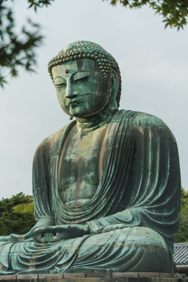
Tokyo is the hub of the Kanto region, and the best day trips cross the prefecture line. Yokohama is under half an hour south on the JR or Tokyu lines. Kamakura, the medieval shogun’s capital, is about an hour on the JR Yokosuka Line from Tokyo Station, with its Great Buddha, its Zen temples and a beach. Kawagoe, in Saitama, keeps a street of clay-walled Edo-period warehouses half an hour from Ikebukuro.
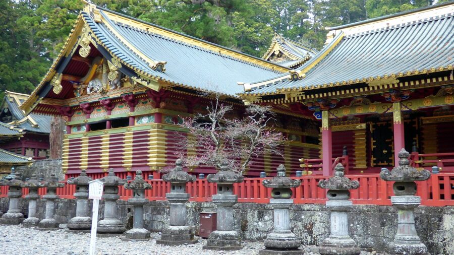
Further out, Nikko is about two hours from Asakusa on the Tobu limited express, with the gilded Toshogu shrine to Tokugawa Ieyasu in its cedar forest. Hakone, with its hot springs, lake and views of Fuji, is about 90 minutes from Shinjuku on the Odakyu Romancecar, and is better as an overnight than a day trip.
From Tokyo Station the Shinkansen lines fan out. The Tokaido Shinkansen reaches Kyoto in about two hours and 15 minutes by Nozomi, the obvious next stop for most first trips. Going north, the Tohoku Shinkansen reaches Sendai in Miyagi Prefecture in about an hour and a half, the gateway to Matsushima and the north. And if you are heading to the far end of the country, a flight from Haneda puts you in Nagasaki in about two hours.
Or go back to Takeshiba. The ship sails at 11:00, and Tokyo does not end until you reach the other side.